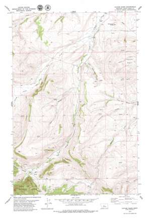
Cayuse Basin Topo Map Montana
To zoom in, hover over the map of Cayuse Basin
USGS Topo Quad 47110a3 - 1:24,000 scale
| Topo Map Name: | Cayuse Basin |
| USGS Topo Quad ID: | 47110a3 |
| Print Size: | ca. 21 1/4" wide x 27" high |
| Southeast Coordinates: | 47° N latitude / 110.25° W longitude |
| Map Center Coordinates: | 47.0625° N latitude / 110.3125° W longitude |
| U.S. State: | MT |
| Filename: | o47110a3.jpg |
| Download Map JPG Image: | Cayuse Basin topo map 1:24,000 scale |
| Map Type: | Topographic |
| Topo Series: | 7.5´ |
| Map Scale: | 1:24,000 |
| Source of Map Images: | United States Geological Survey (USGS) |
| Alternate Map Versions: |
Cayuse Basin MT 1995, updated 1997 Download PDF Buy paper map Cayuse Basin MT 2011 Download PDF Buy paper map Cayuse Basin MT 2014 Download PDF Buy paper map |
| FStopo: | US Forest Service topo Cayuse Basin is available: Download FStopo PDF Download FStopo TIF |
1:24,000 Topo Quads surrounding Cayuse Basin
> Back to 47110a1 at 1:100,000 scale
> Back to 47110a1 at 1:250,000 scale
> Back to U.S. Topo Maps home
Cayuse Basin topo map: Gazetteer
Cayuse Basin: Basins
Cayuse Basin elevation 1467m 4812′Cayuse Basin: Springs
14N11E01AC__01 Spring elevation 1601m 5252′14N11E02BC__01 Spring elevation 1581m 5187′
14N11E02CB__01 Spring elevation 1593m 5226′
14N11E02CB__02 Spring elevation 1593m 5226′
14N11E03AB__01 Spring elevation 1595m 5232′
14N11E04CA__01 Spring elevation 1673m 5488′
14N11E04CB__01 Spring elevation 1654m 5426′
14N11E05AD__01 Spring elevation 1632m 5354′
14N11E05AD__02 Spring elevation 1632m 5354′
14N11E05DA__01 Spring elevation 1681m 5515′
14N12E06BC__01 Spring elevation 1570m 5150′
15N11E03DA__01 Spring elevation 1428m 4685′
15N11E03DB__02 Spring elevation 1424m 4671′
15N11E04BC__01 Spring elevation 1459m 4786′
15N11E04CC__01 Spring elevation 1449m 4753′
15N11E05BB__01 Spring elevation 1573m 5160′
15N11E05BC__01 Spring elevation 1574m 5164′
15N11E05DD__01 Spring elevation 1458m 4783′
15N11E06DB__01 Spring elevation 1676m 5498′
15N11E11AC__01 Spring elevation 1482m 4862′
15N11E11AC__02 Spring elevation 1482m 4862′
15N11E11AC__03 Spring elevation 1482m 4862′
15N11E11BA__01 Spring elevation 1496m 4908′
15N11E14BD__01 Spring elevation 1526m 5006′
15N11E14DD__01 Spring elevation 1513m 4963′
15N11E18DD__02 Spring elevation 1549m 5082′
15N11E20DD__01 Spring elevation 1689m 5541′
15N11E21BA__01 Spring elevation 1621m 5318′
15N11E23BD__01 Spring elevation 1561m 5121′
15N11E23CB__01 Spring elevation 1618m 5308′
15N11E25CC__01 Spring elevation 1551m 5088′
15N11E27BB__01 Spring elevation 1547m 5075′
15N11E28CB__01 Spring elevation 1701m 5580′
15N11E28CC__01 Spring elevation 1602m 5255′
15N11E28DA__01 Spring elevation 1523m 4996′
15N11E28DC__01 Spring elevation 1534m 5032′
15N11E31DA__01 Spring elevation 1626m 5334′
15N11E32BC__01 Spring elevation 1604m 5262′
15N11E32DC__01 Spring elevation 1609m 5278′
15N11E33CC__01 Spring elevation 1596m 5236′
15N11E34CD__01 Spring elevation 1607m 5272′
15N12E06CC__01 Spring elevation 1482m 4862′
15N12E30CC__01 Spring elevation 1562m 5124′
15N12E31BA__01 Spring elevation 1516m 4973′
16N11E27BC__01 Spring elevation 1422m 4665′
16N11E27CB__01 Spring elevation 1429m 4688′
16N11E28AD__01 Spring elevation 1437m 4714′
16N11E28BC__01 Spring elevation 1434m 4704′
16N11E32BC__01 Spring elevation 1512m 4960′
16N11E32CD__01 Spring elevation 1533m 5029′
16N11E33AA__01 Spring elevation 1448m 4750′
16N11E35BB__01 Spring elevation 1394m 4573′
16N11E35BC__01 Spring elevation 1395m 4576′
16N12E31AC__01 Spring elevation 1425m 4675′
16N12E31BB__01 Spring elevation 1380m 4527′
Cayuse Basin: Streams
Dry Wolf Creek elevation 1392m 4566′Running Wolf Creek elevation 1389m 4557′
Cayuse Basin: Summits
Skull Butte elevation 1635m 5364′Steamboat Butte elevation 1418m 4652′
Cayuse Basin: Valleys
Coal Mine Coulee elevation 1414m 4639′Dunsmore Coulee elevation 1433m 4701′
Nickerson Coulee elevation 1571m 5154′
Vann Coulee elevation 1452m 4763′
Cayuse Basin: Wells
14N11E03BB__01 Well elevation 1619m 5311′15N11E03DB__01 Well elevation 1424m 4671′
15N11E04AA__01 Well elevation 1428m 4685′
15N11E08BD__01 Well elevation 1477m 4845′
15N11E18DD__01 Well elevation 1549m 5082′
15N11E32CA__01 Well elevation 1573m 5160′
15N12E18CD__01 Well elevation 1471m 4826′
16N11E25BD__01 Well elevation 1375m 4511′
16N11E25C___01 Well elevation 1381m 4530′
16N11E25DCBC01 Well elevation 1370m 4494′
16N11E26DC__01 Well elevation 1385m 4543′
16N11E35____01 Well elevation 1404m 4606′
16N11E35BD__01 Well elevation 1397m 4583′
16N11E35BD__02 Well elevation 1397m 4583′
16N11E36BA__01 Well elevation 1390m 4560′
16N12E31____01 Well elevation 1452m 4763′
16N12E31AC__02 Well elevation 1425m 4675′
Cayuse Basin digital topo map on disk
Buy this Cayuse Basin topo map showing relief, roads, GPS coordinates and other geographical features, as a high-resolution digital map file on DVD:


