Riceville Topo Map Montana
To zoom in, hover over the map of Riceville
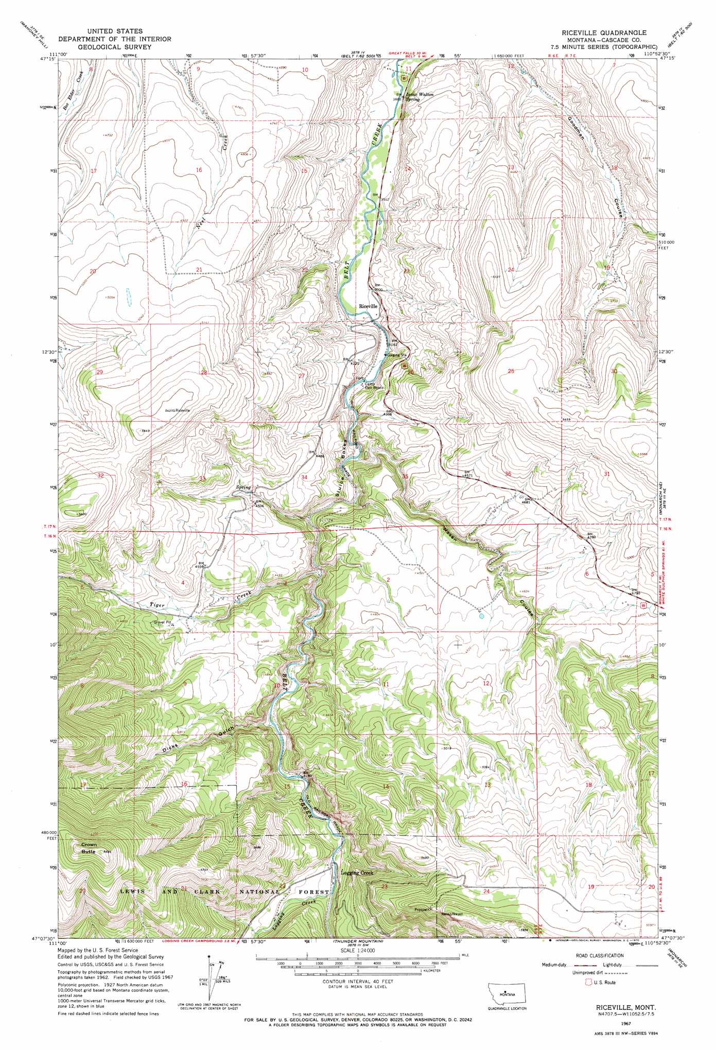
USGS Topo Quad 47110b8 - 1:24,000 scale
| Topo Map Name: | Riceville |
| USGS Topo Quad ID: | 47110b8 |
| Print Size: | ca. 21 1/4" wide x 27" high |
| Southeast Coordinates: | 47.125° N latitude / 110.875° W longitude |
| Map Center Coordinates: | 47.1875° N latitude / 110.9375° W longitude |
| U.S. State: | MT |
| Filename: | o47110b8.jpg |
| Download Map JPG Image: | Riceville topo map 1:24,000 scale |
| Map Type: | Topographic |
| Topo Series: | 7.5´ |
| Map Scale: | 1:24,000 |
| Source of Map Images: | United States Geological Survey (USGS) |
| Alternate Map Versions: |
Riceville MT 1967, updated 1970 Download PDF Buy paper map Riceville MT 1995, updated 1997 Download PDF Buy paper map Riceville MT 2011 Download PDF Buy paper map Riceville MT 2014 Download PDF Buy paper map |
| FStopo: | US Forest Service topo Riceville is available: Download FStopo PDF Download FStopo TIF |
1:24,000 Topo Quads surrounding Riceville
Southeast Great Falls |
Fife |
Belt |
Belt Ne |
Highwood Baldy |
Stockett |
Mahoney Hill |
Armington |
Blythe |
Raynesford |
Calvert |
Evans |
Riceville |
Monarch Ne |
Limestone Butte |
Deep Creek Park |
Blankenbaker Flats |
Thunder Mountain |
Monarch |
Barker |
Bald Hills |
Monument Peak |
Bubbling Springs |
Belt Park Butte |
Neihart |
> Back to 47110a1 at 1:100,000 scale
> Back to 47110a1 at 1:250,000 scale
> Back to U.S. Topo Maps home
Riceville topo map: Gazetteer
Riceville: Basins
Sluice Boxes elevation 1230m 4035′Riceville: Populated Places
Albright (historical) elevation 1260m 4133′Riceville elevation 1219m 3999′
Riceville: Post Offices
Albright Post Office (historical) elevation 1260m 4133′Campsite Post Office (historical) elevation 1304m 4278′
Logging Creek Post Office (historical) elevation 1308m 4291′
Riceville Post Office (historical) elevation 1219m 3999′
Riceville: Springs
Isaac Walton Spring elevation 1181m 3874′Riceville: Streams
Logging Creek elevation 1283m 4209′Tiger Creek elevation 1242m 4074′
Riceville: Summits
Crown Butte elevation 2035m 6676′Riceville: Valleys
Dicks Gulch elevation 1275m 4183′Nasen Coulee elevation 1223m 4012′
Riceville digital topo map on disk
Buy this Riceville topo map showing relief, roads, GPS coordinates and other geographical features, as a high-resolution digital map file on DVD: