Belt Ne Topo Map Montana
To zoom in, hover over the map of Belt Ne
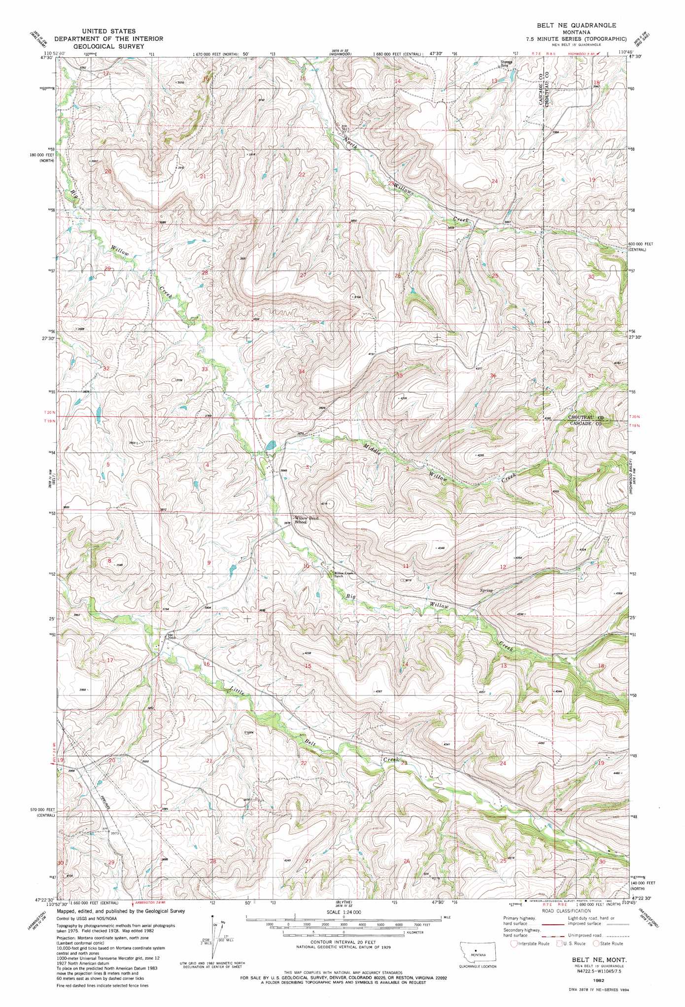
USGS Topo Quad 47110d7 - 1:24,000 scale
| Topo Map Name: | Belt Ne |
| USGS Topo Quad ID: | 47110d7 |
| Print Size: | ca. 21 1/4" wide x 27" high |
| Southeast Coordinates: | 47.375° N latitude / 110.75° W longitude |
| Map Center Coordinates: | 47.4375° N latitude / 110.8125° W longitude |
| U.S. State: | MT |
| Filename: | o47110d7.jpg |
| Download Map JPG Image: | Belt Ne topo map 1:24,000 scale |
| Map Type: | Topographic |
| Topo Series: | 7.5´ |
| Map Scale: | 1:24,000 |
| Source of Map Images: | United States Geological Survey (USGS) |
| Alternate Map Versions: |
Belt NE MT 1982, updated 1983 Download PDF Buy paper map Belt NE MT 2011 Download PDF Buy paper map Belt NE MT 2014 Download PDF Buy paper map |
1:24,000 Topo Quads surrounding Belt Ne
Floweree |
Lander Crossing |
Rice Reservoir |
Shonkin Nw |
Shonkin |
Morony Dam |
Waltham |
Highwood |
Big Sag |
Carter Mountain |
Fife |
Belt |
Belt Ne |
Highwood Baldy |
Arrow Peak |
Mahoney Hill |
Armington |
Blythe |
Raynesford |
Byrne Creek |
Evans |
Riceville |
Monarch Ne |
Limestone Butte |
The Arch |
> Back to 47110a1 at 1:100,000 scale
> Back to 47110a1 at 1:250,000 scale
> Back to U.S. Topo Maps home
Belt Ne topo map: Gazetteer
Belt Ne: Dams
Willow Belt Dam elevation 1126m 3694′Belt Ne: Springs
Mastiff Geyser elevation 1107m 3631′Belt Ne: Streams
Middle Willow Creek elevation 1098m 3602′Belt Ne: Wells
19N07E02DD__01 Well elevation 1276m 4186′20N07E33____01 Well elevation 1088m 3569′
Belt Ne digital topo map on disk
Buy this Belt Ne topo map showing relief, roads, GPS coordinates and other geographical features, as a high-resolution digital map file on DVD: