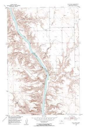
Pilot Rock Topo Map Montana
To zoom in, hover over the map of Pilot Rock
USGS Topo Quad 47110h1 - 1:24,000 scale
| Topo Map Name: | Pilot Rock |
| USGS Topo Quad ID: | 47110h1 |
| Print Size: | ca. 21 1/4" wide x 27" high |
| Southeast Coordinates: | 47.875° N latitude / 110° W longitude |
| Map Center Coordinates: | 47.9375° N latitude / 110.0625° W longitude |
| U.S. State: | MT |
| Filename: | o47110h1.jpg |
| Download Map JPG Image: | Pilot Rock topo map 1:24,000 scale |
| Map Type: | Topographic |
| Topo Series: | 7.5´ |
| Map Scale: | 1:24,000 |
| Source of Map Images: | United States Geological Survey (USGS) |
| Alternate Map Versions: |
Pilot Rock MT 1953, updated 1955 Download PDF Buy paper map Pilot Rock MT 1953, updated 1955 Download PDF Buy paper map Pilot Rock MT 2011 Download PDF Buy paper map Pilot Rock MT 2014 Download PDF Buy paper map |
1:24,000 Topo Quads surrounding Pilot Rock
> Back to 47110e1 at 1:100,000 scale
> Back to 47110a1 at 1:250,000 scale
> Back to U.S. Topo Maps home
Pilot Rock topo map: Gazetteer
Pilot Rock: Dams
Otto Silvan Dam elevation 864m 2834′Pegar Fish Dam elevation 862m 2828′
Pilot Rock: Pillars
LaBarge Rock elevation 807m 2647′Pilot Rock elevation 770m 2526′
Pilot Rock: Post Offices
Conley Post Office (historical) elevation 764m 2506′Eagle Butte Post Office (historical) elevation 961m 3152′
Pilot Rock: Streams
Eagle Creek elevation 763m 2503′Pilot Rock: Summits
Fortress Rock elevation 819m 2687′Pilot Rock: Valleys
Coal Mine Coulee elevation 758m 2486′Crooked Coulee elevation 767m 2516′
Cut Bank Coulee elevation 767m 2516′
Sheep Coulee elevation 777m 2549′
Pilot Rock digital topo map on disk
Buy this Pilot Rock topo map showing relief, roads, GPS coordinates and other geographical features, as a high-resolution digital map file on DVD:


