Mid Canon Topo Map Montana
To zoom in, hover over the map of Mid Canon
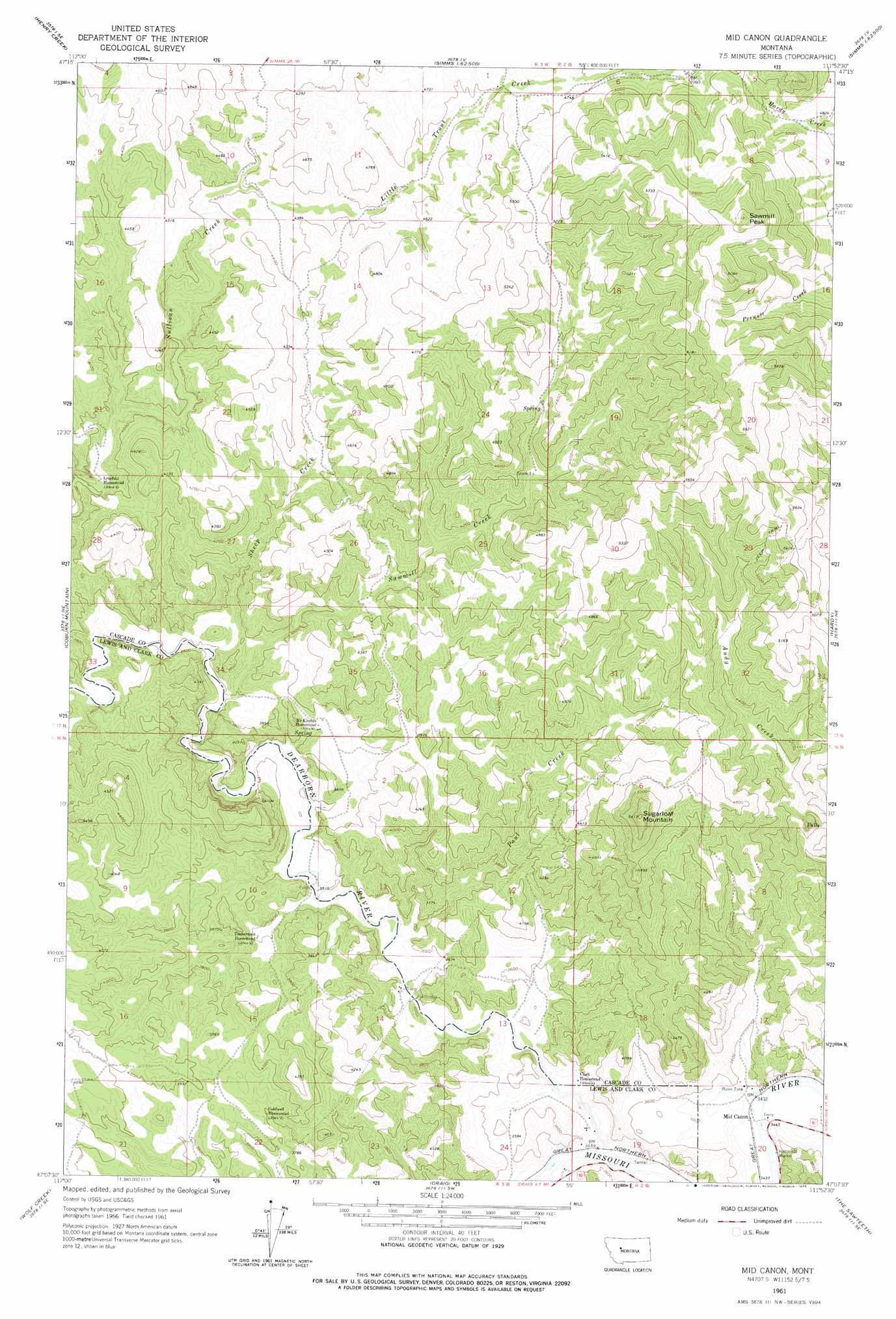
USGS Topo Quad 47111b8 - 1:24,000 scale
| Topo Map Name: | Mid Canon |
| USGS Topo Quad ID: | 47111b8 |
| Print Size: | ca. 21 1/4" wide x 27" high |
| Southeast Coordinates: | 47.125° N latitude / 111.875° W longitude |
| Map Center Coordinates: | 47.1875° N latitude / 111.9375° W longitude |
| U.S. State: | MT |
| Filename: | o47111b8.jpg |
| Download Map JPG Image: | Mid Canon topo map 1:24,000 scale |
| Map Type: | Topographic |
| Topo Series: | 7.5´ |
| Map Scale: | 1:24,000 |
| Source of Map Images: | United States Geological Survey (USGS) |
| Alternate Map Versions: |
Mid Canon MT 1961, updated 1964 Download PDF Buy paper map Mid Canon MT 1961, updated 1975 Download PDF Buy paper map Mid Canon MT 2011 Download PDF Buy paper map Mid Canon MT 2014 Download PDF Buy paper map |
1:24,000 Topo Quads surrounding Mid Canon
Bowmans Corners Nw |
Bowmans Corners Ne |
Simms |
Cascade Colony |
Fair Haven Colony |
Bowmans Corners |
Henry Creek |
Telegraph Mountain |
Mount Cecelia |
Cascade |
Comb Rock |
Coburn Mountain |
Mid Canon |
Hardy |
Rocky Reef |
Roberts Mountain |
Wolf Creek |
Craig |
The Sawteeth |
Hound Creek Reservoir |
Mitchell Mountain |
Sheep Creek |
Beartooth Mountain |
Candle Mountain |
Middle Creek Lake |
> Back to 47111a1 at 1:100,000 scale
> Back to 47110a1 at 1:250,000 scale
> Back to U.S. Topo Maps home
Mid Canon topo map: Gazetteer
Mid Canon: Crossings
Interchange 240 elevation 1077m 3533′Mid Canon: Parks
Missouri River Canyon Historical Marker (historical) elevation 1058m 3471′Mid Canon: Populated Places
Mid Canon elevation 1045m 3428′Mid Canon: Post Offices
Mid Canon Post Office (historical) elevation 1045m 3428′Mid Canon: Streams
Dearborn River elevation 1046m 3431′Paul Creek elevation 1062m 3484′
Sawmill Creek elevation 1096m 3595′
Sheep Creek elevation 1092m 3582′
Trout Creek elevation 1269m 4163′
Mid Canon: Summits
Sawmill Peak elevation 1856m 6089′Sugarloaf Mountain elevation 1652m 5419′
Mid Canon digital topo map on disk
Buy this Mid Canon topo map showing relief, roads, GPS coordinates and other geographical features, as a high-resolution digital map file on DVD: