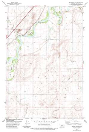
Nelson Island Topo Map Montana
To zoom in, hover over the map of Nelson Island
USGS Topo Quad 47111c5 - 1:24,000 scale
| Topo Map Name: | Nelson Island |
| USGS Topo Quad ID: | 47111c5 |
| Print Size: | ca. 21 1/4" wide x 27" high |
| Southeast Coordinates: | 47.25° N latitude / 111.5° W longitude |
| Map Center Coordinates: | 47.3125° N latitude / 111.5625° W longitude |
| U.S. State: | MT |
| Filename: | o47111c5.jpg |
| Download Map JPG Image: | Nelson Island topo map 1:24,000 scale |
| Map Type: | Topographic |
| Topo Series: | 7.5´ |
| Map Scale: | 1:24,000 |
| Source of Map Images: | United States Geological Survey (USGS) |
| Alternate Map Versions: |
Nelson Island MT 1983, updated 1983 Download PDF Buy paper map Nelson Island MT 2011 Download PDF Buy paper map Nelson Island MT 2014 Download PDF Buy paper map |
1:24,000 Topo Quads surrounding Nelson Island
> Back to 47111a1 at 1:100,000 scale
> Back to 47110a1 at 1:250,000 scale
> Back to U.S. Topo Maps home
Nelson Island topo map: Gazetteer
Nelson Island: Dams
Gallaher Number 2 Dam elevation 1055m 3461′Missouri Bird Dam elevation 1042m 3418′
Nelson Island: Islands
Nelson Island elevation 1021m 3349′Nelson Island: Populated Places
Riverdale elevation 1022m 3353′Nelson Island: Springs
17N01E02A___01 Spring elevation 1057m 3467′18N01E10D___01 Spring elevation 1019m 3343′
18N01E11C___01 Spring elevation 1026m 3366′
18N01E15B___01 Spring elevation 1048m 3438′
18N02E19C___01 Spring elevation 1129m 3704′
18N02E29D___01 Spring elevation 1114m 3654′
18N02E31A___01 Spring elevation 1133m 3717′
19N01E34A___01 Spring elevation 1101m 3612′
Nelson Island: Streams
Bird Creek elevation 1018m 3339′Little Muddy Creek elevation 1018m 3339′
Nelson Island: Valleys
Chestnut Valley elevation 1019m 3343′Nelson Island: Wells
17N02E05A___01 Well elevation 1126m 3694′17N02E06A___01 Well elevation 1136m 3727′
18N01E01A___01 Well elevation 1030m 3379′
18N01E01B___01 Well elevation 1016m 3333′
18N01E01C___01 Well elevation 1025m 3362′
18N01E10C___01 Well elevation 1020m 3346′
18N01E10C___02 Well elevation 1020m 3346′
18N01E11D___01 Well elevation 1028m 3372′
18N01E13A___01 Well elevation 1110m 3641′
18N01E13A___02 Well elevation 1110m 3641′
18N01E22D___01 Well elevation 1071m 3513′
18N01E23A___01 Well elevation 1046m 3431′
18N01E24____01 Well elevation 1095m 3592′
18N01E24A___01 Well elevation 1107m 3631′
18N01E24B___01 Well elevation 1076m 3530′
18N01E24D___01 Well elevation 1107m 3631′
18N01E26D___01 Well elevation 1065m 3494′
18N01E27C___01 Well elevation 1039m 3408′
18N01E27C___02 Well elevation 1039m 3408′
18N02E05B___01 Well elevation 1068m 3503′
18N02E05C___01 Well elevation 1072m 3517′
18N02E06____01 Well elevation 1060m 3477′
18N02E06C___01 Well elevation 1049m 3441′
18N02E07____01 Well elevation 1094m 3589′
18N02E08____01 Well elevation 1089m 3572′
18N02E17____01 Well elevation 1109m 3638′
18N02E17____02 Well elevation 1109m 3638′
18N02E17____03 Well elevation 1109m 3638′
18N02E17____04 Well elevation 1109m 3638′
18N02E17D___01 Well elevation 1102m 3615′
18N02E17D___02 Well elevation 1102m 3615′
18N02E18____01 Well elevation 1132m 3713′
18N02E18A___01 Well elevation 1104m 3622′
18N02E19D___01 Well elevation 1108m 3635′
18N02E20C___01 Well elevation 1116m 3661′
18N02E20C___02 Well elevation 1116m 3661′
18N02E20C___03 Well elevation 1116m 3661′
18N02E20C___04 Well elevation 1116m 3661′
18N02E29A___01 Well elevation 1116m 3661′
18N02E29A___02 Well elevation 1116m 3661′
18N02E29C___01 Well elevation 1126m 3694′
18N02E32D___01 Well elevation 1117m 3664′
18N02E32D___02 Well elevation 1117m 3664′
19N01E27D___01 Well elevation 1062m 3484′
19N01E27D___02 Well elevation 1062m 3484′
19N01E27DADA01 Well elevation 1033m 3389′
19N01E33B___01 Well elevation 1027m 3369′
19N01E33B___02 Well elevation 1027m 3369′
19N01E35B___01 Well elevation 1025m 3362′
19N01E36B___01 Well elevation 1020m 3346′
19N01E36B___02 Well elevation 1020m 3346′
19N02E29____01 Well elevation 1033m 3389′
19N02E29____02 Well elevation 1033m 3389′
19N02E30B___01 Well elevation 1018m 3339′
Nelson Island digital topo map on disk
Buy this Nelson Island topo map showing relief, roads, GPS coordinates and other geographical features, as a high-resolution digital map file on DVD:


