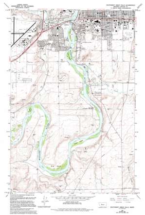
Southwest Great Falls Topo Map Montana
To zoom in, hover over the map of Southwest Great Falls
USGS Topo Quad 47111d3 - 1:24,000 scale
| Topo Map Name: | Southwest Great Falls |
| USGS Topo Quad ID: | 47111d3 |
| Print Size: | ca. 21 1/4" wide x 27" high |
| Southeast Coordinates: | 47.375° N latitude / 111.25° W longitude |
| Map Center Coordinates: | 47.4375° N latitude / 111.3125° W longitude |
| U.S. State: | MT |
| Filename: | o47111d3.jpg |
| Download Map JPG Image: | Southwest Great Falls topo map 1:24,000 scale |
| Map Type: | Topographic |
| Topo Series: | 7.5´ |
| Map Scale: | 1:24,000 |
| Source of Map Images: | United States Geological Survey (USGS) |
| Alternate Map Versions: |
Southwest Great Falls MT 1965, updated 1968 Download PDF Buy paper map Southwest Great Falls MT 1965, updated 1977 Download PDF Buy paper map Southwest Great Falls MT 1965, updated 1994 Download PDF Buy paper map Southwest Great Falls MT 2011 Download PDF Buy paper map Southwest Great Falls MT 2014 Download PDF Buy paper map |
1:24,000 Topo Quads surrounding Southwest Great Falls
> Back to 47111a1 at 1:100,000 scale
> Back to 47110a1 at 1:250,000 scale
> Back to U.S. Topo Maps home
Southwest Great Falls topo map: Gazetteer
Southwest Great Falls: Airports
Columbus Hospital Heliport elevation 1048m 3438′Great Falls International Airport elevation 1117m 3664′
Montana Deaconess Medical Center Heliport elevation 1044m 3425′
Southwest Great Falls: Bends
Big Bend elevation 1033m 3389′Southwest Great Falls: Bridges
Missouri River Bridge elevation 1010m 3313′Southwest Great Falls: Crossings
Interchange 277 elevation 1121m 3677′Interchange 278 elevation 1042m 3418′
Southwest Great Falls: Islands
Buckshot Island elevation 1013m 3323′Fisher Island elevation 1016m 3333′
Park Island elevation 1011m 3316′
Taylor Island elevation 1013m 3323′
White Bear Islands elevation 1011m 3316′
Southwest Great Falls: Parks
Bel View Park elevation 1038m 3405′Broadwater Bay Park elevation 1013m 3323′
Broadwater Overlook Park elevation 1030m 3379′
Carter Park elevation 1016m 3333′
Chowen Springs Park elevation 1034m 3392′
Fox Hollow Park elevation 1016m 3333′
Grande Vista Park elevation 1021m 3349′
Highland South Park elevation 1042m 3418′
Hyland Heights Park elevation 1032m 3385′
Lewis and Clark Statue elevation 1028m 3372′
Lions Park elevation 1063m 3487′
Meadowlark Park elevation 1012m 3320′
Montana Park elevation 1017m 3336′
Oddfellows Park elevation 1033m 3389′
Sand Hills Park elevation 1053m 3454′
Sunnyside Park elevation 1048m 3438′
Verde Park elevation 1024m 3359′
Warden Park elevation 1048m 3438′
West Hill Park elevation 1070m 3510′
Southwest Great Falls: Populated Places
Donovan Park (historical) elevation 1101m 3612′Flood (historical) elevation 1053m 3454′
Missouri Meadows Trailer Park elevation 1012m 3320′
Pleasant Park Mobile Home Court elevation 1012m 3320′
Rivershore Mobile Home Park elevation 1012m 3320′
Southwest Great Falls: Streams
Sand Coulee Creek elevation 1013m 3323′Sun River elevation 1010m 3313′
Southwest Great Falls: Summits
Gore Hill elevation 1077m 3533′Southwest Great Falls: Wells
19N03E01AABA01 Well elevation 1036m 3398′19N03E01AABA02 Well elevation 1055m 3461′
19N03E01ACBB01 Well elevation 1013m 3323′
19N03E01DBBB01 Well elevation 1023m 3356′
19N03E04BBAD01 Well elevation 1048m 3438′
19N03E12CDDA01 Well elevation 1024m 3359′
19N03E12DCAC01 Well elevation 1028m 3372′
19N03E13BBBB01 Well elevation 1026m 3366′
19N03E21BDAB01 Well elevation 1071m 3513′
19N03E21DBCD01 Well elevation 1045m 3428′
19N03E24CCBD01 Well elevation 1117m 3664′
19N04E18A___01 Well elevation 1115m 3658′
19N04E18A___02 Well elevation 1115m 3658′
19N04E18D___01 Well elevation 1135m 3723′
20N03E09CADB01 Well elevation 1040m 3412′
20N03E09CADB02 Well elevation 1038m 3405′
20N03E09CBDD01 Well elevation 1103m 3618′
20N03E09DCDB01 Well elevation 1104m 3622′
20N03E13BDDD01 Well elevation 1051m 3448′
20N03E13CCAD01 Well elevation 1023m 3356′
20N03E13CCCA01 Well elevation 1017m 3336′
20N03E13DDCB01 Well elevation 1036m 3398′
20N03E13DDDD01 Well elevation 1039m 3408′
20N03E20DDAD01 Well elevation 1123m 3684′
20N03E21CAAD01 Well elevation 1126m 3694′
20N03E21CCCB01 Well elevation 1121m 3677′
20N03E21DAAA01 Well elevation 1114m 3654′
20N03E22CBDA01 Well elevation 1048m 3438′
20N03E23ADAA01 Well elevation 1012m 3320′
20N03E23BAAA01 Well elevation 1012m 3320′
20N03E24ACAB01 Well elevation 1031m 3382′
20N03E24BBAD01 Well elevation 1018m 3339′
20N03E25DCAA01 Well elevation 1017m 3336′
20N03E25DCAC01 Well elevation 1019m 3343′
20N03E26BBBD01 Well elevation 1030m 3379′
20N03E26CBBC01 Well elevation 1039m 3408′
20N03E26CDAA01 Well elevation 1044m 3425′
20N03E26CDCC01 Well elevation 1063m 3487′
20N03E27AADA01 Well elevation 1033m 3389′
20N03E27ADAC01 Well elevation 1027m 3369′
20N03E27BCBB01 Well elevation 1075m 3526′
20N03E27DADC01 Well elevation 1058m 3471′
20N03E28AACD01 Well elevation 1126m 3694′
20N03E28BCCC01 Well elevation 1131m 3710′
20N03E28BDDC01 Well elevation 1128m 3700′
20N03E28CABB01 Well elevation 1129m 3704′
20N03E28CABB02 Well elevation 1129m 3704′
20N03E28CBBA01 Well elevation 1130m 3707′
20N03E28CBBB01 Well elevation 1131m 3710′
20N03E28CBBC01 Well elevation 1131m 3710′
20N03E28CBCD01 Well elevation 1131m 3710′
20N03E28CCAC01 Well elevation 1131m 3710′
20N03E28CCBA01 Well elevation 1131m 3710′
20N03E28CCCA01 Well elevation 1131m 3710′
20N03E28CCCD01 Well elevation 1131m 3710′
20N03E28CDAD01 Well elevation 1131m 3710′
20N03E28CDB_01 Well elevation 1131m 3710′
20N03E28DDCB01 Well elevation 1135m 3723′
20N03E29DDAD01 Well elevation 1132m 3713′
20N03E29DDDA01 Well elevation 1132m 3713′
20N03E29DDDC01 Well elevation 1132m 3713′
20N03E29DDDD01 Well elevation 1131m 3710′
20N03E29DDDD02 Well elevation 1131m 3710′
20N03E32AAAB01 Well elevation 1132m 3713′
20N03E32AADD01 Well elevation 1136m 3727′
20N03E32ADDC01 Well elevation 1140m 3740′
20N03E35ADCA01 Well elevation 1054m 3458′
20N03E36BAAD01 Well elevation 1018m 3339′
20N04E18CDAC01 Well elevation 1056m 3464′
20N04E18DBBC01 Well elevation 1051m 3448′
20N04E19BABB01 Well elevation 1049m 3441′
20N04E19BABD01 Well elevation 1055m 3461′
20N04E19BDAA01 Well elevation 1049m 3441′
20N04E19DBAC01 Well elevation 1048m 3438′
20N04E29CCBC01 Well elevation 1032m 3385′
20N04E30AABC01 Well elevation 1057m 3467′
20N04E31B___01 Well elevation 1015m 3330′
20N04E31BCAC01 Well elevation 1016m 3333′
20N04E31BCBB01 Well elevation 1016m 3333′
20N04E31BCBB02 Well elevation 1016m 3333′
20N04E31BCCC01 Well elevation 1019m 3343′
20N04E32CCDD01 Well elevation 1073m 3520′
Southwest Great Falls digital topo map on disk
Buy this Southwest Great Falls topo map showing relief, roads, GPS coordinates and other geographical features, as a high-resolution digital map file on DVD:


