Fair Haven Colony Topo Map Montana
To zoom in, hover over the map of Fair Haven Colony
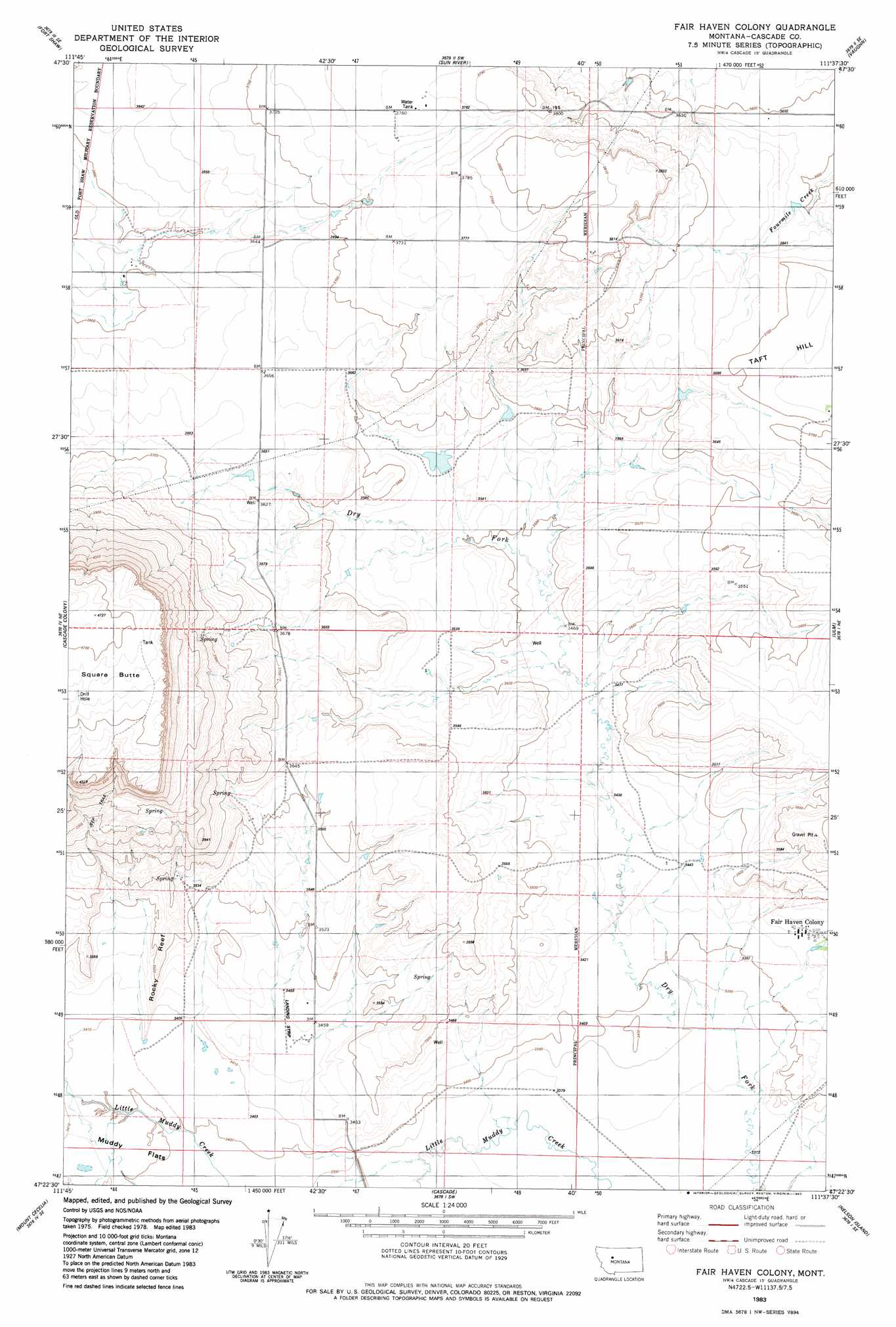
USGS Topo Quad 47111d6 - 1:24,000 scale
| Topo Map Name: | Fair Haven Colony |
| USGS Topo Quad ID: | 47111d6 |
| Print Size: | ca. 21 1/4" wide x 27" high |
| Southeast Coordinates: | 47.375° N latitude / 111.625° W longitude |
| Map Center Coordinates: | 47.4375° N latitude / 111.6875° W longitude |
| U.S. State: | MT |
| Filename: | o47111d6.jpg |
| Download Map JPG Image: | Fair Haven Colony topo map 1:24,000 scale |
| Map Type: | Topographic |
| Topo Series: | 7.5´ |
| Map Scale: | 1:24,000 |
| Source of Map Images: | United States Geological Survey (USGS) |
| Alternate Map Versions: |
Fair Haven Colony MT 1983, updated 1983 Download PDF Buy paper map Fair Haven Colony MT 1983, updated 1985 Download PDF Buy paper map Fair Haven Colony MT 2011 Download PDF Buy paper map Fair Haven Colony MT 2014 Download PDF Buy paper map |
1:24,000 Topo Quads surrounding Fair Haven Colony
Cleiv |
Greenfield |
Power |
Vaughn Ne |
Benton Lake West |
Fairfield |
Fort Shaw |
Sun River |
Vaughn |
Manchester |
Simms |
Cascade Colony |
Fair Haven Colony |
Ulm |
Antelope Butte |
Telegraph Mountain |
Mount Cecelia |
Cascade |
Nelson Island |
Truly |
Mid Canon |
Hardy |
Rocky Reef |
Schrammeck Lake |
Spanish Coulee School |
> Back to 47111a1 at 1:100,000 scale
> Back to 47110a1 at 1:250,000 scale
> Back to U.S. Topo Maps home
Fair Haven Colony topo map: Gazetteer
Fair Haven Colony: Dams
Dry Fork Fairhaven Number 1 Dam elevation 1037m 3402′GMG Dam elevation 1083m 3553′
Fair Haven Colony: Populated Places
Fair Haven Colony elevation 1050m 3444′Fair Haven Colony: Reservoirs
Rocky Reef Reservoir elevation 1039m 3408′Fair Haven Colony: Springs
19N01E05B___01 Spring elevation 1107m 3631′Fair Haven Colony: Summits
Square Butte elevation 1441m 4727′Fair Haven Colony: Wells
19N01E07D___01 Well elevation 1049m 3441′19N01E17A___01 Well elevation 1050m 3444′
19N01W01B___01 Well elevation 1074m 3523′
19N01W02A___01 Well elevation 1078m 3536′
19N01W12B___01 Well elevation 1076m 3530′
19N01W21B___01 Well elevation 1040m 3412′
19N01W22A___01 Well elevation 1047m 3435′
19N01W22A___02 Well elevation 1053m 3454′
20N01W27A___01 Well elevation 1117m 3664′
20N01W34B___01 Well elevation 1128m 3700′
20N01W35B___01 Well elevation 1087m 3566′
Fair Haven Colony digital topo map on disk
Buy this Fair Haven Colony topo map showing relief, roads, GPS coordinates and other geographical features, as a high-resolution digital map file on DVD: