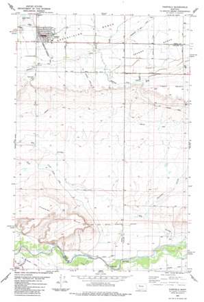
Fairfield Topo Map Montana
To zoom in, hover over the map of Fairfield
USGS Topo Quad 47111e8 - 1:24,000 scale
| Topo Map Name: | Fairfield |
| USGS Topo Quad ID: | 47111e8 |
| Print Size: | ca. 21 1/4" wide x 27" high |
| Southeast Coordinates: | 47.5° N latitude / 111.875° W longitude |
| Map Center Coordinates: | 47.5625° N latitude / 111.9375° W longitude |
| U.S. State: | MT |
| Filename: | o47111e8.jpg |
| Download Map JPG Image: | Fairfield topo map 1:24,000 scale |
| Map Type: | Topographic |
| Topo Series: | 7.5´ |
| Map Scale: | 1:24,000 |
| Source of Map Images: | United States Geological Survey (USGS) |
| Alternate Map Versions: |
Fairfield MT 1983, updated 1983 Download PDF Buy paper map Fairfield MT 2011 Download PDF Buy paper map Fairfield MT 2014 Download PDF Buy paper map |
1:24,000 Topo Quads surrounding Fairfield
> Back to 47111e1 at 1:100,000 scale
> Back to 47110a1 at 1:250,000 scale
> Back to U.S. Topo Maps home
Fairfield topo map: Gazetteer
Fairfield: Canals
Big Coulee Canal elevation 1111m 3645′Hamilton Canal elevation 1153m 3782′
Fairfield: Populated Places
Fairfield elevation 1214m 3982′Fairfield: Post Offices
Fairfield Post Office elevation 1214m 3982′Fairfield: Streams
Duck Creek elevation 1098m 3602′Simms Creek elevation 1087m 3566′
Fairfield: Summits
Floweree Butte elevation 1252m 4107′Fairfield: Valleys
Anderson Coulee elevation 1096m 3595′Big Coulee elevation 1073m 3520′
Blackfoot Coulee elevation 1080m 3543′
Fairfield: Wells
20N03W04D___01 Well elevation 1097m 3599′20N03W10A___01 Well elevation 1093m 3585′
21N02W20C___01 Well elevation 1118m 3667′
21N03W03CBBA01 Well elevation 1220m 4002′
21N03W03CBCB01 Well elevation 1224m 4015′
21N03W03CBCC01 Well elevation 1226m 4022′
21N03W04AAAA01 Well elevation 1217m 3992′
21N03W04AAAB01 Well elevation 1218m 3996′
21N03W04DADD01 Well elevation 1225m 4019′
21N03W09AAAA01 Well elevation 1239m 4064′
22N03W33DBBB01 Well elevation 1220m 4002′
22N03W34ADDD01 Well elevation 1208m 3963′
22N03W34CCBB01 Well elevation 1216m 3989′
22N03W35BCCC01 Well elevation 1209m 3966′
22N03W35C___01 Well elevation 1210m 3969′
22N03W35D___01 Well elevation 1205m 3953′
Fairfield digital topo map on disk
Buy this Fairfield topo map showing relief, roads, GPS coordinates and other geographical features, as a high-resolution digital map file on DVD:


