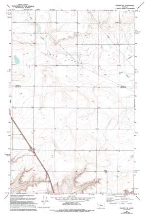
Vaughn Ne Topo Map Montana
To zoom in, hover over the map of Vaughn Ne
USGS Topo Quad 47111f5 - 1:24,000 scale
| Topo Map Name: | Vaughn Ne |
| USGS Topo Quad ID: | 47111f5 |
| Print Size: | ca. 21 1/4" wide x 27" high |
| Southeast Coordinates: | 47.625° N latitude / 111.5° W longitude |
| Map Center Coordinates: | 47.6875° N latitude / 111.5625° W longitude |
| U.S. State: | MT |
| Filename: | o47111f5.jpg |
| Download Map JPG Image: | Vaughn Ne topo map 1:24,000 scale |
| Map Type: | Topographic |
| Topo Series: | 7.5´ |
| Map Scale: | 1:24,000 |
| Source of Map Images: | United States Geological Survey (USGS) |
| Alternate Map Versions: |
Vaughn NE MT 1983, updated 1983 Download PDF Buy paper map Vaughn NE MT 1983, updated 1994 Download PDF Buy paper map Vaughn NE MT 2011 Download PDF Buy paper map Vaughn NE MT 2014 Download PDF Buy paper map |
1:24,000 Topo Quads surrounding Vaughn Ne
> Back to 47111e1 at 1:100,000 scale
> Back to 47110a1 at 1:250,000 scale
> Back to U.S. Topo Maps home
Vaughn Ne topo map: Gazetteer
Vaughn Ne: Crossings
Interchange 297 elevation 1140m 3740′Vaughn Ne: Dams
Muddy Spots Dam elevation 1158m 3799′Neuman Number 2 Dam elevation 1133m 3717′
Vaughn Ne: Flats
Lake Creek Flat elevation 1128m 3700′Vaughn Ne: Wells
22N01E12AAAA01 Well elevation 1137m 3730′22N01E12AADD01 Well elevation 1144m 3753′
22N02E06CCCA01 Well elevation 1136m 3727′
22N02E07BBAA01 Well elevation 1139m 3736′
22N02E07BCCB01 Well elevation 1149m 3769′
22N02E07BCDC01 Well elevation 1149m 3769′
22N02E18CDDB01 Well elevation 1153m 3782′
23N01E28DADD01 Well elevation 1131m 3710′
Vaughn Ne digital topo map on disk
Buy this Vaughn Ne topo map showing relief, roads, GPS coordinates and other geographical features, as a high-resolution digital map file on DVD:


