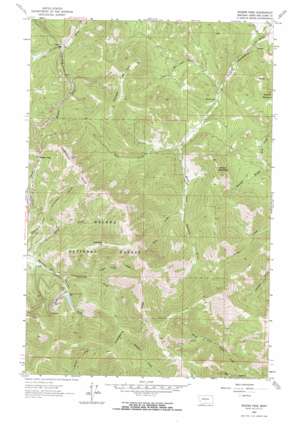
Rogers Pass Topo Map Montana
To zoom in, hover over the map of Rogers Pass
USGS Topo Quad 47112a3 - 1:24,000 scale
| Topo Map Name: | Rogers Pass |
| USGS Topo Quad ID: | 47112a3 |
| Print Size: | ca. 21 1/4" wide x 27" high |
| Southeast Coordinates: | 47° N latitude / 112.25° W longitude |
| Map Center Coordinates: | 47.0625° N latitude / 112.3125° W longitude |
| U.S. State: | MT |
| Filename: | o47112a3.jpg |
| Download Map JPG Image: | Rogers Pass topo map 1:24,000 scale |
| Map Type: | Topographic |
| Topo Series: | 7.5´ |
| Map Scale: | 1:24,000 |
| Source of Map Images: | United States Geological Survey (USGS) |
| Alternate Map Versions: |
Rogers Pass MT 1963, updated 1964 Download PDF Buy paper map Rogers Pass MT 1963, updated 1964 Download PDF Buy paper map Rogers Pass MT 2001, updated 2004 Download PDF Buy paper map Rogers Pass MT 2011 Download PDF Buy paper map Rogers Pass MT 2014 Download PDF Buy paper map |
| FStopo: | US Forest Service topo Rogers Pass is available: Download FStopo PDF Download FStopo TIF |
1:24,000 Topo Quads surrounding Rogers Pass
> Back to 47112a1 at 1:100,000 scale
> Back to 47112a1 at 1:250,000 scale
> Back to U.S. Topo Maps home
Rogers Pass topo map: Gazetteer
Rogers Pass: Dams
Mike Horse Mine Dam elevation 1660m 5446′Rogers Pass: Gaps
Rogers Pass elevation 1716m 5629′Rogers Pass: Mines
Anaconda Mine elevation 1776m 5826′Mary P Mine elevation 1719m 5639′
Mike Horse Mine elevation 1730m 5675′
Rogers Pass: Populated Places
Mike Horse (historical) elevation 1718m 5636′Rogers Pass: Post Offices
Mike Horse Post Office (historical) elevation 1718m 5636′Silver Camp Post Office (historical) elevation 1627m 5337′
Rogers Pass: Reservoirs
Mike Horse elevation 1660m 5446′Rogers Pass: Streams
Anaconda Creek elevation 1622m 5321′Beartrap Creek elevation 1631m 5351′
Cave Creek elevation 1385m 4543′
Mike Horse Creek elevation 1658m 5439′
Routt Creek elevation 1328m 4356′
Teepee Lodge Creek elevation 1670m 5479′
West Prong Dearborn River elevation 1427m 4681′
Rogers Pass: Summits
Anaconda Hill elevation 2179m 7148′Denton Mountain elevation 1869m 6131′
Midnight Hill elevation 1847m 6059′
Sunset Mountain elevation 1993m 6538′
Rogers Pass: Valleys
Chambers Gulch elevation 1645m 5396′Dark Gulch elevation 1497m 4911′
Shaue Gulch elevation 1595m 5232′
Willet Gulch elevation 1533m 5029′
Rogers Pass digital topo map on disk
Buy this Rogers Pass topo map showing relief, roads, GPS coordinates and other geographical features, as a high-resolution digital map file on DVD:


