Bean Lake Topo Map Montana
To zoom in, hover over the map of Bean Lake
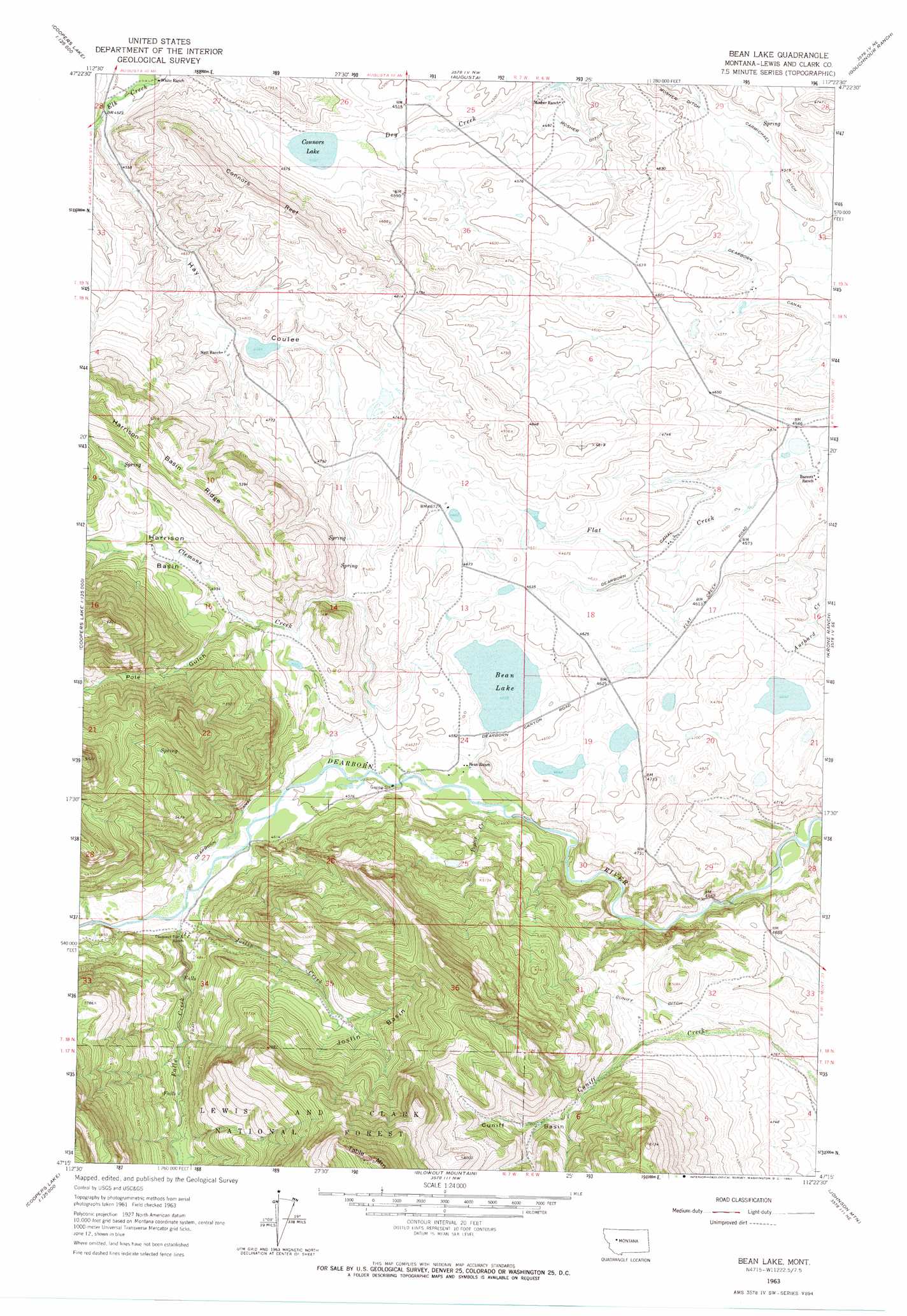
USGS Topo Quad 47112c4 - 1:24,000 scale
| Topo Map Name: | Bean Lake |
| USGS Topo Quad ID: | 47112c4 |
| Print Size: | ca. 21 1/4" wide x 27" high |
| Southeast Coordinates: | 47.25° N latitude / 112.375° W longitude |
| Map Center Coordinates: | 47.3125° N latitude / 112.4375° W longitude |
| U.S. State: | MT |
| Filename: | o47112c4.jpg |
| Download Map JPG Image: | Bean Lake topo map 1:24,000 scale |
| Map Type: | Topographic |
| Topo Series: | 7.5´ |
| Map Scale: | 1:24,000 |
| Source of Map Images: | United States Geological Survey (USGS) |
| Alternate Map Versions: |
Bean Lake MT 1963, updated 1965 Download PDF Buy paper map Bean Lake MT 1995, updated 1997 Download PDF Buy paper map Bean Lake MT 2011 Download PDF Buy paper map Bean Lake MT 2014 Download PDF Buy paper map |
| FStopo: | US Forest Service topo Bean Lake is available: Download FStopo PDF Download FStopo TIF |
1:24,000 Topo Quads surrounding Bean Lake
Sawtooth Ridge |
Barr Creek |
Split Rock Junction |
Gilman |
Golden Ridge |
Double Falls |
Nilan Reservoir |
Augusta |
Gouchnour Ranch |
Bowmans Corners Nw |
Jakie Creek |
Steamboat Mountain |
Bean Lake |
Krone Ranch |
Bowmans Corners |
Heart Lake |
Caribou Peak |
Blowout Mountain |
Johnson Mountain |
Comb Rock |
Stonewall Mountain |
Silver King Mountain |
Cadotte Creek |
Rogers Pass |
Roberts Mountain |
> Back to 47112a1 at 1:100,000 scale
> Back to 47112a1 at 1:250,000 scale
> Back to U.S. Topo Maps home
Bean Lake topo map: Gazetteer
Bean Lake: Basins
Cuniff Basin elevation 1590m 5216′Harrison Basin elevation 1521m 4990′
Joslin Basin elevation 1604m 5262′
Bean Lake: Bridges
Dearborn River High Bridge elevation 1347m 4419′Bean Lake: Canals
Carmichael Ditch elevation 1382m 4534′Cuniff Ditch elevation 1500m 4921′
Dearborn Canal elevation 1406m 4612′
Bean Lake: Dams
Bean Lake Dam elevation 1389m 4557′Bean Lake: Lakes
Bean Lake elevation 1389m 4557′Connors Lake elevation 1375m 4511′
Bean Lake: Populated Places
Clemons (historical) elevation 1410m 4625′Bean Lake: Post Offices
Clemons Post Office (historical) elevation 1410m 4625′Bean Lake: Ridges
Connors Reef elevation 1543m 5062′Harrison Basin Ridge elevation 1629m 5344′
Bean Lake: Streams
Clemons Creek elevation 1385m 4543′Falls Creek elevation 1420m 4658′
Joslin Creek elevation 1417m 4648′
Poplar Creek elevation 1375m 4511′
Bean Lake: Summits
Table Mountain elevation 2174m 7132′Bean Lake: Valleys
Hay Coulee elevation 1373m 4504′Pole Gulch elevation 1488m 4881′
Bean Lake digital topo map on disk
Buy this Bean Lake topo map showing relief, roads, GPS coordinates and other geographical features, as a high-resolution digital map file on DVD: