Scapegoat Mountain Topo Map Montana
To zoom in, hover over the map of Scapegoat Mountain
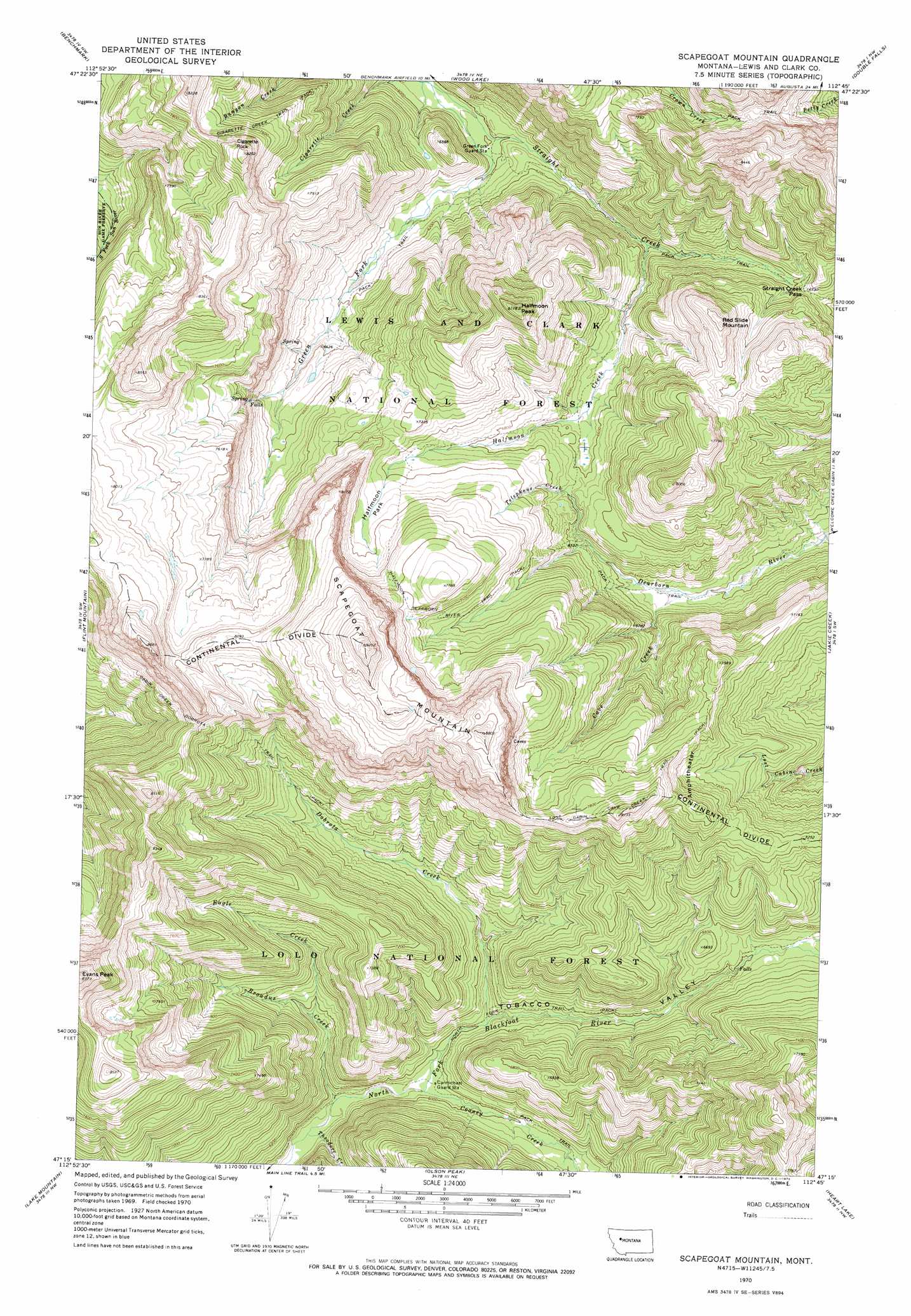
USGS Topo Quad 47112c7 - 1:24,000 scale
| Topo Map Name: | Scapegoat Mountain |
| USGS Topo Quad ID: | 47112c7 |
| Print Size: | ca. 21 1/4" wide x 27" high |
| Southeast Coordinates: | 47.25° N latitude / 112.75° W longitude |
| Map Center Coordinates: | 47.3125° N latitude / 112.8125° W longitude |
| U.S. State: | MT |
| Filename: | o47112c7.jpg |
| Download Map JPG Image: | Scapegoat Mountain topo map 1:24,000 scale |
| Map Type: | Topographic |
| Topo Series: | 7.5´ |
| Map Scale: | 1:24,000 |
| Source of Map Images: | United States Geological Survey (USGS) |
| Alternate Map Versions: |
Scapegoat Mountain MT 1970, updated 1973 Download PDF Buy paper map Scapegoat Mountain MT 1995, updated 1997 Download PDF Buy paper map Scapegoat Mountain MT 1995, updated 1997 Download PDF Buy paper map Scapegoat Mountain MT 2011 Download PDF Buy paper map Scapegoat Mountain MT 2014 Download PDF Buy paper map |
| FStopo: | US Forest Service topo Scapegoat Mountain is available: Download FStopo PDF Download FStopo TIF |
1:24,000 Topo Quads surrounding Scapegoat Mountain
Prairie Reef |
Pretty Prairie |
Patricks Basin |
Sawtooth Ridge |
Barr Creek |
Trap Mountain |
Benchmark |
Wood Lake |
Double Falls |
Nilan Reservoir |
Danaher Mountain |
Flint Mountain |
Scapegoat Mountain |
Jakie Creek |
Steamboat Mountain |
Spread Mountain |
Lake Mountain |
Olson Peak |
Heart Lake |
Caribou Peak |
Ovando Mountain |
Coopers Lake |
Arrastra Mountain |
Stonewall Mountain |
Silver King Mountain |
> Back to 47112a1 at 1:100,000 scale
> Back to 47112a1 at 1:250,000 scale
> Back to U.S. Topo Maps home
Scapegoat Mountain topo map: Gazetteer
Scapegoat Mountain: Flats
Halfmoon Park elevation 2164m 7099′McDonnell Meadow elevation 2013m 6604′
Scapegoat Mountain: Gaps
Straight Creek Pass elevation 2055m 6742′Scapegoat Mountain: Streams
Broadus Creek elevation 1782m 5846′Cave Creek elevation 1905m 6250′
Cooney Creek elevation 1805m 5921′
Dobrota Creek elevation 1835m 6020′
Eagle Creek elevation 1864m 6115′
Green Fork Straight Creek elevation 1810m 5938′
Halfmoon Creek elevation 1911m 6269′
Telephone Creek elevation 1973m 6473′
Theodore Creek elevation 1776m 5826′
Scapegoat Mountain: Summits
Cigarette Rock elevation 2510m 8234′Halfmoon Peak elevation 2469m 8100′
Red Slide Mountain elevation 2344m 7690′
Scapegoat Mountain elevation 2800m 9186′
Scapegoat Mountain: Trails
Cigarette Creek Trail elevation 2232m 7322′Halfmoon Dearborn River Trail elevation 2200m 7217′
Lost Cabin Cave Creek Trail elevation 2310m 7578′
Scapegoat Mountain: Valleys
Tobacco Valley elevation 1808m 5931′Scapegoat Mountain digital topo map on disk
Buy this Scapegoat Mountain topo map showing relief, roads, GPS coordinates and other geographical features, as a high-resolution digital map file on DVD: