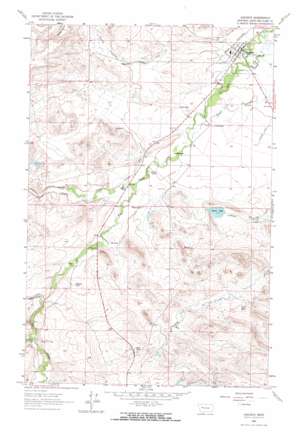
Augusta Topo Map Montana
To zoom in, hover over the map of Augusta
USGS Topo Quad 47112d4 - 1:24,000 scale
| Topo Map Name: | Augusta |
| USGS Topo Quad ID: | 47112d4 |
| Print Size: | ca. 21 1/4" wide x 27" high |
| Southeast Coordinates: | 47.375° N latitude / 112.375° W longitude |
| Map Center Coordinates: | 47.4375° N latitude / 112.4375° W longitude |
| U.S. State: | MT |
| Filename: | o47112d4.jpg |
| Download Map JPG Image: | Augusta topo map 1:24,000 scale |
| Map Type: | Topographic |
| Topo Series: | 7.5´ |
| Map Scale: | 1:24,000 |
| Source of Map Images: | United States Geological Survey (USGS) |
| Alternate Map Versions: |
Augusta MT 1963, updated 1965 Download PDF Buy paper map Augusta MT 1963, updated 1965 Download PDF Buy paper map Augusta MT 2011 Download PDF Buy paper map Augusta MT 2014 Download PDF Buy paper map |
1:24,000 Topo Quads surrounding Augusta
> Back to 47112a1 at 1:100,000 scale
> Back to 47112a1 at 1:250,000 scale
> Back to U.S. Topo Maps home
Augusta topo map: Gazetteer
Augusta: Airports
Augusta Airport elevation 1257m 4124′Augusta: Canals
Mosher Ditch elevation 1379m 4524′Vaughn Ditch elevation 1284m 4212′
Augusta: Lakes
Krone Lake elevation 1292m 4238′Augusta: Populated Places
Augusta elevation 1240m 4068′Augusta: Post Offices
Augusta Post Office elevation 1240m 4068′Southvale Post Office (historical) elevation 1242m 4074′
Augusta: Streams
Blubber Creek elevation 1348m 4422′Smith Creek elevation 1283m 4209′
Augusta: Summits
Sandy Butte elevation 1406m 4612′Augusta: Valleys
Murphy Coulee elevation 1282m 4206′Swallow Canyon elevation 1333m 4373′
Augusta: Wells
20N06W17DDAA01 Well elevation 1245m 4084′Augusta digital topo map on disk
Buy this Augusta topo map showing relief, roads, GPS coordinates and other geographical features, as a high-resolution digital map file on DVD:


