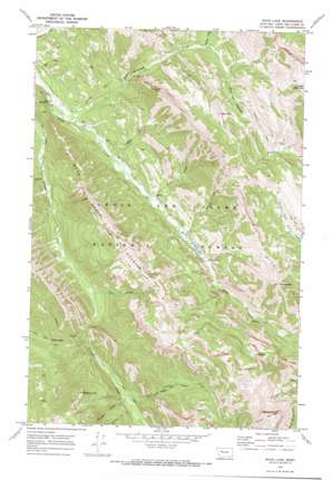
Wood Lake Topo Map Montana
To zoom in, hover over the map of Wood Lake
USGS Topo Quad 47112d7 - 1:24,000 scale
| Topo Map Name: | Wood Lake |
| USGS Topo Quad ID: | 47112d7 |
| Print Size: | ca. 21 1/4" wide x 27" high |
| Southeast Coordinates: | 47.375° N latitude / 112.75° W longitude |
| Map Center Coordinates: | 47.4375° N latitude / 112.8125° W longitude |
| U.S. State: | MT |
| Filename: | o47112d7.jpg |
| Download Map JPG Image: | Wood Lake topo map 1:24,000 scale |
| Map Type: | Topographic |
| Topo Series: | 7.5´ |
| Map Scale: | 1:24,000 |
| Source of Map Images: | United States Geological Survey (USGS) |
| Alternate Map Versions: |
Wood Lake MT 1970, updated 1973 Download PDF Buy paper map Wood Lake MT 1995, updated 1997 Download PDF Buy paper map Wood Lake MT 2011 Download PDF Buy paper map Wood Lake MT 2014 Download PDF Buy paper map |
| FStopo: | US Forest Service topo Wood Lake is available: Download FStopo PDF Download FStopo TIF |
1:24,000 Topo Quads surrounding Wood Lake
> Back to 47112a1 at 1:100,000 scale
> Back to 47112a1 at 1:250,000 scale
> Back to U.S. Topo Maps home
Wood Lake topo map: Gazetteer
Wood Lake: Airports
Benchmark Airport elevation 1641m 5383′Wood Lake: Dams
Wood Lake Dam elevation 1752m 5748′Wood Lake: Gaps
Elbow Pass elevation 1987m 6519′Wood Lake: Lakes
Alpine Lake elevation 2095m 6873′Wood Lake elevation 1752m 5748′
Wood Lake: Plains
Fairview Plateau elevation 1980m 6496′Ford Creek Plateau elevation 2192m 7191′
Wood Lake: Reservoirs
Wood Lake elevation 1752m 5748′Wood Lake: Ridges
Wood Creek Hogback elevation 2260m 7414′Wood Lake: Streams
Blackrock Creek elevation 1830m 6003′Bunyan Creek elevation 1795m 5889′
Cigarette Creek elevation 1805m 5921′
Crown Creek elevation 1793m 5882′
Elbow Creek elevation 1770m 5807′
Fairview Creek elevation 1647m 5403′
Green Timber Creek elevation 1752m 5748′
Lick Creek elevation 1723m 5652′
Mule Creek elevation 1701m 5580′
Park Creek elevation 1742m 5715′
Renshaw Creek elevation 1872m 6141′
Wood Lake: Summits
Bunyan Point elevation 2219m 7280′Crown Mountain elevation 2542m 8339′
Cyanide Mountain elevation 2385m 7824′
Fairview Mountain elevation 2512m 8241′
Red Hill elevation 2187m 7175′
Wood Lake: Trails
Elbow Pass Trail elevation 2013m 6604′Fairview Trail elevation 1889m 6197′
Patrol Mountain Lookout Trail elevation 1687m 5534′
Petty Crown Creek Trail elevation 2118m 6948′
Wood Lake digital topo map on disk
Buy this Wood Lake topo map showing relief, roads, GPS coordinates and other geographical features, as a high-resolution digital map file on DVD:


