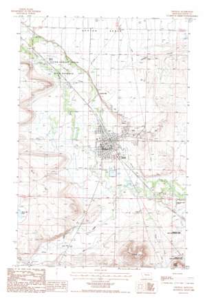
Choteau Topo Map Montana
To zoom in, hover over the map of Choteau
USGS Topo Quad 47112g2 - 1:24,000 scale
| Topo Map Name: | Choteau |
| USGS Topo Quad ID: | 47112g2 |
| Print Size: | ca. 21 1/4" wide x 27" high |
| Southeast Coordinates: | 47.75° N latitude / 112.125° W longitude |
| Map Center Coordinates: | 47.8125° N latitude / 112.1875° W longitude |
| U.S. State: | MT |
| Filename: | o47112g2.jpg |
| Download Map JPG Image: | Choteau topo map 1:24,000 scale |
| Map Type: | Topographic |
| Topo Series: | 7.5´ |
| Map Scale: | 1:24,000 |
| Source of Map Images: | United States Geological Survey (USGS) |
| Alternate Map Versions: |
Choteau MT 1987, updated 1987 Download PDF Buy paper map Choteau MT 2011 Download PDF Buy paper map Choteau MT 2014 Download PDF Buy paper map |
1:24,000 Topo Quads surrounding Choteau
> Back to 47112e1 at 1:100,000 scale
> Back to 47112a1 at 1:250,000 scale
> Back to U.S. Topo Maps home
Choteau topo map: Gazetteer
Choteau: Airports
Choteau Airport elevation 1201m 3940′Choteau: Benches
Burd Hill elevation 1229m 4032′Choteau: Canals
S-T Canal elevation 1180m 3871′Teton Ditch elevation 1171m 3841′
Choteau: Dams
Choteau Sewage Lagoon Dam elevation 1155m 3789′Choteau: Parks
Old Agency on the Teton Historical Marker elevation 1193m 3914′Teton-Spring Creek Bird Reserve elevation 1190m 3904′
Choteau: Populated Places
Choteau elevation 1164m 3818′Choteau Junction elevation 1159m 3802′
Truchot Hill elevation 1182m 3877′
Choteau: Post Offices
Choteau Post Office elevation 1164m 3818′Choteau: Reservoirs
Burd Hill Lake elevation 1218m 3996′Choteau: Springs
Agency Spring elevation 1198m 3930′Choteau: Streams
Agency Creek elevation 1178m 3864′Deep Creek elevation 1150m 3772′
Dog Creek elevation 1190m 3904′
Spring Creek elevation 1138m 3733′
Choteau: Summits
Priest Butte elevation 1268m 4160′Rattlesnake Butte elevation 1338m 4389′
Choteau: Valleys
Cashman Coulee elevation 1159m 3802′Choteau: Wells
24N04W05A___01 Well elevation 1174m 3851′24N04W05C___01 Well elevation 1180m 3871′
24N04W08CBB_01 Well elevation 1189m 3900′
24N04W19C___01 Well elevation 1168m 3832′
Choteau digital topo map on disk
Buy this Choteau topo map showing relief, roads, GPS coordinates and other geographical features, as a high-resolution digital map file on DVD:


