Bynum Topo Map Montana
To zoom in, hover over the map of Bynum
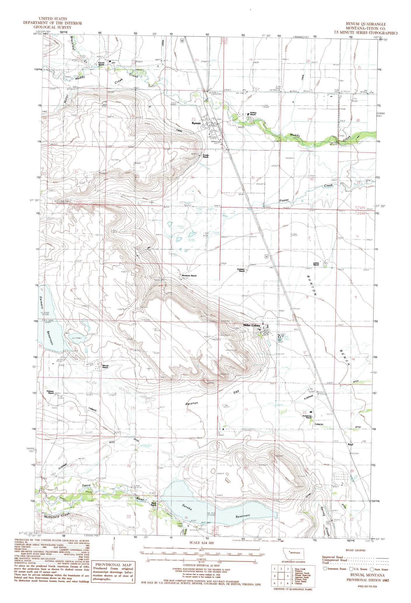
USGS Topo Quad 47112h3 - 1:24,000 scale
| Topo Map Name: | Bynum |
| USGS Topo Quad ID: | 47112h3 |
| Print Size: | ca. 21 1/4" wide x 27" high |
| Southeast Coordinates: | 47.875° N latitude / 112.25° W longitude |
| Map Center Coordinates: | 47.9375° N latitude / 112.3125° W longitude |
| U.S. State: | MT |
| Filename: | o47112h3.jpg |
| Download Map JPG Image: | Bynum topo map 1:24,000 scale |
| Map Type: | Topographic |
| Topo Series: | 7.5´ |
| Map Scale: | 1:24,000 |
| Source of Map Images: | United States Geological Survey (USGS) |
| Alternate Map Versions: |
Bynum MT 1987, updated 1987 Download PDF Buy paper map Bynum MT 2011 Download PDF Buy paper map Bynum MT 2014 Download PDF Buy paper map |
1:24,000 Topo Quads surrounding Bynum
Dupuyer West |
Dupuyer East |
Lone Man Coulee West |
Lone Man Coulee East |
Sam George Hill |
Blackleaf |
Soap Creek |
Pendroy |
Agawam North |
Gallup City |
Twin Lakes |
Bynum Reservoir |
Bynum |
Agawam South |
Eyraud Lakes |
Lake Theboe |
Watson Flats |
Teton Buttes |
Choteau |
Choteau Se |
Split Rock Lake |
Pishkun Reservoir |
Nunemaker Hill |
Sevenmile Hill |
Freezeout Lake |
> Back to 47112e1 at 1:100,000 scale
> Back to 47112a1 at 1:250,000 scale
> Back to U.S. Topo Maps home
Bynum topo map: Gazetteer
Bynum: Canals
D Canal elevation 1199m 3933′Eldorado Ditch elevation 1222m 4009′
Farmers Ditch elevation 1263m 4143′
S Canal elevation 1227m 4025′
Bynum: Dams
Eureka Reservoir Dam elevation 1257m 4124′Farmers Coop Canal Company Dam elevation 1282m 4206′
Bynum: Gaps
Ralston Gap elevation 1244m 4081′Bynum: Populated Places
Bynum elevation 1212m 3976′Koyl elevation 1228m 4028′
Miller Colony elevation 1226m 4022′
Bynum: Post Offices
Bynum Post Office elevation 1212m 3976′Koyl Post Office (historical) elevation 1228m 4028′
Bynum: Reservoirs
Eureka Reservoir elevation 1257m 4124′Farmers Reservoir elevation 1282m 4206′
Farmers Reservoir elevation 1281m 4202′
Bynum: Streams
Blackleaf Creek elevation 1238m 4061′McDonald Creek elevation 1275m 4183′
Miller Creek elevation 1221m 4005′
North Fork Muddy Creek elevation 1239m 4064′
Bynum: Wells
25N05W05D___01 Well elevation 1208m 3963′26N05W20____01 Well elevation 1197m 3927′
26N05W30____01 Well elevation 1206m 3956′
Bynum digital topo map on disk
Buy this Bynum topo map showing relief, roads, GPS coordinates and other geographical features, as a high-resolution digital map file on DVD: