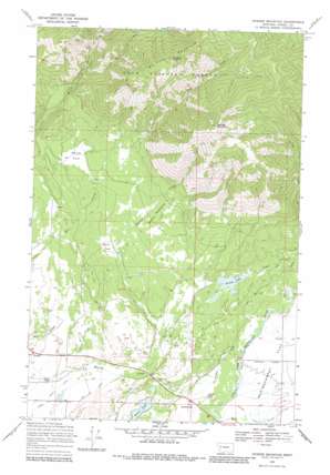
Ovando Mountain Topo Map Montana
To zoom in, hover over the map of Ovando Mountain
USGS Topo Quad 47113a1 - 1:24,000 scale
| Topo Map Name: | Ovando Mountain |
| USGS Topo Quad ID: | 47113a1 |
| Print Size: | ca. 21 1/4" wide x 27" high |
| Southeast Coordinates: | 47° N latitude / 113° W longitude |
| Map Center Coordinates: | 47.0625° N latitude / 113.0625° W longitude |
| U.S. State: | MT |
| Filename: | o47113a1.jpg |
| Download Map JPG Image: | Ovando Mountain topo map 1:24,000 scale |
| Map Type: | Topographic |
| Topo Series: | 7.5´ |
| Map Scale: | 1:24,000 |
| Source of Map Images: | United States Geological Survey (USGS) |
| Alternate Map Versions: |
Ovando Mountain MT 1968, updated 1971 Download PDF Buy paper map Ovando Mountain MT 1968, updated 1982 Download PDF Buy paper map Ovando Mountain MT 1999, updated 2003 Download PDF Buy paper map Ovando Mountain MT 2011 Download PDF Buy paper map Ovando Mountain MT 2014 Download PDF Buy paper map |
| FStopo: | US Forest Service topo Ovando Mountain is available: Download FStopo PDF Download FStopo TIF |
1:24,000 Topo Quads surrounding Ovando Mountain
> Back to 47113a1 at 1:100,000 scale
> Back to 47112a1 at 1:250,000 scale
> Back to U.S. Topo Maps home
Ovando Mountain topo map: Gazetteer
Ovando Mountain: Canals
Cedar Falls Ditch elevation 1270m 4166′Day Ditch elevation 1292m 4238′
Hoffland Lateral elevation 1285m 4215′
Jacobsen Ditch elevation 1280m 4199′
Krutar Ditch elevation 1274m 4179′
Murphy Ditch elevation 1367m 4484′
Ovando Mountain: Dams
Doney Lake Number 2 Dam elevation 1361m 4465′Evans Lake Dam elevation 1278m 4192′
Ovando Mountain: Flats
Doney Meadows elevation 1418m 4652′Martin Park elevation 1370m 4494′
Mollet Park elevation 1399m 4589′
Ovando Mountain: Lakes
Doney Lake elevation 1361m 4465′Evans Lake elevation 1278m 4192′
Ovando Mountain: Parks
Copenhaver Park elevation 1311m 4301′Ovando Mountain: Populated Places
Geary elevation 1288m 4225′Ovando Mountain: Springs
Jacobsen Spring elevation 1269m 4163′Ovando Mountain: Streams
East Fork McCabe Creek elevation 1453m 4767′Smith Creek elevation 1282m 4206′
Spring Creek elevation 1295m 4248′
Ovando Mountain: Summits
McCabe Mountain elevation 2254m 7395′McCabe Point elevation 2270m 7447′
Ovando Mountain elevation 2346m 7696′
Ovando Mountain: Wells
15N11W28BBBB01 Well elevation 1298m 4258′15N11W29BDCA01 Well elevation 1285m 4215′
15N11W31CDBA01 Well elevation 1270m 4166′
15N11W32BBAB01 Well elevation 1282m 4206′
15N12W25CADD01 Well elevation 1326m 4350′
15N12W25CDAD01 Well elevation 1330m 4363′
15N12W36BCDD01 Well elevation 1310m 4297′
15N12W36DDDA01 Well elevation 1269m 4163′
15N13W12CACA01 Well elevation 1408m 4619′
Ovando Mountain digital topo map on disk
Buy this Ovando Mountain topo map showing relief, roads, GPS coordinates and other geographical features, as a high-resolution digital map file on DVD:


