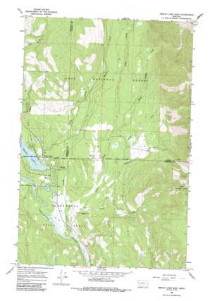
Seeley Lake East Topo Map Montana
To zoom in, hover over the map of Seeley Lake East
USGS Topo Quad 47113b4 - 1:24,000 scale
| Topo Map Name: | Seeley Lake East |
| USGS Topo Quad ID: | 47113b4 |
| Print Size: | ca. 21 1/4" wide x 27" high |
| Southeast Coordinates: | 47.125° N latitude / 113.375° W longitude |
| Map Center Coordinates: | 47.1875° N latitude / 113.4375° W longitude |
| U.S. State: | MT |
| Filename: | o47113b4.jpg |
| Download Map JPG Image: | Seeley Lake East topo map 1:24,000 scale |
| Map Type: | Topographic |
| Topo Series: | 7.5´ |
| Map Scale: | 1:24,000 |
| Source of Map Images: | United States Geological Survey (USGS) |
| Alternate Map Versions: |
Seeley Lake East MT 1965, updated 1968 Download PDF Buy paper map Seeley Lake East MT 1965, updated 1987 Download PDF Buy paper map Seeley Lake East MT 1999, updated 2003 Download PDF Buy paper map Seeley Lake East MT 2011 Download PDF Buy paper map Seeley Lake East MT 2014 Download PDF Buy paper map |
| FStopo: | US Forest Service topo Seeley Lake East is available: Download FStopo PDF Download FStopo TIF |
1:24,000 Topo Quads surrounding Seeley Lake East
> Back to 47113a1 at 1:100,000 scale
> Back to 47112a1 at 1:250,000 scale
> Back to U.S. Topo Maps home
Seeley Lake East topo map: Gazetteer
Seeley Lake East: Airports
Lindeys Landing West Seaplane Base elevation 1218m 3996′Seeley Lake Airport elevation 1281m 4202′
Seeley Lake East: Populated Places
Seeley Lake elevation 1225m 4019′Seeley Lake East: Post Offices
Seeley Lake Post Office elevation 1225m 4019′Seeley Lake East: Ridges
Rice Ridge elevation 1815m 5954′Seeley Lake East: Streams
Blind Canyon Creek elevation 1290m 4232′Drew Creek elevation 1208m 3963′
Morrell Creek elevation 1201m 3940′
Mountain Creek elevation 1255m 4117′
Seeley Creek elevation 1218m 3996′
Swamp Creek elevation 1259m 4130′
Trail Creek elevation 1209m 3966′
Seeley Lake East: Wells
16N15W01ABCD01 Well elevation 1266m 4153′16N15W01BABA01 Well elevation 1280m 4199′
16N15W01BADB01 Well elevation 1274m 4179′
16N15W01BDCC01 Well elevation 1270m 4166′
16N15W01CCAA01 Well elevation 1263m 4143′
16N15W02AAAD01 Well elevation 1280m 4199′
16N15W03ABBA01 Well elevation 1226m 4022′
16N15W03ABBD01 Well elevation 1227m 4025′
16N15W03CDCC01 Well elevation 1225m 4019′
16N15W03CDDD01 Well elevation 1227m 4025′
16N15W04ABAD01 Well elevation 1226m 4022′
16N15W10BACA01 Well elevation 1228m 4028′
16N15W10BDBB01 Well elevation 1227m 4025′
16N15W10BDBD01 Well elevation 1226m 4022′
16N15W10BDCB01 Well elevation 1216m 3989′
16N15W14DBAA01 Well elevation 1220m 4002′
17N15W34ACDC01 Well elevation 1223m 4012′
17N15W34DAAD01 Well elevation 1226m 4022′
Seeley Lake East digital topo map on disk
Buy this Seeley Lake East topo map showing relief, roads, GPS coordinates and other geographical features, as a high-resolution digital map file on DVD:


