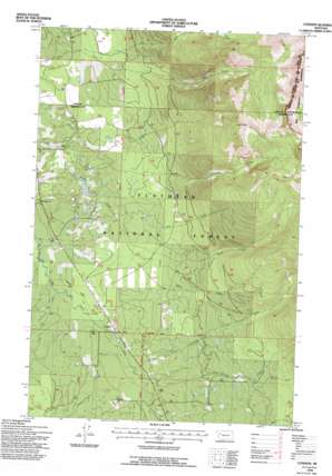
Condon Topo Map Montana
To zoom in, hover over the map of Condon
USGS Topo Quad 47113e6 - 1:24,000 scale
| Topo Map Name: | Condon |
| USGS Topo Quad ID: | 47113e6 |
| Print Size: | ca. 21 1/4" wide x 27" high |
| Southeast Coordinates: | 47.5° N latitude / 113.625° W longitude |
| Map Center Coordinates: | 47.5625° N latitude / 113.6875° W longitude |
| U.S. State: | MT |
| Filename: | o47113e6.jpg |
| Download Map JPG Image: | Condon topo map 1:24,000 scale |
| Map Type: | Topographic |
| Topo Series: | 7.5´ |
| Map Scale: | 1:24,000 |
| Source of Map Images: | United States Geological Survey (USGS) |
| Alternate Map Versions: |
Condon MT 1965, updated 1968 Download PDF Buy paper map Condon MT 1965, updated 1981 Download PDF Buy paper map Condon MT 1965, updated 1986 Download PDF Buy paper map Condon MT 1994, updated 1996 Download PDF Buy paper map Condon MT 2011 Download PDF Buy paper map Condon MT 2014 Download PDF Buy paper map |
| FStopo: | US Forest Service topo Condon is available: Download FStopo PDF Download FStopo TIF |
1:24,000 Topo Quads surrounding Condon
> Back to 47113e1 at 1:100,000 scale
> Back to 47112a1 at 1:250,000 scale
> Back to U.S. Topo Maps home
Condon topo map: Gazetteer
Condon: Airports
Condon-US Forest Service Airport elevation 1121m 3677′Condon: Flats
Smith Flats elevation 1117m 3664′Condon: Populated Places
Condon elevation 1131m 3710′Condon: Post Offices
Condon Post Office elevation 1091m 3579′Rumble Creek Post Office (historical) elevation 1110m 3641′
Condon: Streams
Cat Creek elevation 1852m 6076′Cooney Creek elevation 1134m 3720′
Elk Creek elevation 1108m 3635′
Falls Creek elevation 1111m 3645′
Glacier Creek elevation 1119m 3671′
McKay Creek elevation 1129m 3704′
Rumble Creek elevation 1138m 3733′
Simpson Creek elevation 1087m 3566′
Smith Creek elevation 1086m 3562′
South Fork Rumble Creek elevation 1290m 4232′
Condon: Wells
20N16W06CBAA01 Well elevation 1160m 3805′20N16W06DCD_01 Well elevation 1186m 3891′
20N16W07ADAA01 Well elevation 1188m 3897′
20N16W07CABB01 Well elevation 1162m 3812′
20N16W07CACB01 Well elevation 1151m 3776′
20N17W01ABCD01 Well elevation 1136m 3727′
20N17W01BAAB01 Well elevation 1132m 3713′
20N17W01BDDD01 Well elevation 1131m 3710′
20N17W01DCBD01 Well elevation 1138m 3733′
20N17W02BAAA01 Well elevation 1125m 3690′
20N17W02DCBA01 Well elevation 1136m 3727′
20N17W12DADB01 Well elevation 1164m 3818′
21N16W32ACBA01 Well elevation 1208m 3963′
21N17W14BBAB01 Well elevation 1091m 3579′
21N17W14CABC01 Well elevation 1090m 3576′
21N17W23BBDA01 Well elevation 1090m 3576′
21N17W24DBDB01 Well elevation 1110m 3641′
21N17W26ABCD01 Well elevation 1102m 3615′
21N17W26ADBD01 Well elevation 1106m 3628′
21N17W26BADA01 Well elevation 1099m 3605′
21N17W26DAAA01 Well elevation 1110m 3641′
21N17W26DACC01 Well elevation 1110m 3641′
21N17W26DCBC01 Well elevation 1104m 3622′
21N17W26DDDB01 Well elevation 1113m 3651′
21N17W36ACCA01 Well elevation 1123m 3684′
21N17W36DDBA01 Well elevation 1128m 3700′
Condon digital topo map on disk
Buy this Condon topo map showing relief, roads, GPS coordinates and other geographical features, as a high-resolution digital map file on DVD:


