Thunderbolt Mountain Topo Map Montana
To zoom in, hover over the map of Thunderbolt Mountain
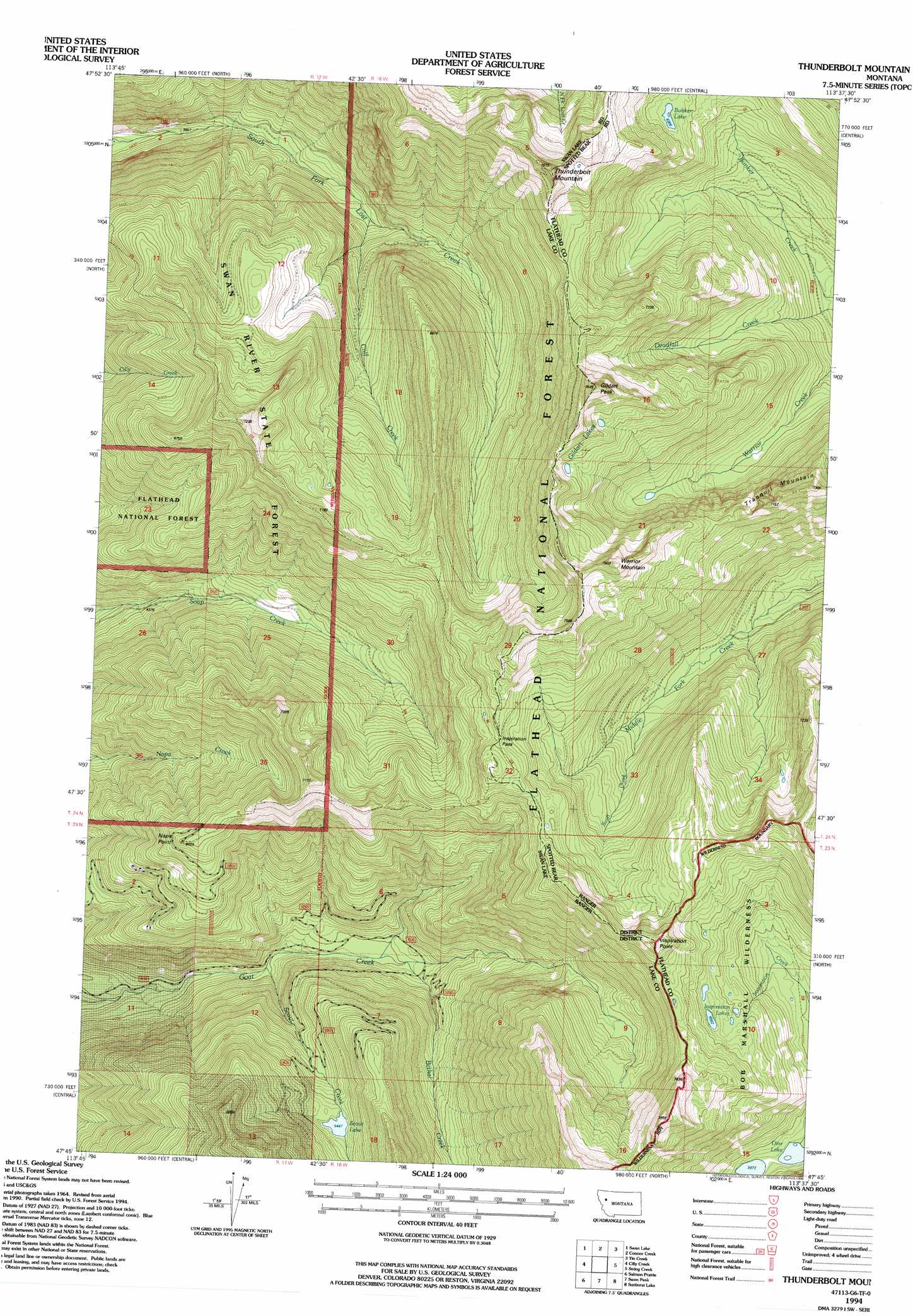
USGS Topo Quad 47113g6 - 1:24,000 scale
| Topo Map Name: | Thunderbolt Mountain |
| USGS Topo Quad ID: | 47113g6 |
| Print Size: | ca. 21 1/4" wide x 27" high |
| Southeast Coordinates: | 47.75° N latitude / 113.625° W longitude |
| Map Center Coordinates: | 47.8125° N latitude / 113.6875° W longitude |
| U.S. State: | MT |
| Filename: | o47113g6.jpg |
| Download Map JPG Image: | Thunderbolt Mountain topo map 1:24,000 scale |
| Map Type: | Topographic |
| Topo Series: | 7.5´ |
| Map Scale: | 1:24,000 |
| Source of Map Images: | United States Geological Survey (USGS) |
| Alternate Map Versions: |
Thunderbolt Mountain MT 1965, updated 1968 Download PDF Buy paper map Thunderbolt Mountain MT 1965, updated 1984 Download PDF Buy paper map Thunderbolt Mountain MT 1965, updated 1991 Download PDF Buy paper map Thunderbolt Mountain MT 1994, updated 1996 Download PDF Buy paper map Thunderbolt Mountain MT 2011 Download PDF Buy paper map Thunderbolt Mountain MT 2014 Download PDF Buy paper map |
| FStopo: | US Forest Service topo Thunderbolt Mountain is available: Download FStopo PDF Download FStopo TIF |
1:24,000 Topo Quads surrounding Thunderbolt Mountain
Crater Lake |
Big Hawk Mountain |
Quintonkon |
Circus Peak |
Horseshoe Peak |
Yew Creek |
Swan Lake |
Connor Creek |
Tin Creek |
Spotted Bear Mountain |
Porcupine Creek |
Cilly Creek |
Thunderbolt Mountain |
String Creek |
Meadow Creek |
Cedar Lake |
Salmon Prairie |
Swan Peak |
Sunburst Lake |
Marmot Mountain |
Piper-Crow Pass |
Peck Lake |
Condon |
Holland Peak |
Big Salmon Lake West |
> Back to 47113e1 at 1:100,000 scale
> Back to 47112a1 at 1:250,000 scale
> Back to U.S. Topo Maps home
Thunderbolt Mountain topo map: Gazetteer
Thunderbolt Mountain: Gaps
Inspiration Pass elevation 2123m 6965′Thunderbolt Mountain: Lakes
Bunker Lake elevation 1921m 6302′Gildart Lakes elevation 2179m 7148′
Inspiration Lakes elevation 2037m 6683′
Olor Lake elevation 1730m 5675′
Scout Lake elevation 1661m 5449′
Thunderbolt Mountain: Streams
Bethal Creek elevation 1345m 4412′Cliff Creek elevation 1333m 4373′
Scout Creek elevation 1272m 4173′
Swift Creek elevation 1664m 5459′
Thunderbolt Mountain: Summits
Gildart Peak elevation 2395m 7857′Inspiration Point elevation 2302m 7552′
Napa Point elevation 1951m 6400′
Thunderbolt Mountain elevation 2366m 7762′
Tranquil Mountain elevation 2200m 7217′
Warrior Mountain elevation 2367m 7765′
Thunderbolt Mountain digital topo map on disk
Buy this Thunderbolt Mountain topo map showing relief, roads, GPS coordinates and other geographical features, as a high-resolution digital map file on DVD: