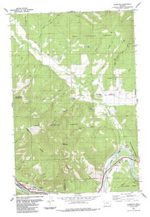
Alberton Topo Map Montana
To zoom in, hover over the map of Alberton
USGS Topo Quad 47114a4 - 1:24,000 scale
| Topo Map Name: | Alberton |
| USGS Topo Quad ID: | 47114a4 |
| Print Size: | ca. 21 1/4" wide x 27" high |
| Southeast Coordinates: | 47° N latitude / 114.375° W longitude |
| Map Center Coordinates: | 47.0625° N latitude / 114.4375° W longitude |
| U.S. State: | MT |
| Filename: | o47114a4.jpg |
| Download Map JPG Image: | Alberton topo map 1:24,000 scale |
| Map Type: | Topographic |
| Topo Series: | 7.5´ |
| Map Scale: | 1:24,000 |
| Source of Map Images: | United States Geological Survey (USGS) |
| Alternate Map Versions: |
Alberton MT 1984, updated 1984 Download PDF Buy paper map Alberton MT 1999, updated 2003 Download PDF Buy paper map Alberton MT 2011 Download PDF Buy paper map Alberton MT 2014 Download PDF Buy paper map |
| FStopo: | US Forest Service topo Alberton is available: Download FStopo PDF Download FStopo TIF |
1:24,000 Topo Quads surrounding Alberton
> Back to 47114a1 at 1:100,000 scale
> Back to 47114a1 at 1:250,000 scale
> Back to U.S. Topo Maps home
Alberton topo map: Gazetteer
Alberton: Airports
Nine Mile Airport elevation 1014m 3326′Ted Luark Private Stolport elevation 1354m 4442′
Alberton: Crossings
Eddy Overpass elevation 940m 3083′Interchange 75 elevation 914m 2998′
Alberton: Dams
Longpre Dam elevation 1016m 3333′Spring Creek Dam elevation 1122m 3681′
Alberton: Lakes
Kreis Pond elevation 1122m 3681′Alberton: Populated Places
Alberton elevation 931m 3054′Ninemile elevation 922m 3024′
Soudan elevation 936m 3070′
Alberton: Post Offices
Alberton Post Office elevation 934m 3064′Ninemile Post Office (historical) elevation 922m 3024′
Alberton: Reservoirs
Spring Creek Reservoir elevation 1122m 3681′Alberton: Streams
Butler Creek elevation 964m 3162′Cedar Creek elevation 976m 3202′
Cromwell Creek elevation 935m 3067′
Duff Creek elevation 983m 3225′
Eddy Creek elevation 914m 2998′
Ellis Creek elevation 930m 3051′
Free Creek elevation 972m 3188′
Issac Creek elevation 920m 3018′
Kennedy Creek elevation 983m 3225′
Ninemile Creek elevation 915m 3001′
Rennic Creek elevation 932m 3057′
Rock Creek elevation 915m 3001′
Spring Creek elevation 938m 3077′
Stark Creek elevation 961m 3152′
Stony Creek elevation 933m 3061′
Tank Creek elevation 915m 3001′
Alberton: Summits
Ellis Mountain elevation 1808m 5931′Alberton: Wells
15N22W07DCAB01 Well elevation 934m 3064′15N22W28BADC01 Well elevation 915m 3001′
15N22W33BAC_01 Well elevation 926m 3038′
15N22W33BAC_02 Well elevation 925m 3034′
15N22W33BDDD01 Well elevation 942m 3090′
15N22W33DBCC01 Well elevation 939m 3080′
15N23W01ADAA01 Well elevation 1009m 3310′
15N23W01BDCB01 Well elevation 959m 3146′
15N23W12ABCA01 Well elevation 954m 3129′
15N23W12ABDD01 Well elevation 950m 3116′
15N23W12ACCA01 Well elevation 978m 3208′
Alberton digital topo map on disk
Buy this Alberton topo map showing relief, roads, GPS coordinates and other geographical features, as a high-resolution digital map file on DVD:


