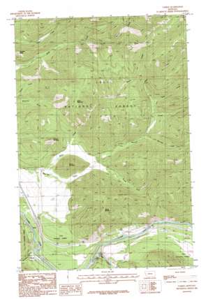
Tarkio Topo Map Montana
To zoom in, hover over the map of Tarkio
USGS Topo Quad 47114a6 - 1:24,000 scale
| Topo Map Name: | Tarkio |
| USGS Topo Quad ID: | 47114a6 |
| Print Size: | ca. 21 1/4" wide x 27" high |
| Southeast Coordinates: | 47° N latitude / 114.625° W longitude |
| Map Center Coordinates: | 47.0625° N latitude / 114.6875° W longitude |
| U.S. State: | MT |
| Filename: | o47114a6.jpg |
| Download Map JPG Image: | Tarkio topo map 1:24,000 scale |
| Map Type: | Topographic |
| Topo Series: | 7.5´ |
| Map Scale: | 1:24,000 |
| Source of Map Images: | United States Geological Survey (USGS) |
| Alternate Map Versions: |
Tarkio MT 1983, updated 1984 Download PDF Buy paper map Tarkio MT 1999, updated 2003 Download PDF Buy paper map Tarkio MT 2011 Download PDF Buy paper map Tarkio MT 2014 Download PDF Buy paper map |
| FStopo: | US Forest Service topo Tarkio is available: Download FStopo PDF Download FStopo TIF |
1:24,000 Topo Quads surrounding Tarkio
> Back to 47114a1 at 1:100,000 scale
> Back to 47114a1 at 1:250,000 scale
> Back to U.S. Topo Maps home
Tarkio topo map: Gazetteer
Tarkio: Crossings
Interchange 61 elevation 927m 3041′Interchange 66 elevation 938m 3077′
Tarkio: Mines
Gold King Mine elevation 1594m 5229′Roosevelt Mine elevation 1366m 4481′
Tarkio: Populated Places
Tarkio elevation 895m 2936′Tarkio: Post Offices
Rivulet Post Office (historical) elevation 890m 2919′Tarkio Post Office (historical) elevation 895m 2936′
Tarkio: Streams
Alice Creek elevation 1084m 3556′Bear Creek elevation 1116m 3661′
Fish Creek elevation 853m 2798′
Miller Creek elevation 923m 3028′
Sheridan Creek elevation 1032m 3385′
South Fork Deep Creek elevation 1099m 3605′
South Fork Nemote Creek elevation 941m 3087′
Tarkio: Summits
Cobden Peak elevation 1301m 4268′Graham Mountain elevation 1270m 4166′
Martel Mountain elevation 1560m 5118′
Miller Mountain elevation 1620m 5314′
Round Mountain elevation 1282m 4206′
Tarkio: Valleys
Malley Gulch elevation 1215m 3986′McGinty Gulch elevation 866m 2841′
Mullan Gulch elevation 948m 3110′
Tarkio digital topo map on disk
Buy this Tarkio topo map showing relief, roads, GPS coordinates and other geographical features, as a high-resolution digital map file on DVD:


