Saddle Mountain Topo Map Montana
To zoom in, hover over the map of Saddle Mountain
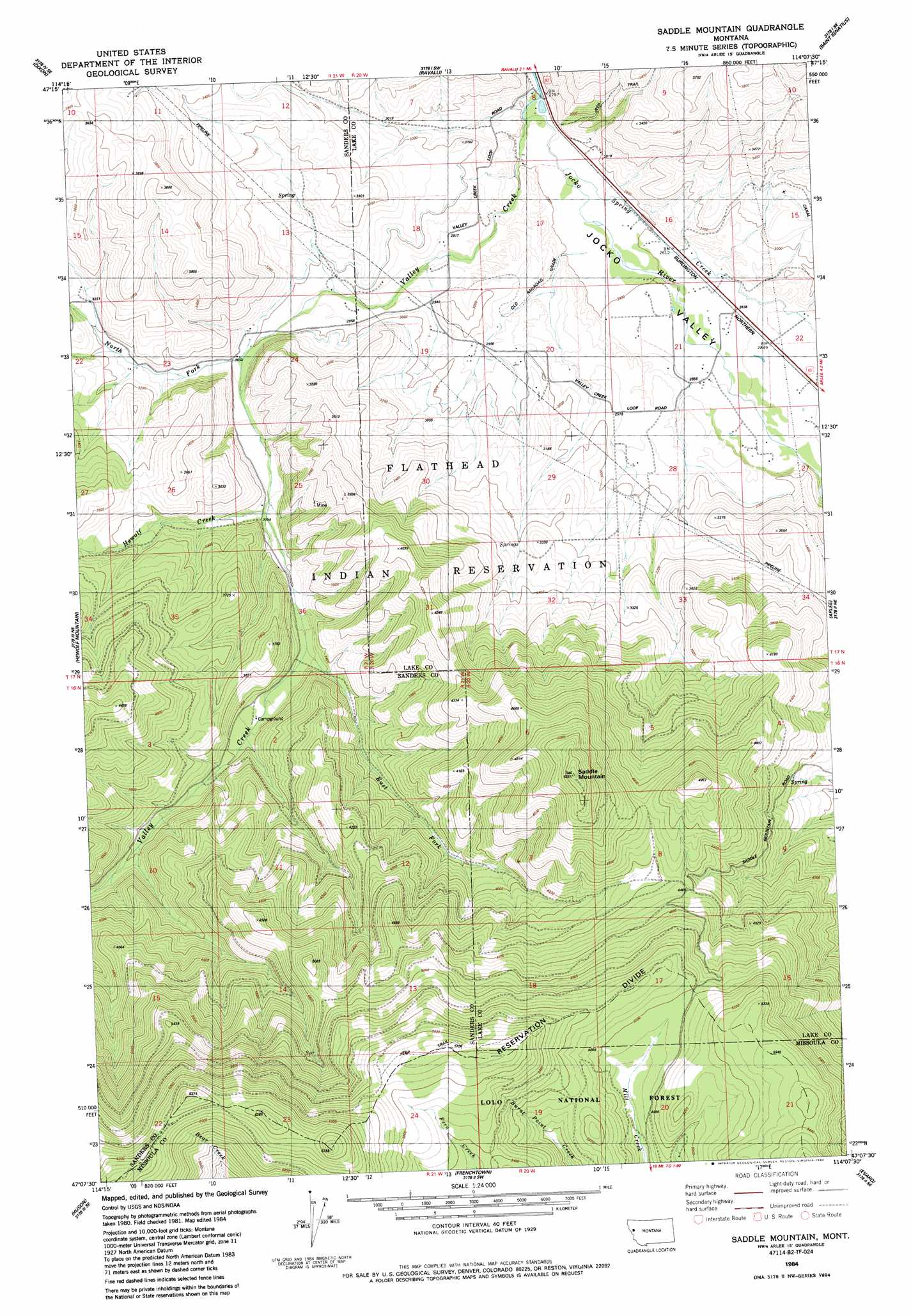
USGS Topo Quad 47114b2 - 1:24,000 scale
| Topo Map Name: | Saddle Mountain |
| USGS Topo Quad ID: | 47114b2 |
| Print Size: | ca. 21 1/4" wide x 27" high |
| Southeast Coordinates: | 47.125° N latitude / 114.125° W longitude |
| Map Center Coordinates: | 47.1875° N latitude / 114.1875° W longitude |
| U.S. State: | MT |
| Filename: | o47114b2.jpg |
| Download Map JPG Image: | Saddle Mountain topo map 1:24,000 scale |
| Map Type: | Topographic |
| Topo Series: | 7.5´ |
| Map Scale: | 1:24,000 |
| Source of Map Images: | United States Geological Survey (USGS) |
| Alternate Map Versions: |
Saddle Mountain MT 1984, updated 1984 Download PDF Buy paper map Saddle Mountain MT 1999, updated 2003 Download PDF Buy paper map Saddle Mountain MT 2011 Download PDF Buy paper map Saddle Mountain MT 2014 Download PDF Buy paper map |
| FStopo: | US Forest Service topo Saddle Mountain is available: Download FStopo PDF Download FStopo TIF |
1:24,000 Topo Quads surrounding Saddle Mountain
Melton Ranch |
Sloan |
Charlo |
Fort Connah |
Mount Harding |
Mcdonald |
Dixon |
Ravalli |
Saint Ignatius |
Saint Marys Lake |
Mccormick Peak |
Hewolf Mountain |
Saddle Mountain |
Arlee |
Gold Creek |
Alberton |
Huson |
Frenchtown |
Evaro |
Stuart Peak |
Petty Mountain |
Diamond Point |
Primrose |
Northwest Missoula |
Northeast Missoula |
> Back to 47114a1 at 1:100,000 scale
> Back to 47114a1 at 1:250,000 scale
> Back to U.S. Topo Maps home
Saddle Mountain topo map: Gazetteer
Saddle Mountain: Streams
East Fork Valley Creek elevation 994m 3261′Hewolf Creek elevation 956m 3136′
North Fork Valley Creek elevation 919m 3015′
Spring Creek elevation 842m 2762′
Valley Creek elevation 856m 2808′
Saddle Mountain: Summits
Saddle Mountain elevation 1616m 5301′Saddle Mountain: Valleys
Jocko Valley elevation 843m 2765′Saddle Mountain: Wells
16N19W16ABAB01 Well elevation 1338m 4389′17N20W16CBAA01 Well elevation 852m 2795′
17N20W18CCDA01 Well elevation 906m 2972′
17N20W18DBCD01 Well elevation 852m 2795′
17N20W19ACB_01 Well elevation 905m 2969′
17N20W20ADAA01 Well elevation 871m 2857′
17N20W20BCD_01 Well elevation 906m 2972′
17N20W20CAB_01 Well elevation 915m 3001′
17N20W20CAB_02 Well elevation 915m 3001′
17N20W21ABA_01 Well elevation 858m 2814′
17N20W21BAB_01 Well elevation 856m 2808′
17N20W21BDA_01 Well elevation 860m 2821′
17N20W29ACB_01 Well elevation 917m 3008′
Saddle Mountain digital topo map on disk
Buy this Saddle Mountain topo map showing relief, roads, GPS coordinates and other geographical features, as a high-resolution digital map file on DVD: