Hewolf Mountain Topo Map Montana
To zoom in, hover over the map of Hewolf Mountain
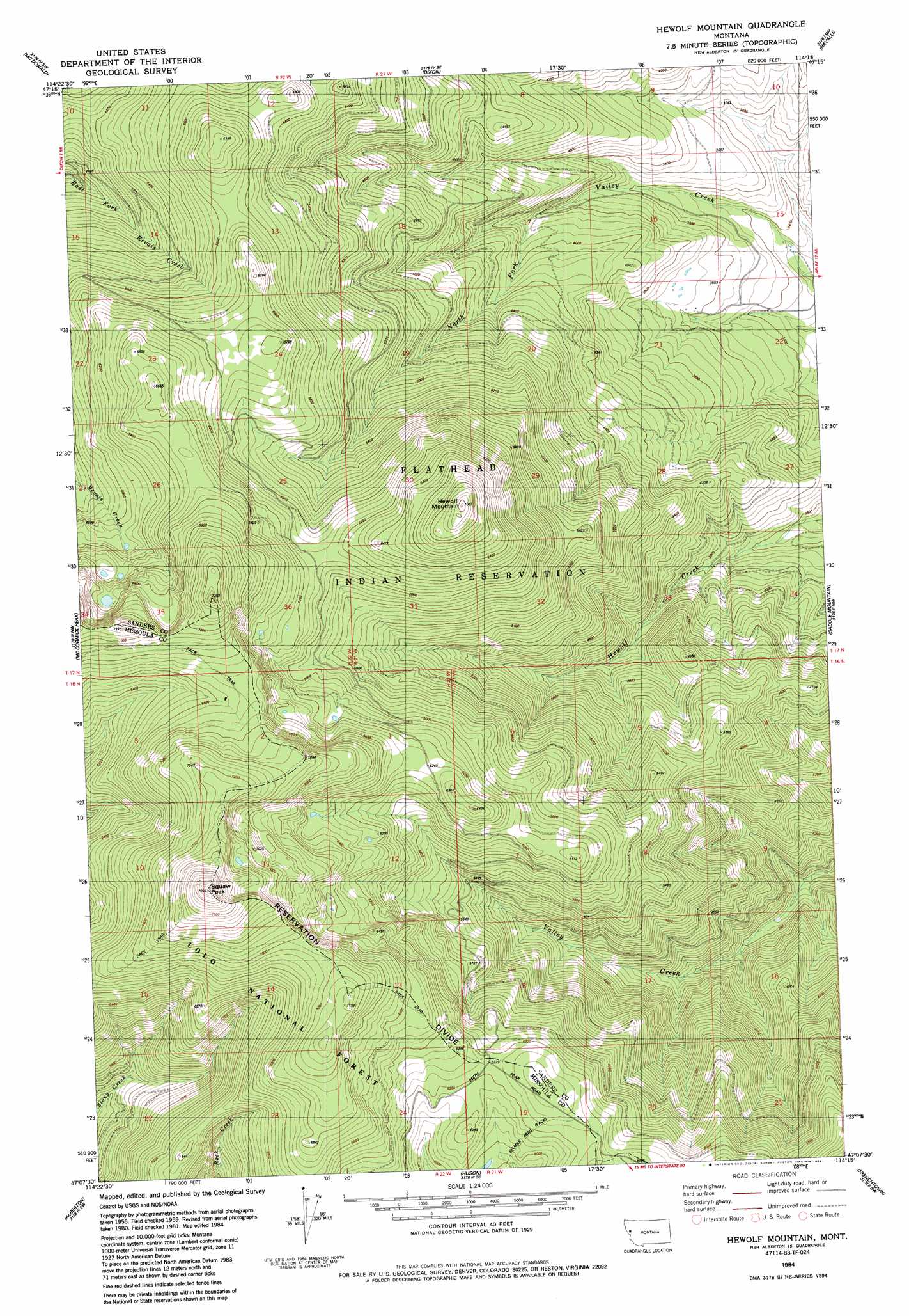
USGS Topo Quad 47114b3 - 1:24,000 scale
| Topo Map Name: | Hewolf Mountain |
| USGS Topo Quad ID: | 47114b3 |
| Print Size: | ca. 21 1/4" wide x 27" high |
| Southeast Coordinates: | 47.125° N latitude / 114.25° W longitude |
| Map Center Coordinates: | 47.1875° N latitude / 114.3125° W longitude |
| U.S. State: | MT |
| Filename: | o47114b3.jpg |
| Download Map JPG Image: | Hewolf Mountain topo map 1:24,000 scale |
| Map Type: | Topographic |
| Topo Series: | 7.5´ |
| Map Scale: | 1:24,000 |
| Source of Map Images: | United States Geological Survey (USGS) |
| Alternate Map Versions: |
Hewolf Mountain MT 1984 Download PDF Buy paper map Hewolf Mountain MT 1999, updated 2003 Download PDF Buy paper map Hewolf Mountain MT 2011 Download PDF Buy paper map Hewolf Mountain MT 2014 Download PDF Buy paper map |
| FStopo: | US Forest Service topo Hewolf Mountain is available: Download FStopo PDF Download FStopo TIF |
1:24,000 Topo Quads surrounding Hewolf Mountain
Camas Prairie |
Melton Ranch |
Sloan |
Charlo |
Fort Connah |
Perma |
Mcdonald |
Dixon |
Ravalli |
Saint Ignatius |
Stark North |
Mccormick Peak |
Hewolf Mountain |
Saddle Mountain |
Arlee |
Stark South |
Alberton |
Huson |
Frenchtown |
Evaro |
Deer Peak |
Petty Mountain |
Diamond Point |
Primrose |
Northwest Missoula |
> Back to 47114a1 at 1:100,000 scale
> Back to 47114a1 at 1:250,000 scale
> Back to U.S. Topo Maps home
Hewolf Mountain topo map: Gazetteer
Hewolf Mountain: Ridges
Reservation Divide elevation 1941m 6368′Hewolf Mountain: Summits
Ch-paa-qn Peak elevation 2435m 7988′Hewolf Mountain elevation 2130m 6988′
Hewolf Mountain digital topo map on disk
Buy this Hewolf Mountain topo map showing relief, roads, GPS coordinates and other geographical features, as a high-resolution digital map file on DVD: