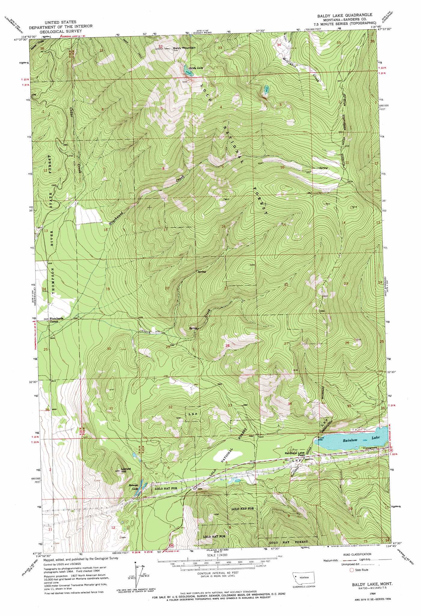
Baldy Lake Topo Map Montana
To zoom in, hover over the map of Baldy Lake
USGS Topo Quad 47114e7 - 1:24,000 scale
| Topo Map Name: | Baldy Lake |
| USGS Topo Quad ID: | 47114e7 |
| Print Size: | ca. 21 1/4" wide x 27" high |
| Southeast Coordinates: | 47.5° N latitude / 114.75° W longitude |
| Map Center Coordinates: | 47.5625° N latitude / 114.8125° W longitude |
| U.S. State: | MT |
| Filename: | o47114e7.jpg |
| Download Map JPG Image: | Baldy Lake topo map 1:24,000 scale |
| Map Type: | Topographic |
| Topo Series: | 7.5´ |
| Map Scale: | 1:24,000 |
| Source of Map Images: | United States Geological Survey (USGS) |
| Alternate Map Versions: |
Baldy Lake MT 1964, updated 1967 Download PDF Buy paper map Baldy Lake MT 1999, updated 2003 Download PDF Buy paper map Baldy Lake MT 2011 Download PDF Buy paper map Baldy Lake MT 2014 Download PDF Buy paper map |
| FStopo: | US Forest Service topo Baldy Lake is available: Download FStopo PDF Download FStopo TIF |
1:24,000 Topo Quads surrounding Baldy Lake
Richards Peak |
Cook Mountain |
Bassoo Peak |
Mill Pocket Creek |
Niarada |
Calico Creek |
Loneman Creek |
Coney Peak |
Lonepine |
Hot Springs Ne |
Big Hole Peak |
Weeksville |
Baldy Lake |
Hot Springs |
Markle Pass |
Sunset Peak |
Plains |
Paradise |
Sunrise Spring |
Camas Prairie |
Saint Regis |
Keystone Peak |
Quinns Hot Springs |
Knowles |
Perma |
> Back to 47114e1 at 1:100,000 scale
> Back to 47114a1 at 1:250,000 scale
> Back to U.S. Topo Maps home
Baldy Lake topo map: Gazetteer
Baldy Lake: Gaps
Rainbow Lake Pass elevation 1097m 3599′Baldy Lake: Lakes
Baldy Lake elevation 2051m 6729′Banana Lake elevation 1096m 3595′
Rainbow Lake elevation 1094m 3589′
Baldy Lake: Populated Places
Blanchards Corner elevation 922m 3024′Baldy Lake: Summits
Baldy Mountain elevation 2274m 7460′Locust Hill elevation 1308m 4291′
Baldy Lake: Wells
20N25W03CBBA01 Well elevation 1097m 3599′21N26W25DCDC01 Well elevation 906m 2972′
Baldy Lake digital topo map on disk
Buy this Baldy Lake topo map showing relief, roads, GPS coordinates and other geographical features, as a high-resolution digital map file on DVD: