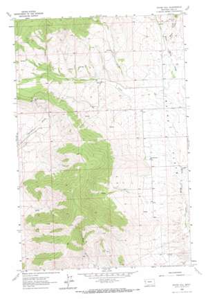
Irvine Hill Topo Map Montana
To zoom in, hover over the map of Irvine Hill
USGS Topo Quad 47114f4 - 1:24,000 scale
| Topo Map Name: | Irvine Hill |
| USGS Topo Quad ID: | 47114f4 |
| Print Size: | ca. 21 1/4" wide x 27" high |
| Southeast Coordinates: | 47.625° N latitude / 114.375° W longitude |
| Map Center Coordinates: | 47.6875° N latitude / 114.4375° W longitude |
| U.S. State: | MT |
| Filename: | o47114f4.jpg |
| Download Map JPG Image: | Irvine Hill topo map 1:24,000 scale |
| Map Type: | Topographic |
| Topo Series: | 7.5´ |
| Map Scale: | 1:24,000 |
| Source of Map Images: | United States Geological Survey (USGS) |
| Alternate Map Versions: |
Irvine Hill MT 1965, updated 1967 Download PDF Buy paper map Irvine Hill MT 2011 Download PDF Buy paper map Irvine Hill MT 2014 Download PDF Buy paper map |
1:24,000 Topo Quads surrounding Irvine Hill
> Back to 47114e1 at 1:100,000 scale
> Back to 47114a1 at 1:250,000 scale
> Back to U.S. Topo Maps home
Irvine Hill topo map: Gazetteer
Irvine Hill: Flats
Irvine Flats elevation 888m 2913′Irvine Hill: Streams
Irvine Creek elevation 891m 2923′Vinson Creek elevation 925m 3034′
Irvine Hill: Summits
Irvine Hill elevation 1346m 4416′Irvine Hill: Valleys
Black Gulch elevation 926m 3038′Irvine Hill: Wells
22N19W32BCAD01 Well elevation 858m 2814′22N22W02DCD_01 Well elevation 885m 2903′
22N22W04ABA_01 Well elevation 927m 3041′
22N22W22BABC01 Well elevation 899m 2949′
23N22W26BDCC01 Well elevation 904m 2965′
23N22W35CDB_01 Well elevation 890m 2919′
24N22W30BCAC01 Well elevation 1378m 4520′
Irvine Hill digital topo map on disk
Buy this Irvine Hill topo map showing relief, roads, GPS coordinates and other geographical features, as a high-resolution digital map file on DVD:


