Lake Mary Ronan Topo Map Montana
To zoom in, hover over the map of Lake Mary Ronan
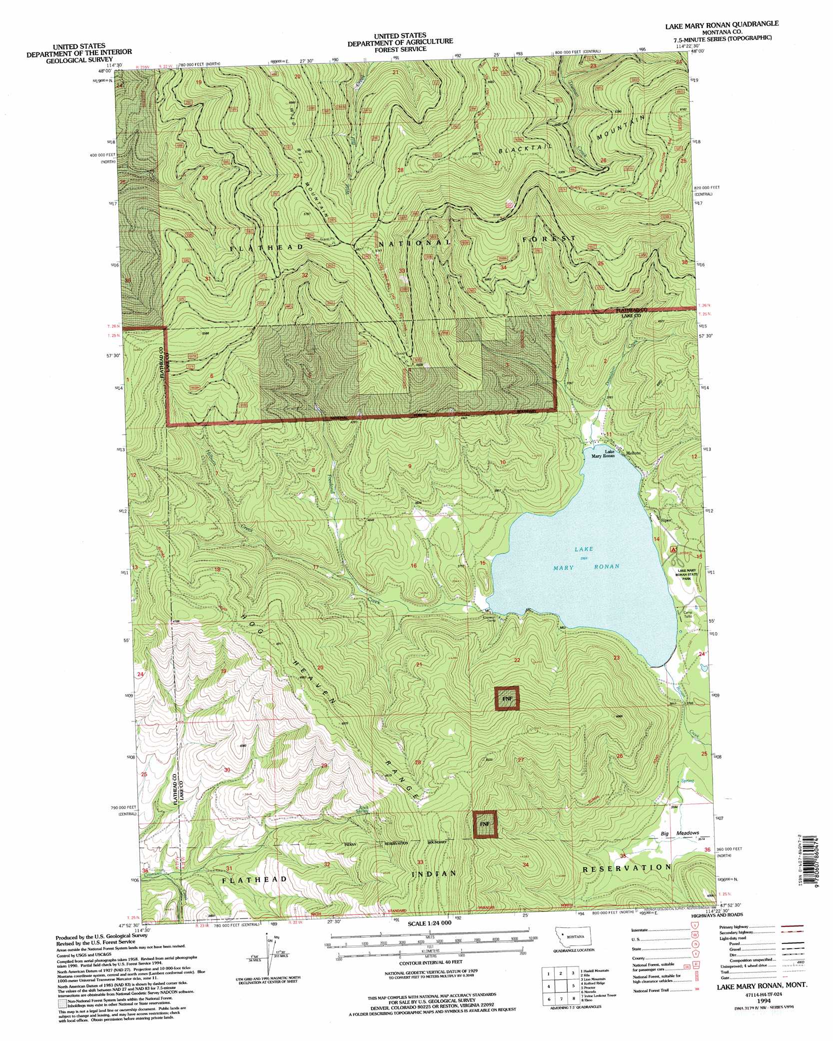
USGS Topo Quad 47114h4 - 1:24,000 scale
| Topo Map Name: | Lake Mary Ronan |
| USGS Topo Quad ID: | 47114h4 |
| Print Size: | ca. 21 1/4" wide x 27" high |
| Southeast Coordinates: | 47.875° N latitude / 114.375° W longitude |
| Map Center Coordinates: | 47.9375° N latitude / 114.4375° W longitude |
| U.S. State: | MT |
| Filename: | o47114h4.jpg |
| Download Map JPG Image: | Lake Mary Ronan topo map 1:24,000 scale |
| Map Type: | Topographic |
| Topo Series: | 7.5´ |
| Map Scale: | 1:24,000 |
| Source of Map Images: | United States Geological Survey (USGS) |
| Alternate Map Versions: |
Lake Mary Ronan MT 1964, updated 1966 Download PDF Buy paper map Lake Mary Ronan MT 1994, updated 1996 Download PDF Buy paper map Lake Mary Ronan MT 1994, updated 1996 Download PDF Buy paper map Lake Mary Ronan MT 2011 Download PDF Buy paper map Lake Mary Ronan MT 2014 Download PDF Buy paper map |
| FStopo: | US Forest Service topo Lake Mary Ronan is available: Download FStopo PDF Download FStopo TIF |
1:24,000 Topo Quads surrounding Lake Mary Ronan
Pleasant Valley Mountain |
Lone Lake |
Blue Grass Ridge |
Kalispell |
Creston |
Marion |
Haskill Mountain |
Kila |
Lion Mountain |
Somers |
Hubbart Reservoir |
Kofford Ridge |
Lake Mary Ronan |
Proctor |
Rollins |
Mill Pocket Creek |
Niarada |
Irvine Lookout Tower |
Elmo |
Wild Horse Island |
Lonepine |
Hot Springs Ne |
Irvine Hill |
Buffalo Bridge |
Polson |
> Back to 47114e1 at 1:100,000 scale
> Back to 47114a1 at 1:250,000 scale
> Back to U.S. Topo Maps home
Lake Mary Ronan topo map: Gazetteer
Lake Mary Ronan: Areas
Big Meadows elevation 1091m 3579′Lake Mary Ronan: Lakes
Lake Mary Ronan elevation 1129m 3704′Lake Mary Ronan: Parks
Lake Mary Ronan State Park elevation 1136m 3727′Lake Mary Ronan: Populated Places
Lake Mary Ronan elevation 1139m 3736′Meltons elevation 1130m 3707′
Sipes elevation 1135m 3723′
Lake Mary Ronan: Streams
Donaldson Creek elevation 1130m 3707′Freeland Creek elevation 1129m 3704′
Hilburn Creek elevation 1154m 3786′
Lake Mary Ronan digital topo map on disk
Buy this Lake Mary Ronan topo map showing relief, roads, GPS coordinates and other geographical features, as a high-resolution digital map file on DVD: