Shroder Creek Topo Map Montana
To zoom in, hover over the map of Shroder Creek
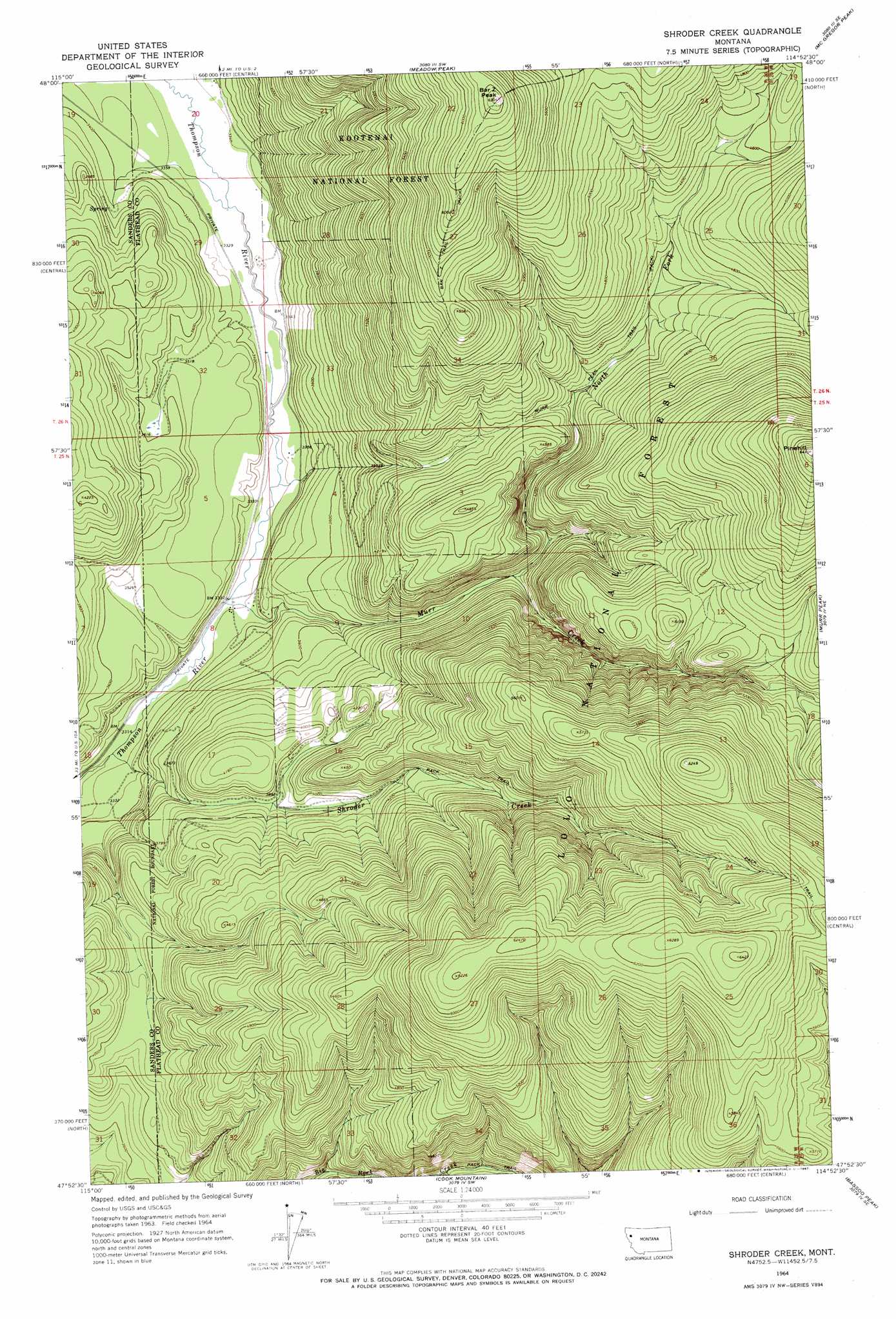
USGS Topo Quad 47114h8 - 1:24,000 scale
| Topo Map Name: | Shroder Creek |
| USGS Topo Quad ID: | 47114h8 |
| Print Size: | ca. 21 1/4" wide x 27" high |
| Southeast Coordinates: | 47.875° N latitude / 114.875° W longitude |
| Map Center Coordinates: | 47.9375° N latitude / 114.9375° W longitude |
| U.S. State: | MT |
| Filename: | o47114h8.jpg |
| Download Map JPG Image: | Shroder Creek topo map 1:24,000 scale |
| Map Type: | Topographic |
| Topo Series: | 7.5´ |
| Map Scale: | 1:24,000 |
| Source of Map Images: | United States Geological Survey (USGS) |
| Alternate Map Versions: |
Shroder Creek MT 1964, updated 1967 Download PDF Buy paper map Shroder Creek MT 1999, updated 2003 Download PDF Buy paper map Shroder Creek MT 2011 Download PDF Buy paper map Shroder Creek MT 2014 Download PDF Buy paper map |
| FStopo: | US Forest Service topo Shroder Creek is available: Download FStopo PDF Download FStopo TIF |
1:24,000 Topo Quads surrounding Shroder Creek
Calx Mountain |
Deer Creek |
Lynch Lake |
Dahl Lake |
Pleasant Valley Mountain |
Loon Lake |
Thompson Lakes |
Meadow Peak |
Mcgregor Peak |
Marion |
Mantrap Fork |
Bend |
Shroder Creek |
Murr Peak |
Hubbart Reservoir |
Fishtrap Lake |
Richards Peak |
Cook Mountain |
Bassoo Peak |
Mill Pocket Creek |
Priscilla Peak |
Calico Creek |
Loneman Creek |
Coney Peak |
Lonepine |
> Back to 47114e1 at 1:100,000 scale
> Back to 47114a1 at 1:250,000 scale
> Back to U.S. Topo Maps home
Shroder Creek topo map: Gazetteer
Shroder Creek: Streams
Boulder Gulch elevation 1716m 5629′Murr Creek elevation 1013m 3323′
North Fork Murr Creek elevation 1164m 3818′
Shroder Creek elevation 1003m 3290′
Shroder Creek: Summits
Bar Z Peak elevation 1918m 6292′Pinehill elevation 1950m 6397′
Shroder Creek: Trails
Bar Z Trail elevation 1870m 6135′Shroder Creek digital topo map on disk
Buy this Shroder Creek topo map showing relief, roads, GPS coordinates and other geographical features, as a high-resolution digital map file on DVD: