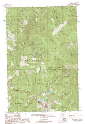
Torino Peak Topo Map Montana
To zoom in, hover over the map of Torino Peak
USGS Topo Quad 47115b2 - 1:24,000 scale
| Topo Map Name: | Torino Peak |
| USGS Topo Quad ID: | 47115b2 |
| Print Size: | ca. 21 1/4" wide x 27" high |
| Southeast Coordinates: | 47.125° N latitude / 115.125° W longitude |
| Map Center Coordinates: | 47.1875° N latitude / 115.1875° W longitude |
| U.S. States: | MT, ID |
| Filename: | o47115b2.jpg |
| Download Map JPG Image: | Torino Peak topo map 1:24,000 scale |
| Map Type: | Topographic |
| Topo Series: | 7.5´ |
| Map Scale: | 1:24,000 |
| Source of Map Images: | United States Geological Survey (USGS) |
| Alternate Map Versions: |
Torino Peak MT 1988, updated 1988 Download PDF Buy paper map Torino Peak MT 1999, updated 2003 Download PDF Buy paper map Torino Peak MT 2011 Download PDF Buy paper map Torino Peak MT 2014 Download PDF Buy paper map |
| FStopo: | US Forest Service topo Torino Peak is available: Download FStopo PDF Download FStopo TIF |
1:24,000 Topo Quads surrounding Torino Peak
> Back to 47115a1 at 1:100,000 scale
> Back to 47114a1 at 1:250,000 scale
> Back to U.S. Topo Maps home
Torino Peak topo map: Gazetteer
Torino Peak: Cliffs
Eagle Cliff elevation 2297m 7536′Eagle Cliff elevation 2286m 7500′
Torino Peak: Lakes
Cliff Lake elevation 1808m 5931′Diamond Lake elevation 1650m 5413′
Torino Peak: Ridges
Crooked Ridge elevation 1946m 6384′Torino Peak: Streams
Jordan Creek elevation 1028m 3372′Moore Creek elevation 1210m 3969′
Sunset Creek elevation 1176m 3858′
Torino Creek elevation 1190m 3904′
Torino Peak: Summits
Little Joe Mountain elevation 2162m 7093′Little Joe Mountain elevation 2161m 7089′
Sunset Peak elevation 1747m 5731′
Torino Peak elevation 2099m 6886′
Torino Peak: Valleys
Fourth of July Gulch elevation 1158m 3799′Torino Peak digital topo map on disk
Buy this Torino Peak topo map showing relief, roads, GPS coordinates and other geographical features, as a high-resolution digital map file on DVD:


