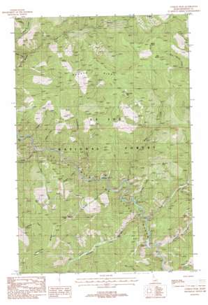
Conrad Peak Topo Map Idaho
To zoom in, hover over the map of Conrad Peak
USGS Topo Quad 47115b4 - 1:24,000 scale
| Topo Map Name: | Conrad Peak |
| USGS Topo Quad ID: | 47115b4 |
| Print Size: | ca. 21 1/4" wide x 27" high |
| Southeast Coordinates: | 47.125° N latitude / 115.375° W longitude |
| Map Center Coordinates: | 47.1875° N latitude / 115.4375° W longitude |
| U.S. State: | ID |
| Filename: | o47115b4.jpg |
| Download Map JPG Image: | Conrad Peak topo map 1:24,000 scale |
| Map Type: | Topographic |
| Topo Series: | 7.5´ |
| Map Scale: | 1:24,000 |
| Source of Map Images: | United States Geological Survey (USGS) |
| Alternate Map Versions: |
Conrad Peak ID 1988, updated 1988 Download PDF Buy paper map Conrad Peak ID 1995, updated 1998 Download PDF Buy paper map Conrad Peak ID 2011 Download PDF Buy paper map Conrad Peak ID 2013 Download PDF Buy paper map |
| FStopo: | US Forest Service topo Conrad Peak is available: Download FStopo PDF Download FStopo TIF |
1:24,000 Topo Quads surrounding Conrad Peak
> Back to 47115a1 at 1:100,000 scale
> Back to 47114a1 at 1:250,000 scale
> Back to U.S. Topo Maps home
Conrad Peak topo map: Gazetteer
Conrad Peak: Mines
Saint Joe Quartz Mine elevation 1120m 3674′Conrad Peak: Populated Places
Gold Creek elevation 1030m 3379′Conrad Peak: Ridges
Junction Ridge elevation 1862m 6108′Point Siam elevation 1631m 5351′
Quartz Ridge elevation 1743m 5718′
Conrad Peak: Springs
Bear Spring elevation 1632m 5354′Conrad Peak: Streams
Aconite Creek elevation 1008m 3307′Bear Creek elevation 978m 3208′
Bluff Creek elevation 933m 3061′
Bruin Creek elevation 984m 3228′
East Fork Gold Creek elevation 1069m 3507′
Entente Creek elevation 1118m 3667′
Gold Creek elevation 1021m 3349′
Haggerty Creek elevation 970m 3182′
Mosquito Creek elevation 1009m 3310′
Niagara Creek elevation 981m 3218′
Shady Creek elevation 936m 3070′
Simmons Creek elevation 1036m 3398′
Stevens Creek elevation 1053m 3454′
Tumbledown Creek elevation 969m 3179′
Conrad Peak: Summits
Beetle Hump elevation 1872m 6141′Black Jack Peak elevation 1814m 5951′
Conrad Peak elevation 1957m 6420′
Whitetail Peak elevation 1627m 5337′
Conrad Peak digital topo map on disk
Buy this Conrad Peak topo map showing relief, roads, GPS coordinates and other geographical features, as a high-resolution digital map file on DVD:


