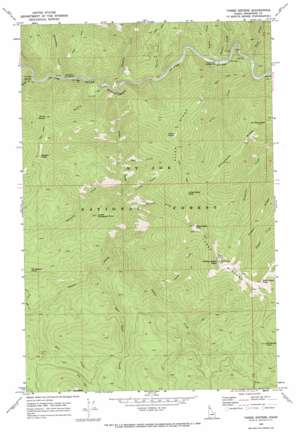
Three Sisters Topo Map Idaho
To zoom in, hover over the map of Three Sisters
USGS Topo Quad 47115b6 - 1:24,000 scale
| Topo Map Name: | Three Sisters |
| USGS Topo Quad ID: | 47115b6 |
| Print Size: | ca. 21 1/4" wide x 27" high |
| Southeast Coordinates: | 47.125° N latitude / 115.625° W longitude |
| Map Center Coordinates: | 47.1875° N latitude / 115.6875° W longitude |
| U.S. State: | ID |
| Filename: | o47115b6.jpg |
| Download Map JPG Image: | Three Sisters topo map 1:24,000 scale |
| Map Type: | Topographic |
| Topo Series: | 7.5´ |
| Map Scale: | 1:24,000 |
| Source of Map Images: | United States Geological Survey (USGS) |
| Alternate Map Versions: |
Three Sisters ID 1969, updated 1973 Download PDF Buy paper map Three Sisters ID 1995, updated 1997 Download PDF Buy paper map Three Sisters ID 2011 Download PDF Buy paper map Three Sisters ID 2013 Download PDF Buy paper map |
| FStopo: | US Forest Service topo Three Sisters is available: Download FStopo PDF Download FStopo TIF |
1:24,000 Topo Quads surrounding Three Sisters
> Back to 47115a1 at 1:100,000 scale
> Back to 47114a1 at 1:250,000 scale
> Back to U.S. Topo Maps home
Three Sisters topo map: Gazetteer
Three Sisters: Basins
Sisters Basin elevation 1197m 3927′Three Sisters: Ridges
Allen Ridge elevation 1674m 5492′Nugget Ridge elevation 1701m 5580′
Prospector Ridge elevation 1696m 5564′
Three Sisters elevation 2008m 6587′
Three Sisters: Streams
Allen Creek elevation 841m 2759′Alpine Creek elevation 990m 3248′
Bear Skull Creek elevation 1083m 3553′
Bird Creek elevation 833m 2732′
Bootleg Creek elevation 791m 2595′
Coyote Creek elevation 825m 2706′
Dunce Creek elevation 1155m 3789′
Elevator Creek elevation 926m 3038′
Gypo Creek elevation 903m 2962′
Hilo Creek elevation 1176m 3858′
Packsaddle Creek elevation 779m 2555′
Shoepack Creek elevation 901m 2956′
Sisters Creek elevation 803m 2634′
Siwash Creek elevation 775m 2542′
Skookum Creek elevation 800m 2624′
Tourist Creek elevation 811m 2660′
Turner Creek elevation 825m 2706′
Three Sisters: Summits
Allen Point elevation 1678m 5505′East Sister Peak elevation 2090m 6856′
Hilo Peak elevation 1756m 5761′
Little Sister Peak elevation 1868m 6128′
Lower Shoepack Point elevation 1436m 4711′
Middle Sister Peak elevation 2104m 6902′
Mount Chenoweth elevation 1591m 5219′
North Siwash elevation 1606m 5269′
Shoepack Point elevation 1614m 5295′
Siwash Peak elevation 1771m 5810′
West Sister Peak elevation 2053m 6735′
Whistling Peak elevation 1832m 6010′
Three Sisters: Valleys
Skookum Canyon elevation 790m 2591′Trickle Gulch elevation 978m 3208′
Three Sisters digital topo map on disk
Buy this Three Sisters topo map showing relief, roads, GPS coordinates and other geographical features, as a high-resolution digital map file on DVD:


