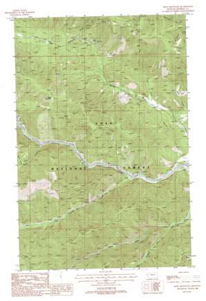
Boyd Mountain Topo Map Montana
To zoom in, hover over the map of Boyd Mountain
USGS Topo Quad 47115c2 - 1:24,000 scale
| Topo Map Name: | Boyd Mountain |
| USGS Topo Quad ID: | 47115c2 |
| Print Size: | ca. 21 1/4" wide x 27" high |
| Southeast Coordinates: | 47.25° N latitude / 115.125° W longitude |
| Map Center Coordinates: | 47.3125° N latitude / 115.1875° W longitude |
| U.S. State: | MT |
| Filename: | o47115c2.jpg |
| Download Map JPG Image: | Boyd Mountain topo map 1:24,000 scale |
| Map Type: | Topographic |
| Topo Series: | 7.5´ |
| Map Scale: | 1:24,000 |
| Source of Map Images: | United States Geological Survey (USGS) |
| Alternate Map Versions: |
Boyd Mountain MT 1988, updated 1988 Download PDF Buy paper map Boyd Mountain MT 1999, updated 2003 Download PDF Buy paper map Boyd Mountain MT 2011 Download PDF Buy paper map Boyd Mountain MT 2014 Download PDF Buy paper map |
| FStopo: | US Forest Service topo Boyd Mountain is available: Download FStopo PDF Download FStopo TIF |
1:24,000 Topo Quads surrounding Boyd Mountain
> Back to 47115a1 at 1:100,000 scale
> Back to 47114a1 at 1:250,000 scale
> Back to U.S. Topo Maps home
Boyd Mountain topo map: Gazetteer
Boyd Mountain: Crossings
Interchange 25 elevation 1314m 4311′Interchange 26 elevation 862m 2828′
Interchange 30 elevation 823m 2700′
Boyd Mountain: Lakes
Twomile Pond elevation 830m 2723′Boyd Mountain: Mines
Keith Creek Mine elevation 1061m 3480′Wolf Creek Mine elevation 1047m 3435′
Boyd Mountain: Populated Places
Buford (historical) elevation 816m 2677′Foraker elevation 837m 2746′
Boyd Mountain: Streams
Keith Creek elevation 872m 2860′Moon Creek elevation 909m 2982′
North Fork Little Joe Creek elevation 870m 2854′
South Fork Little Joe Creek elevation 871m 2857′
Twomile Creek elevation 827m 2713′
Ward Creek elevation 852m 2795′
Wolf Creek elevation 916m 3005′
Boyd Mountain: Summits
Boyd Mountain elevation 1627m 5337′Boyd Mountain: Valleys
Hendrickson Gulch elevation 940m 3083′Boyd Mountain digital topo map on disk
Buy this Boyd Mountain topo map showing relief, roads, GPS coordinates and other geographical features, as a high-resolution digital map file on DVD:


