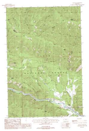
Haugan Topo Map Montana
To zoom in, hover over the map of Haugan
USGS Topo Quad 47115d4 - 1:24,000 scale
| Topo Map Name: | Haugan |
| USGS Topo Quad ID: | 47115d4 |
| Print Size: | ca. 21 1/4" wide x 27" high |
| Southeast Coordinates: | 47.375° N latitude / 115.375° W longitude |
| Map Center Coordinates: | 47.4375° N latitude / 115.4375° W longitude |
| U.S. State: | MT |
| Filename: | o47115d4.jpg |
| Download Map JPG Image: | Haugan topo map 1:24,000 scale |
| Map Type: | Topographic |
| Topo Series: | 7.5´ |
| Map Scale: | 1:24,000 |
| Source of Map Images: | United States Geological Survey (USGS) |
| Alternate Map Versions: |
Haugan MT 1988, updated 1988 Download PDF Buy paper map Haugan MT 1999, updated 2003 Download PDF Buy paper map Haugan MT 2011 Download PDF Buy paper map Haugan MT 2014 Download PDF Buy paper map |
| FStopo: | US Forest Service topo Haugan is available: Download FStopo PDF Download FStopo TIF |
1:24,000 Topo Quads surrounding Haugan
> Back to 47115a1 at 1:100,000 scale
> Back to 47114a1 at 1:250,000 scale
> Back to U.S. Topo Maps home
Haugan topo map: Gazetteer
Haugan: Crossings
Interchange 16 elevation 958m 3143′Haugan: Gaps
East Fork Pass elevation 1604m 5262′Haugan: Mines
Black Traveler Mine elevation 1312m 4304′Black Traveler Mine elevation 1307m 4288′
East Coeur D'Alene Mine elevation 1086m 3562′
East Coeur D'Alene Mine elevation 1143m 3750′
Last Chance Mine elevation 1126m 3694′
Meadow Mountain Mine elevation 1246m 4087′
Queen Bee Mine elevation 1327m 4353′
Saltese Consolidated Mine elevation 1263m 4143′
Tarbox Mine elevation 1202m 3943′
Tarbox-Mineral King Mine elevation 1206m 3956′
Wabash Mine elevation 1168m 3832′
Wabash Mine elevation 1171m 3841′
Haugan: Populated Places
Haugan elevation 957m 3139′Haugan: Post Offices
Haugan Post Office (historical) elevation 957m 3139′Haugan: Streams
Big Creek elevation 946m 3103′Cook Creek elevation 988m 3241′
East Fork Packer Creek elevation 1087m 3566′
East Fork Timber Creek elevation 974m 3195′
McGee Creek elevation 940m 3083′
McManus Creek elevation 991m 3251′
Middle Fork Savanac Creek elevation 1234m 4048′
Savenac Creek elevation 945m 3100′
Timber Creek elevation 959m 3146′
West Fork Timber Creek elevation 995m 3264′
Haugan: Summits
Cruzane Mountain elevation 1480m 4855′Haugan Mountain elevation 1452m 4763′
Hawk Mountain elevation 1696m 5564′
Meadow Mountain elevation 1354m 4442′
Haugan: Trails
Storm Peak Trail elevation 1554m 5098′Haugan: Valleys
Cruzane Gulch elevation 1030m 3379′Haugan digital topo map on disk
Buy this Haugan topo map showing relief, roads, GPS coordinates and other geographical features, as a high-resolution digital map file on DVD:


