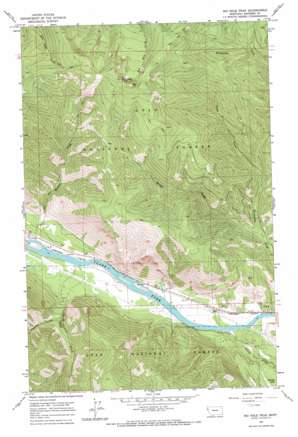
Big Hole Peak Topo Map Montana
To zoom in, hover over the map of Big Hole Peak
USGS Topo Quad 47115e1 - 1:24,000 scale
| Topo Map Name: | Big Hole Peak |
| USGS Topo Quad ID: | 47115e1 |
| Print Size: | ca. 21 1/4" wide x 27" high |
| Southeast Coordinates: | 47.5° N latitude / 115° W longitude |
| Map Center Coordinates: | 47.5625° N latitude / 115.0625° W longitude |
| U.S. State: | MT |
| Filename: | o47115e1.jpg |
| Download Map JPG Image: | Big Hole Peak topo map 1:24,000 scale |
| Map Type: | Topographic |
| Topo Series: | 7.5´ |
| Map Scale: | 1:24,000 |
| Source of Map Images: | United States Geological Survey (USGS) |
| Alternate Map Versions: |
Big Hole Peak MT 1964, updated 1967 Download PDF Buy paper map Big Hole Peak MT 1999, updated 2003 Download PDF Buy paper map Big Hole Peak MT 2011 Download PDF Buy paper map Big Hole Peak MT 2014 Download PDF Buy paper map |
| FStopo: | US Forest Service topo Big Hole Peak is available: Download FStopo PDF Download FStopo TIF |
1:24,000 Topo Quads surrounding Big Hole Peak
> Back to 47115e1 at 1:100,000 scale
> Back to 47114a1 at 1:250,000 scale
> Back to U.S. Topo Maps home
Big Hole Peak topo map: Gazetteer
Big Hole Peak: Streams
Eddy Creek elevation 738m 2421′Munson Creek elevation 741m 2431′
Spring Creek elevation 804m 2637′
Swamp Creek elevation 743m 2437′
Tepee Creek elevation 891m 2923′
Big Hole Peak: Summits
Big Hole Peak elevation 2096m 6876′Big Hole Peak: Swamps
Swamp Lake elevation 803m 2634′Big Hole Peak: Valleys
Poacher Gulch elevation 868m 2847′Big Hole Peak: Wells
20N27W03ABDB01 Well elevation 749m 2457′20N27W10AAAB01 Well elevation 784m 2572′
20N27W10ABAD01 Well elevation 749m 2457′
Big Hole Peak digital topo map on disk
Buy this Big Hole Peak topo map showing relief, roads, GPS coordinates and other geographical features, as a high-resolution digital map file on DVD:


