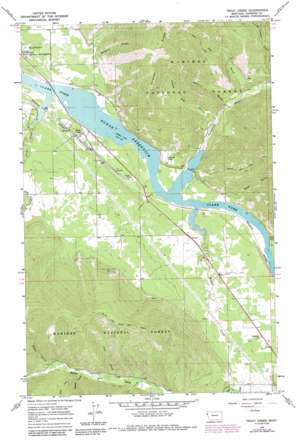
Trout Creek Topo Map Montana
To zoom in, hover over the map of Trout Creek
USGS Topo Quad 47115g5 - 1:24,000 scale
| Topo Map Name: | Trout Creek |
| USGS Topo Quad ID: | 47115g5 |
| Print Size: | ca. 21 1/4" wide x 27" high |
| Southeast Coordinates: | 47.75° N latitude / 115.5° W longitude |
| Map Center Coordinates: | 47.8125° N latitude / 115.5625° W longitude |
| U.S. State: | MT |
| Filename: | o47115g5.jpg |
| Download Map JPG Image: | Trout Creek topo map 1:24,000 scale |
| Map Type: | Topographic |
| Topo Series: | 7.5´ |
| Map Scale: | 1:24,000 |
| Source of Map Images: | United States Geological Survey (USGS) |
| Alternate Map Versions: |
Trout Creek MT 1966, updated 1971 Download PDF Buy paper map Trout Creek MT 1966, updated 1980 Download PDF Buy paper map Trout Creek MT 1966, updated 1984 Download PDF Buy paper map Trout Creek MT 1997, updated 2000 Download PDF Buy paper map Trout Creek MT 2011 Download PDF Buy paper map Trout Creek MT 2014 Download PDF Buy paper map |
| FStopo: | US Forest Service topo Trout Creek is available: Download FStopo PDF Download FStopo TIF |
1:24,000 Topo Quads surrounding Trout Creek
> Back to 47115e1 at 1:100,000 scale
> Back to 47114a1 at 1:250,000 scale
> Back to U.S. Topo Maps home
Trout Creek topo map: Gazetteer
Trout Creek: Flats
Honey Flat elevation 774m 2539′Trout Creek: Populated Places
Trout Creek elevation 723m 2372′Trout Creek: Post Offices
Alger Post Office (historical) elevation 762m 2500′Larchwood Post Office (historical) elevation 712m 2335′
Trout Creek Post Office elevation 723m 2372′
Vermilion Post Office (historical) elevation 714m 2342′
Trout Creek: Ridges
Copper Ridge elevation 1545m 5068′Trout Creek: Streams
Beaver Creek elevation 712m 2335′Canyon Creek elevation 769m 2522′
Pine Creek elevation 804m 2637′
Set Creek elevation 786m 2578′
Trout Creek elevation 712m 2335′
Vermilion River elevation 712m 2335′
West Fork Canyon Creek elevation 910m 2985′
White Pine Creek elevation 753m 2470′
Trout Creek: Trails
White Pine Ridge Trail elevation 1329m 4360′Trout Creek: Valleys
Belgian Gulch elevation 715m 2345′Berry Gulch elevation 733m 2404′
Grays Gulch elevation 847m 2778′
Kirby Gulch elevation 712m 2335′
Reader Gulch elevation 823m 2700′
Roe Gulch elevation 746m 2447′
Twenty Odd Gulch elevation 721m 2365′
Water Gulch elevation 713m 2339′
Trout Creek: Wells
24N31W05BCBA01 Well elevation 781m 2562′24N31W07AA__01 Well elevation 732m 2401′
24N31W17DBAA01 Well elevation 716m 2349′
24N31W17DDDC01 Well elevation 726m 2381′
Trout Creek digital topo map on disk
Buy this Trout Creek topo map showing relief, roads, GPS coordinates and other geographical features, as a high-resolution digital map file on DVD:


