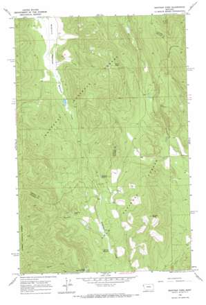
Mantrap Fork Topo Map Montana
To zoom in, hover over the map of Mantrap Fork
USGS Topo Quad 47115h2 - 1:24,000 scale
| Topo Map Name: | Mantrap Fork |
| USGS Topo Quad ID: | 47115h2 |
| Print Size: | ca. 21 1/4" wide x 27" high |
| Southeast Coordinates: | 47.875° N latitude / 115.125° W longitude |
| Map Center Coordinates: | 47.9375° N latitude / 115.1875° W longitude |
| U.S. State: | MT |
| Filename: | o47115h2.jpg |
| Download Map JPG Image: | Mantrap Fork topo map 1:24,000 scale |
| Map Type: | Topographic |
| Topo Series: | 7.5´ |
| Map Scale: | 1:24,000 |
| Source of Map Images: | United States Geological Survey (USGS) |
| Alternate Map Versions: |
Mantrap Fork MT 1966, updated 1971 Download PDF Buy paper map Mantrap Fork MT 1999, updated 2003 Download PDF Buy paper map Mantrap Fork MT 2011 Download PDF Buy paper map Mantrap Fork MT 2014 Download PDF Buy paper map |
| FStopo: | US Forest Service topo Mantrap Fork is available: Download FStopo PDF Download FStopo TIF |
1:24,000 Topo Quads surrounding Mantrap Fork
> Back to 47115e1 at 1:100,000 scale
> Back to 47114a1 at 1:250,000 scale
> Back to U.S. Topo Maps home
Mantrap Fork topo map: Gazetteer
Mantrap Fork: Dams
McGilla Gorilla Number 50 Dam elevation 1059m 3474′Mantrap Fork: Flats
Jefferson Meadows elevation 1190m 3904′McGinnis Meadows elevation 1045m 3428′
Mantrap Fork: Lakes
Crescent Lake elevation 1231m 4038′Upper Fishtrap Lake elevation 1243m 4078′
Whitney Lake elevation 1212m 3976′
Mantrap Fork: Mines
Sales Mine elevation 1284m 4212′Sales Prospect elevation 1260m 4133′
Mantrap Fork: Streams
Doe Creek elevation 1058m 3471′Mantrap Fork elevation 1193m 3914′
Mantrap Fork: Summits
Border Peak elevation 1652m 5419′Davis Peak elevation 1626m 5334′
Mantrap Fork digital topo map on disk
Buy this Mantrap Fork topo map showing relief, roads, GPS coordinates and other geographical features, as a high-resolution digital map file on DVD:


