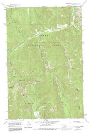
Silver Butte Pass Topo Map Montana
To zoom in, hover over the map of Silver Butte Pass
USGS Topo Quad 47115h4 - 1:24,000 scale
| Topo Map Name: | Silver Butte Pass |
| USGS Topo Quad ID: | 47115h4 |
| Print Size: | ca. 21 1/4" wide x 27" high |
| Southeast Coordinates: | 47.875° N latitude / 115.375° W longitude |
| Map Center Coordinates: | 47.9375° N latitude / 115.4375° W longitude |
| U.S. State: | MT |
| Filename: | o47115h4.jpg |
| Download Map JPG Image: | Silver Butte Pass topo map 1:24,000 scale |
| Map Type: | Topographic |
| Topo Series: | 7.5´ |
| Map Scale: | 1:24,000 |
| Source of Map Images: | United States Geological Survey (USGS) |
| Alternate Map Versions: |
Silver Butte Pass MT 1966, updated 1971 Download PDF Buy paper map Silver Butte Pass MT 1966, updated 1984 Download PDF Buy paper map Silver Butte Pass MT 1997, updated 2000 Download PDF Buy paper map Silver Butte Pass MT 2011 Download PDF Buy paper map Silver Butte Pass MT 2014 Download PDF Buy paper map |
| FStopo: | US Forest Service topo Silver Butte Pass is available: Download FStopo PDF Download FStopo TIF |
1:24,000 Topo Quads surrounding Silver Butte Pass
> Back to 47115e1 at 1:100,000 scale
> Back to 47114a1 at 1:250,000 scale
> Back to U.S. Topo Maps home
Silver Butte Pass topo map: Gazetteer
Silver Butte Pass: Flats
Iron Meadow elevation 1354m 4442′Silver Butte Pass: Gaps
Silver Butte Pass elevation 1302m 4271′Silver Butte Pass: Lakes
Elk Lake elevation 1287m 4222′Silver Butte Pass: Mines
Snowfall Mine elevation 1292m 4238′Vermilion Mine elevation 1341m 4399′
Vermilion Mine elevation 1391m 4563′
Viking Mine elevation 1116m 3661′
Viking Mine elevation 1199m 3933′
Silver Butte Pass: Ridges
Whitetail Ridge elevation 1570m 5150′Silver Butte Pass: Streams
Baree Creek elevation 1132m 3713′Bench Creek elevation 982m 3221′
East Fisher Creek elevation 962m 3156′
Iron Meadow Creek elevation 1074m 3523′
Olson Creek elevation 1005m 3297′
Silver Bow Creek elevation 1238m 4061′
Silver Butte Creek elevation 1148m 3766′
Spring Creek elevation 998m 3274′
Trapper Creek elevation 1024m 3359′
Waloven Creek elevation 1031m 3382′
Silver Butte Pass: Summits
Allen Peak elevation 2053m 6735′Elk Mountain elevation 1711m 5613′
Silver Butte Pass: Trails
Allen Peak Trail elevation 1987m 6519′Bear Lakes Trail elevation 1521m 4990′
Elk Mountain Trail elevation 1414m 4639′
Himes Creek Trail elevation 1610m 5282′
Silver Butte Pass: Valleys
West Fork Lyons Gulch elevation 1012m 3320′Silver Butte Pass digital topo map on disk
Buy this Silver Butte Pass topo map showing relief, roads, GPS coordinates and other geographical features, as a high-resolution digital map file on DVD:


