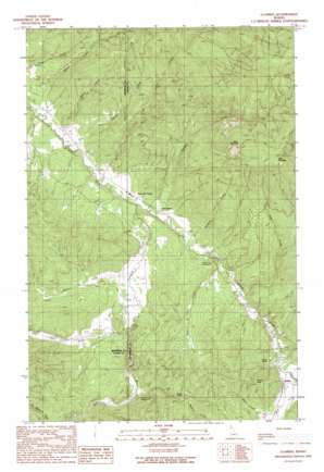
Clarkia Topo Map Idaho
To zoom in, hover over the map of Clarkia
USGS Topo Quad 47116a3 - 1:24,000 scale
| Topo Map Name: | Clarkia |
| USGS Topo Quad ID: | 47116a3 |
| Print Size: | ca. 21 1/4" wide x 27" high |
| Southeast Coordinates: | 47° N latitude / 116.25° W longitude |
| Map Center Coordinates: | 47.0625° N latitude / 116.3125° W longitude |
| U.S. State: | ID |
| Filename: | o47116a3.jpg |
| Download Map JPG Image: | Clarkia topo map 1:24,000 scale |
| Map Type: | Topographic |
| Topo Series: | 7.5´ |
| Map Scale: | 1:24,000 |
| Source of Map Images: | United States Geological Survey (USGS) |
| Alternate Map Versions: |
Clarkia ID 1990, updated 1991 Download PDF Buy paper map Clarkia ID 1995, updated 1997 Download PDF Buy paper map Clarkia ID 1995, updated 1997 Download PDF Buy paper map Clarkia ID 2011 Download PDF Buy paper map Clarkia ID 2013 Download PDF Buy paper map |
| FStopo: | US Forest Service topo Clarkia is available: Download FStopo PDF Download FStopo TIF |
1:24,000 Topo Quads surrounding Clarkia
> Back to 47116a1 at 1:100,000 scale
> Back to 47116a1 at 1:250,000 scale
> Back to U.S. Topo Maps home
Clarkia topo map: Gazetteer
Clarkia: Populated Places
Clarkia elevation 862m 2828′Emerald Creek elevation 833m 2732′
Clarkia: Streams
Adams Creek elevation 825m 2706′Blair Creek elevation 851m 2791′
Cedar Creek elevation 846m 2775′
Childs Creek elevation 833m 2732′
East Fork Emerald Creek elevation 853m 2798′
Emerald Creek elevation 831m 2726′
Estes Creek elevation 866m 2841′
Hatton Creek elevation 825m 2706′
Middle Fork Saint Maries River elevation 860m 2821′
Olson Creek elevation 830m 2723′
Pierce Creek elevation 825m 2706′
Staples Creek elevation 837m 2746′
West Fork Emerald Creek elevation 853m 2798′
West Fork Saint Maries River elevation 860m 2821′
Willow Creek elevation 842m 2762′
Clarkia: Summits
Cedar Butte elevation 1047m 3435′Clarkia Peak elevation 1056m 3464′
East Elk Peak elevation 1578m 5177′
West Elk Peak elevation 1538m 5045′
Clarkia digital topo map on disk
Buy this Clarkia topo map showing relief, roads, GPS coordinates and other geographical features, as a high-resolution digital map file on DVD:


