Crystal Peak Topo Map Idaho
To zoom in, hover over the map of Crystal Peak
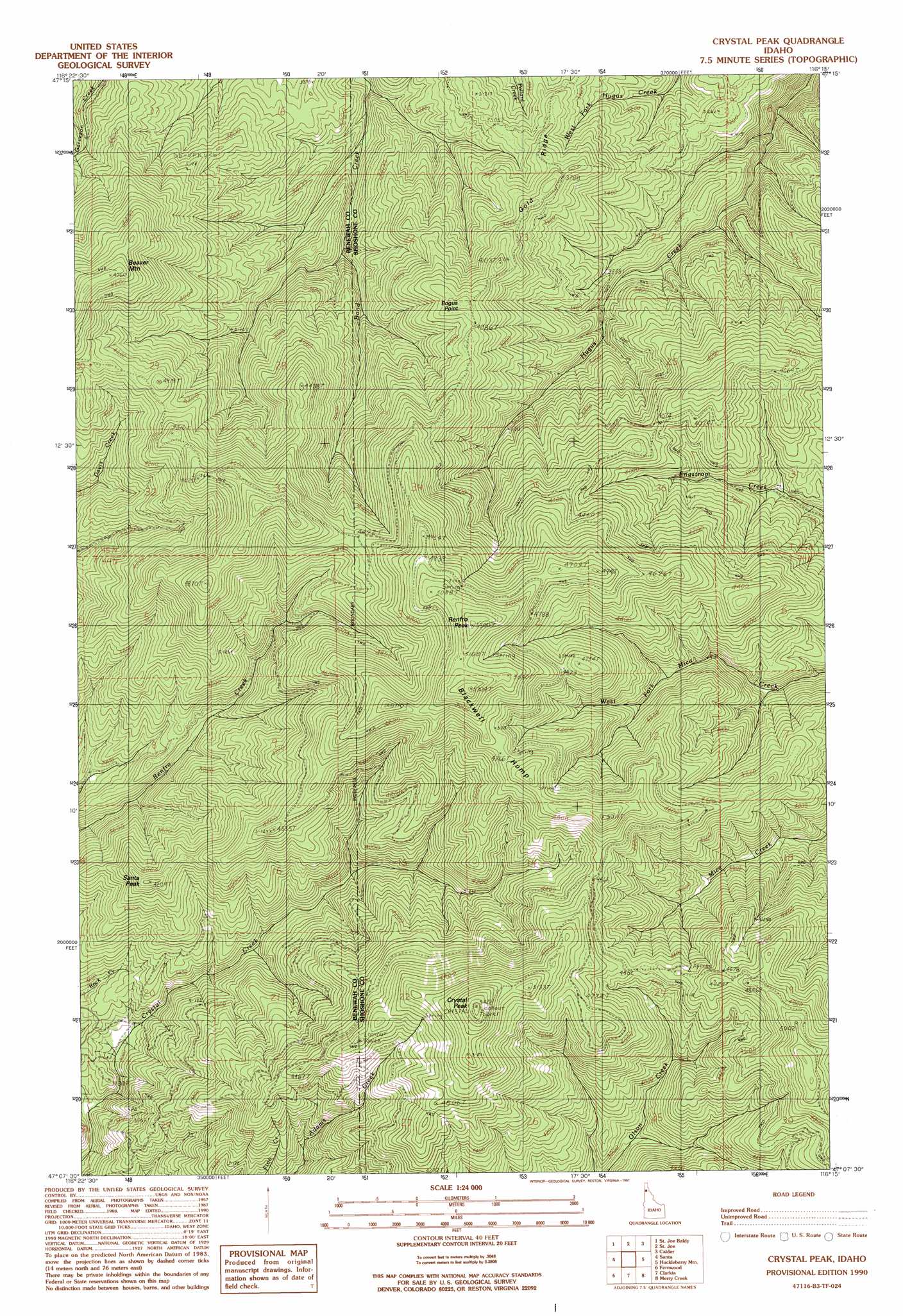
USGS Topo Quad 47116b3 - 1:24,000 scale
| Topo Map Name: | Crystal Peak |
| USGS Topo Quad ID: | 47116b3 |
| Print Size: | ca. 21 1/4" wide x 27" high |
| Southeast Coordinates: | 47.125° N latitude / 116.25° W longitude |
| Map Center Coordinates: | 47.1875° N latitude / 116.3125° W longitude |
| U.S. State: | ID |
| Filename: | o47116b3.jpg |
| Download Map JPG Image: | Crystal Peak topo map 1:24,000 scale |
| Map Type: | Topographic |
| Topo Series: | 7.5´ |
| Map Scale: | 1:24,000 |
| Source of Map Images: | United States Geological Survey (USGS) |
| Alternate Map Versions: |
Crystal Peak ID 1990, updated 1991 Download PDF Buy paper map Crystal Peak ID 1995, updated 1997 Download PDF Buy paper map Crystal Peak ID 2011 Download PDF Buy paper map Crystal Peak ID 2013 Download PDF Buy paper map |
| FStopo: | US Forest Service topo Crystal Peak is available: Download FStopo PDF Download FStopo TIF |
1:24,000 Topo Quads surrounding Crystal Peak
Medimont |
Rochat Peak |
Twin Crags |
Masonia |
Polaris Peak |
Saint Maries |
Saint Joe Baldy |
Saint Joe |
Calder |
Marble Creek |
Lindstrom Peak |
Santa |
Crystal Peak |
Huckleberry Mountain |
Marble Mountain |
Emida |
Fernwood |
Clarkia |
Merry Creek |
Grandmother Mountain |
Sand Mountain |
Abes Knob |
Bechtel Butte |
Anthony Peak |
Grice Ridge |
> Back to 47116a1 at 1:100,000 scale
> Back to 47116a1 at 1:250,000 scale
> Back to U.S. Topo Maps home
Crystal Peak topo map: Gazetteer
Crystal Peak: Ridges
Blackwell Hump elevation 1612m 5288′Gold Ridge elevation 1173m 3848′
Crystal Peak: Summits
Beaver Mountain elevation 1443m 4734′Bogus Point elevation 1257m 4124′
Crystal Peak elevation 1651m 5416′
Renfro Peak elevation 1612m 5288′
Santa Peak elevation 1283m 4209′
Crystal Peak digital topo map on disk
Buy this Crystal Peak topo map showing relief, roads, GPS coordinates and other geographical features, as a high-resolution digital map file on DVD: