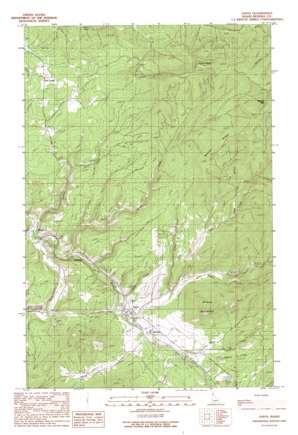
Santa Topo Map Idaho
To zoom in, hover over the map of Santa
USGS Topo Quad 47116b4 - 1:24,000 scale
| Topo Map Name: | Santa |
| USGS Topo Quad ID: | 47116b4 |
| Print Size: | ca. 21 1/4" wide x 27" high |
| Southeast Coordinates: | 47.125° N latitude / 116.375° W longitude |
| Map Center Coordinates: | 47.1875° N latitude / 116.4375° W longitude |
| U.S. State: | ID |
| Filename: | o47116b4.jpg |
| Download Map JPG Image: | Santa topo map 1:24,000 scale |
| Map Type: | Topographic |
| Topo Series: | 7.5´ |
| Map Scale: | 1:24,000 |
| Source of Map Images: | United States Geological Survey (USGS) |
| Alternate Map Versions: |
Santa ID 1990, updated 1991 Download PDF Buy paper map Santa ID 1995, updated 1997 Download PDF Buy paper map Santa ID 2011 Download PDF Buy paper map Santa ID 2013 Download PDF Buy paper map |
| FStopo: | US Forest Service topo Santa is available: Download FStopo PDF Download FStopo TIF |
1:24,000 Topo Quads surrounding Santa
> Back to 47116a1 at 1:100,000 scale
> Back to 47116a1 at 1:250,000 scale
> Back to U.S. Topo Maps home
Santa topo map: Gazetteer
Santa: Parks
Grange Park elevation 812m 2664′Santa: Populated Places
Flat Creek elevation 915m 3001′Mashburn elevation 792m 2598′
Renfrew elevation 823m 2700′
Santa elevation 811m 2660′
Tyson Creek Station elevation 838m 2749′
Wayland elevation 800m 2624′
Santa: Ridges
Beaver Ridge elevation 1188m 3897′Santa: Streams
Beaver Creek elevation 793m 2601′Dago Creek elevation 801m 2627′
Davis Creek elevation 833m 2732′
Flat Creek elevation 890m 2919′
Pokey Creek elevation 829m 2719′
Renfro Creek elevation 804m 2637′
Rock Creek elevation 810m 2657′
Santa Creek elevation 788m 2585′
Sheep Creek elevation 805m 2641′
Soldier Creek elevation 786m 2578′
Tram Creek elevation 806m 2644′
Tyson Creek elevation 810m 2657′
Wilson Creek elevation 811m 2660′
Santa: Summits
Pettis Peak elevation 1285m 4215′Wilson Mountain elevation 1149m 3769′
Santa digital topo map on disk
Buy this Santa topo map showing relief, roads, GPS coordinates and other geographical features, as a high-resolution digital map file on DVD:


