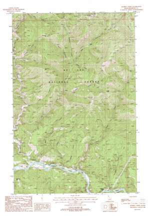
Marble Creek Topo Map Idaho
To zoom in, hover over the map of Marble Creek
USGS Topo Quad 47116c1 - 1:24,000 scale
| Topo Map Name: | Marble Creek |
| USGS Topo Quad ID: | 47116c1 |
| Print Size: | ca. 21 1/4" wide x 27" high |
| Southeast Coordinates: | 47.25° N latitude / 116° W longitude |
| Map Center Coordinates: | 47.3125° N latitude / 116.0625° W longitude |
| U.S. State: | ID |
| Filename: | o47116c1.jpg |
| Download Map JPG Image: | Marble Creek topo map 1:24,000 scale |
| Map Type: | Topographic |
| Topo Series: | 7.5´ |
| Map Scale: | 1:24,000 |
| Source of Map Images: | United States Geological Survey (USGS) |
| Alternate Map Versions: |
Marble Creek ID 1988, updated 1988 Download PDF Buy paper map Marble Creek ID 1995, updated 1997 Download PDF Buy paper map Marble Creek ID 2011 Download PDF Buy paper map Marble Creek ID 2013 Download PDF Buy paper map |
| FStopo: | US Forest Service topo Marble Creek is available: Download FStopo PDF Download FStopo TIF |
1:24,000 Topo Quads surrounding Marble Creek
> Back to 47116a1 at 1:100,000 scale
> Back to 47116a1 at 1:250,000 scale
> Back to U.S. Topo Maps home
Marble Creek topo map: Gazetteer
Marble Creek: Populated Places
Erlmo elevation 691m 2267′Herrick elevation 686m 2250′
Marble Creek elevation 705m 2312′
Marble Creek: Ridges
Cemetery Ridge elevation 1697m 5567′Marble Creek: Streams
Agatha Creek elevation 702m 2303′Big Creek elevation 680m 2230′
Black Prince Creek elevation 682m 2237′
Cabin Creek elevation 802m 2631′
Cameron Creek elevation 813m 2667′
Donaldson Creek elevation 930m 3051′
East Fork Big Creek elevation 719m 2358′
Flag Creek elevation 778m 2552′
Francis Creek elevation 684m 2244′
Hall Creek elevation 924m 3031′
Jumbo Creek elevation 739m 2424′
Marble Creek elevation 692m 2270′
Mowat Creek elevation 859m 2818′
Mud Cabin Creek elevation 684m 2244′
Rogers Creek elevation 924m 3031′
Tank Creek elevation 698m 2290′
Marble Creek: Summits
Cameron Hill elevation 1543m 5062′Daugherty Hill elevation 1468m 4816′
Drive Point elevation 1513m 4963′
Hill 36 elevation 1423m 4668′
Maternity Hill elevation 998m 3274′
Sheep Butte elevation 1533m 5029′
Marble Creek digital topo map on disk
Buy this Marble Creek topo map showing relief, roads, GPS coordinates and other geographical features, as a high-resolution digital map file on DVD:


