Saint Joe Baldy Topo Map Idaho
To zoom in, hover over the map of Saint Joe Baldy
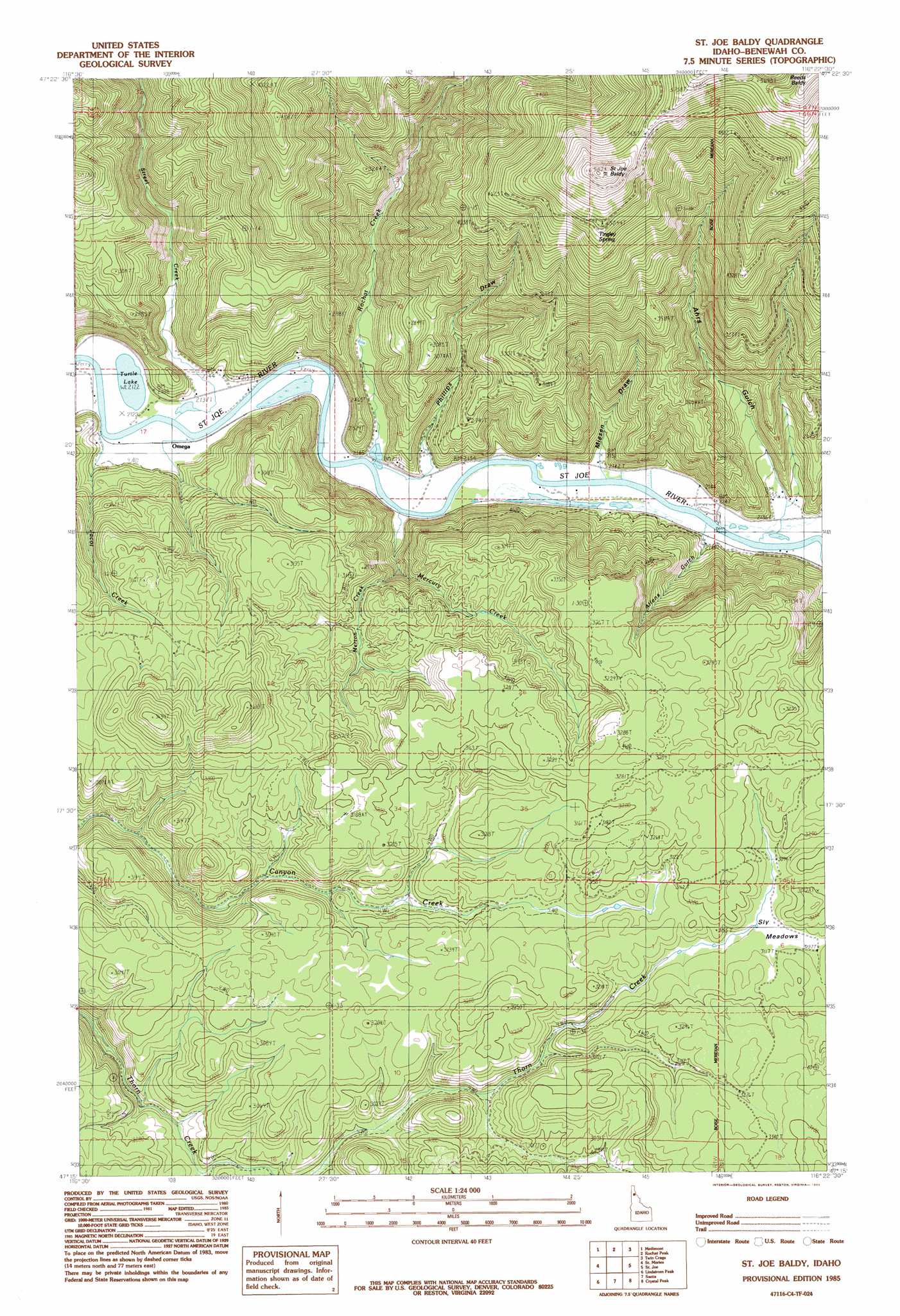
USGS Topo Quad 47116c4 - 1:24,000 scale
| Topo Map Name: | Saint Joe Baldy |
| USGS Topo Quad ID: | 47116c4 |
| Print Size: | ca. 21 1/4" wide x 27" high |
| Southeast Coordinates: | 47.25° N latitude / 116.375° W longitude |
| Map Center Coordinates: | 47.3125° N latitude / 116.4375° W longitude |
| U.S. State: | ID |
| Filename: | o47116c4.jpg |
| Download Map JPG Image: | Saint Joe Baldy topo map 1:24,000 scale |
| Map Type: | Topographic |
| Topo Series: | 7.5´ |
| Map Scale: | 1:24,000 |
| Source of Map Images: | United States Geological Survey (USGS) |
| Alternate Map Versions: |
St. Joe Baldy ID 1985, updated 1985 Download PDF Buy paper map St. Joe Baldy ID 1995, updated 1997 Download PDF Buy paper map Saint Joe Baldy ID 2011 Download PDF Buy paper map Saint Joe Baldy ID 2013 Download PDF Buy paper map |
| FStopo: | US Forest Service topo Saint Joe Baldy is available: Download FStopo PDF Download FStopo TIF |
1:24,000 Topo Quads surrounding Saint Joe Baldy
Mount Coeur D'Alene |
Lane |
Rose Lake |
Cataldo |
Kellogg West |
Black Lake |
Medimont |
Rochat Peak |
Twin Crags |
Masonia |
Benewah Lake |
Saint Maries |
Saint Joe Baldy |
Saint Joe |
Calder |
Alder Creek Flats |
Lindstrom Peak |
Santa |
Crystal Peak |
Huckleberry Mountain |
West Dennis |
Emida |
Fernwood |
Clarkia |
Merry Creek |
> Back to 47116a1 at 1:100,000 scale
> Back to 47116a1 at 1:250,000 scale
> Back to U.S. Topo Maps home
Saint Joe Baldy topo map: Gazetteer
Saint Joe Baldy: Flats
Hnmiłn Meadow elevation 655m 2148′Sly Meadows elevation 940m 3083′
Saint Joe Baldy: Lakes
Turtle Lake elevation 651m 2135′Saint Joe Baldy: Populated Places
Omega elevation 657m 2155′Saint Joe Baldy: Springs
Tingley Spring elevation 1587m 5206′Saint Joe Baldy: Streams
Ahrs Creek elevation 651m 2135′Jacot Creek elevation 654m 2145′
Mercury Creek elevation 655m 2148′
Merton Creek elevation 693m 2273′
Rochat Creek elevation 655m 2148′
Street Creek elevation 653m 2142′
Saint Joe Baldy: Summits
Saint Joe Baldy elevation 1768m 5800′Saint Joe Baldy: Valleys
Ahrs Gulch elevation 652m 2139′Allens Gulch elevation 658m 2158′
Miesen Draw elevation 655m 2148′
Phillips Draw elevation 655m 2148′
Saint Joe Baldy digital topo map on disk
Buy this Saint Joe Baldy topo map showing relief, roads, GPS coordinates and other geographical features, as a high-resolution digital map file on DVD: