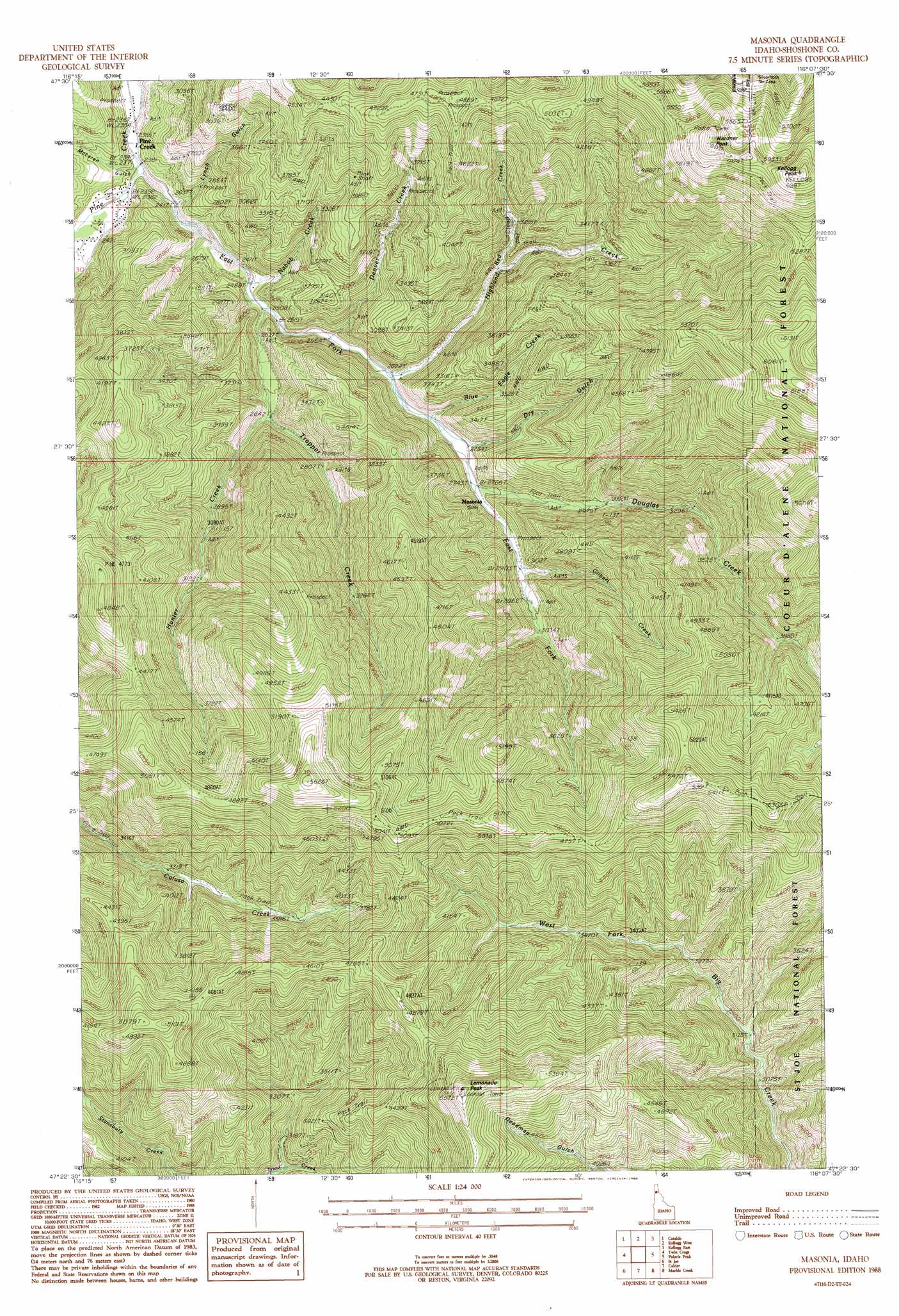
Masonia Topo Map Idaho
To zoom in, hover over the map of Masonia
USGS Topo Quad 47116d2 - 1:24,000 scale
| Topo Map Name: | Masonia |
| USGS Topo Quad ID: | 47116d2 |
| Print Size: | ca. 21 1/4" wide x 27" high |
| Southeast Coordinates: | 47.375° N latitude / 116.125° W longitude |
| Map Center Coordinates: | 47.4375° N latitude / 116.1875° W longitude |
| U.S. State: | ID |
| Filename: | o47116d2.jpg |
| Download Map JPG Image: | Masonia topo map 1:24,000 scale |
| Map Type: | Topographic |
| Topo Series: | 7.5´ |
| Map Scale: | 1:24,000 |
| Source of Map Images: | United States Geological Survey (USGS) |
| Alternate Map Versions: |
Masonia ID 1988, updated 1988 Download PDF Buy paper map Masonia ID 1995, updated 1997 Download PDF Buy paper map Masonia ID 2011 Download PDF Buy paper map Masonia ID 2014 Download PDF Buy paper map |
| FStopo: | US Forest Service topo Masonia is available: Download FStopo PDF Download FStopo TIF |
1:24,000 Topo Quads surrounding Masonia
Skitwish Peak |
Bumblebee Peak |
Steamboat Creek |
Grizzly Mountain |
Prichard |
Rose Lake |
Cataldo |
Kellogg West |
Kellogg East |
Osburn |
Rochat Peak |
Twin Crags |
Masonia |
Polaris Peak |
Wallace |
Saint Joe Baldy |
Saint Joe |
Calder |
Marble Creek |
Mastodon Mountain |
Santa |
Crystal Peak |
Huckleberry Mountain |
Marble Mountain |
Hoyt Mountain |
> Back to 47116a1 at 1:100,000 scale
> Back to 47116a1 at 1:250,000 scale
> Back to U.S. Topo Maps home
Masonia topo map: Gazetteer
Masonia: Populated Places
Masonia (historical) elevation 897m 2942′Masonia: Streams
Blue Eagle Creek elevation 815m 2673′Denver Creek elevation 777m 2549′
Douglas Creek elevation 837m 2746′
East Fork Pine Creek elevation 725m 2378′
Gilbert Creek elevation 884m 2900′
Highland Creek elevation 800m 2624′
Hunter Creek elevation 764m 2506′
Nabob Creek elevation 756m 2480′
Red Cloud Creek elevation 901m 2956′
Trapper Creek elevation 808m 2650′
Masonia: Summits
Kellogg Peak elevation 1920m 6299′Lemonade Peak elevation 1724m 5656′
Wardner Peak elevation 1884m 6181′
Masonia: Valleys
Dry Gulch elevation 841m 2759′Lynch Gulch elevation 760m 2493′
McLaren Gulch elevation 732m 2401′
Masonia digital topo map on disk
Buy this Masonia topo map showing relief, roads, GPS coordinates and other geographical features, as a high-resolution digital map file on DVD: