Saint John Topo Map Washington
To zoom in, hover over the map of Saint John
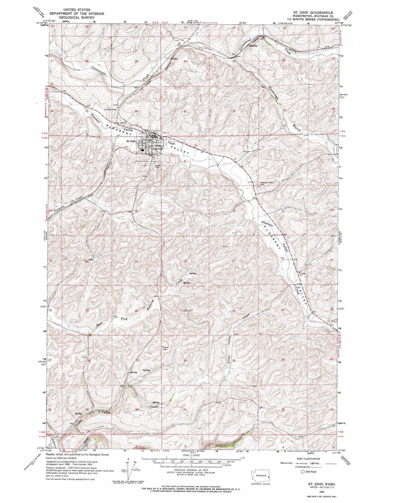
USGS Topo Quad 47117a5 - 1:24,000 scale
| Topo Map Name: | Saint John |
| USGS Topo Quad ID: | 47117a5 |
| Print Size: | ca. 21 1/4" wide x 27" high |
| Southeast Coordinates: | 47° N latitude / 117.5° W longitude |
| Map Center Coordinates: | 47.0625° N latitude / 117.5625° W longitude |
| U.S. State: | WA |
| Filename: | o47117a5.jpg |
| Download Map JPG Image: | Saint John topo map 1:24,000 scale |
| Map Type: | Topographic |
| Topo Series: | 7.5´ |
| Map Scale: | 1:24,000 |
| Source of Map Images: | United States Geological Survey (USGS) |
| Alternate Map Versions: |
St. John WA 1964, updated 1965 Download PDF Buy paper map Saint John WA 2011 Download PDF Buy paper map Saint John WA 2014 Download PDF Buy paper map |
1:24,000 Topo Quads surrounding Saint John
Fishtrap Lake |
Amber |
Chapman Lake |
Plaza |
Spring Valley |
Lamont Ne |
Rock Lake |
Pine City |
Malden |
Rosalia |
Texas Lake |
Ewan |
Saint John |
Thornton |
Steptoe |
Winona |
Endicott |
Thera |
Diamond |
Colfax North |
La Crosse East |
Dusty |
Little Penawawa Creek |
Wilcox |
Colfax South |
> Back to 47117a1 at 1:100,000 scale
> Back to 47116a1 at 1:250,000 scale
> Back to U.S. Topo Maps home
Saint John topo map: Gazetteer
Saint John: Airports
Larmie Field elevation 624m 2047′Saint John: Populated Places
Huntley elevation 629m 2063′Juno elevation 602m 1975′
Saint John elevation 598m 1961′
Saint John: Streams
Little Valley Creek elevation 483m 1584′Saint John: Valleys
Hastings Gulch elevation 619m 2030′Saint John digital topo map on disk
Buy this Saint John topo map showing relief, roads, GPS coordinates and other geographical features, as a high-resolution digital map file on DVD: