Texas Lake Topo Map Washington
To zoom in, hover over the map of Texas Lake
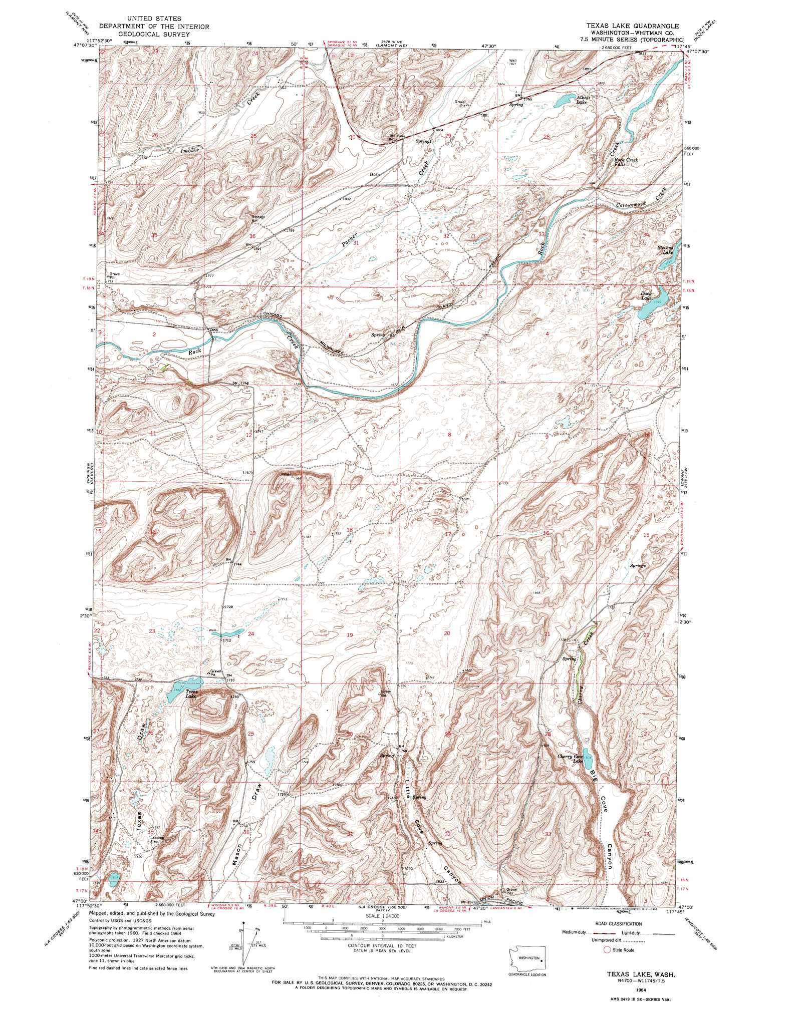
USGS Topo Quad 47117a7 - 1:24,000 scale
| Topo Map Name: | Texas Lake |
| USGS Topo Quad ID: | 47117a7 |
| Print Size: | ca. 21 1/4" wide x 27" high |
| Southeast Coordinates: | 47° N latitude / 117.75° W longitude |
| Map Center Coordinates: | 47.0625° N latitude / 117.8125° W longitude |
| U.S. State: | WA |
| Filename: | o47117a7.jpg |
| Download Map JPG Image: | Texas Lake topo map 1:24,000 scale |
| Map Type: | Topographic |
| Topo Series: | 7.5´ |
| Map Scale: | 1:24,000 |
| Source of Map Images: | United States Geological Survey (USGS) |
| Alternate Map Versions: |
Texas Lake WA 1964, updated 1965 Download PDF Buy paper map Texas Lake WA 2011 Download PDF Buy paper map Texas Lake WA 2014 Download PDF Buy paper map |
1:24,000 Topo Quads surrounding Texas Lake
Sprague Lake |
Sprague |
Fishtrap Lake |
Amber |
Chapman Lake |
Palm Lake |
Lamont |
Lamont Ne |
Rock Lake |
Pine City |
Macall |
Revere |
Texas Lake |
Ewan |
Saint John |
Benge |
Honn Lakes |
Winona |
Endicott |
Thera |
Rattlesnake Canyon |
La Crosse West |
La Crosse East |
Dusty |
Little Penawawa Creek |
> Back to 47117a1 at 1:100,000 scale
> Back to 47116a1 at 1:250,000 scale
> Back to U.S. Topo Maps home
Texas Lake topo map: Gazetteer
Texas Lake: Falls
Rock Creek Falls elevation 521m 1709′Texas Lake: Lakes
Alkali Lake elevation 545m 1788′Cherry Cove Lake elevation 460m 1509′
Duck Lake elevation 526m 1725′
Stevens Lake elevation 526m 1725′
Texas Lake elevation 520m 1706′
Texas Lake: Streams
Cherry Creek elevation 461m 1512′Cottonwood Creek elevation 513m 1683′
Packer Creek elevation 504m 1653′
Texas Lake digital topo map on disk
Buy this Texas Lake topo map showing relief, roads, GPS coordinates and other geographical features, as a high-resolution digital map file on DVD: