Oakesdale Topo Map Washington
To zoom in, hover over the map of Oakesdale
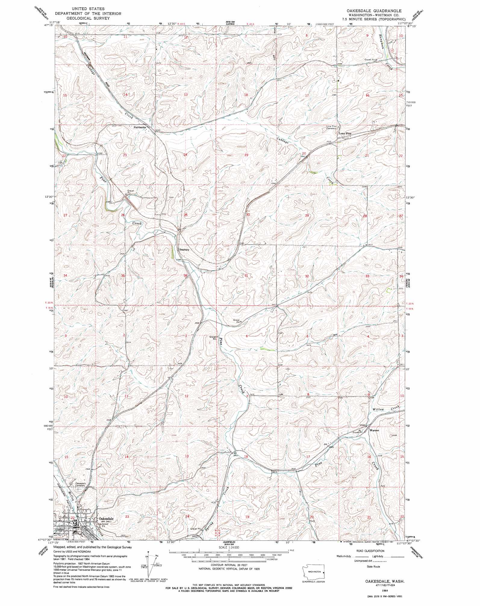
USGS Topo Quad 47117b2 - 1:24,000 scale
| Topo Map Name: | Oakesdale |
| USGS Topo Quad ID: | 47117b2 |
| Print Size: | ca. 21 1/4" wide x 27" high |
| Southeast Coordinates: | 47.125° N latitude / 117.125° W longitude |
| Map Center Coordinates: | 47.1875° N latitude / 117.1875° W longitude |
| U.S. State: | WA |
| Filename: | o47117b2.jpg |
| Download Map JPG Image: | Oakesdale topo map 1:24,000 scale |
| Map Type: | Topographic |
| Topo Series: | 7.5´ |
| Map Scale: | 1:24,000 |
| Source of Map Images: | United States Geological Survey (USGS) |
| Alternate Map Versions: |
Oakesdale WA 1964, updated 1965 Download PDF Buy paper map Oakesdale WA 1964, updated 1991 Download PDF Buy paper map Oakesdale WA 2011 Download PDF Buy paper map Oakesdale WA 2014 Download PDF Buy paper map |
1:24,000 Topo Quads surrounding Oakesdale
Spangle West |
Spangle East |
Fairfield |
Setters |
Worley |
Plaza |
Spring Valley |
Latah |
Tekoa Mountain |
Plummer |
Malden |
Rosalia |
Oakesdale |
Tekoa |
Tensed |
Thornton |
Steptoe |
Garfield |
Farmington |
Mission Mountain |
Diamond |
Colfax North |
Elberton |
Palouse |
Potlatch |
> Back to 47117a1 at 1:100,000 scale
> Back to 47116a1 at 1:250,000 scale
> Back to U.S. Topo Maps home
Oakesdale topo map: Gazetteer
Oakesdale: Populated Places
Fairbanks elevation 745m 2444′Lone Pine elevation 777m 2549′
Oakesdale elevation 751m 2463′
Warner elevation 749m 2457′
Oakesdale: Streams
Kelley Creek elevation 739m 2424′Spring Creek elevation 736m 2414′
Willow Creek elevation 744m 2440′
Oakesdale: Trails
John Wayne Trail elevation 729m 2391′Oakesdale digital topo map on disk
Buy this Oakesdale topo map showing relief, roads, GPS coordinates and other geographical features, as a high-resolution digital map file on DVD: