Lamont Topo Map Washington
To zoom in, hover over the map of Lamont
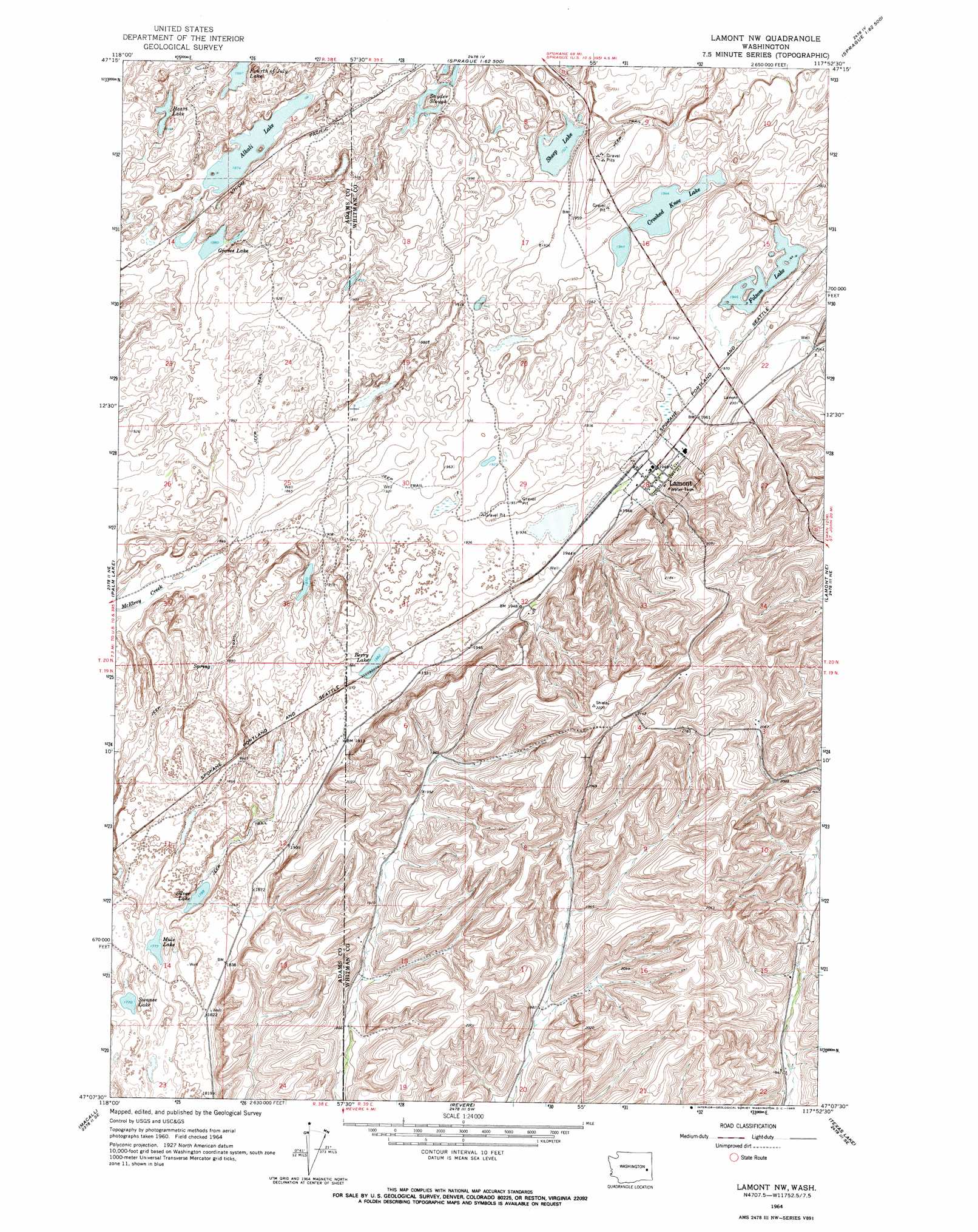
USGS Topo Quad 47117b8 - 1:24,000 scale
| Topo Map Name: | Lamont |
| USGS Topo Quad ID: | 47117b8 |
| Print Size: | ca. 21 1/4" wide x 27" high |
| Southeast Coordinates: | 47.125° N latitude / 117.875° W longitude |
| Map Center Coordinates: | 47.1875° N latitude / 117.9375° W longitude |
| U.S. State: | WA |
| Filename: | o47117b8.jpg |
| Download Map JPG Image: | Lamont topo map 1:24,000 scale |
| Map Type: | Topographic |
| Topo Series: | 7.5´ |
| Map Scale: | 1:24,000 |
| Source of Map Images: | United States Geological Survey (USGS) |
| Alternate Map Versions: |
Lamont NW WA 1964, updated 1965 Download PDF Buy paper map Lamont WA 2011 Download PDF Buy paper map Lamont WA 2014 Download PDF Buy paper map |
1:24,000 Topo Quads surrounding Lamont
Lords Valley |
Sprague Lake Ne |
Sassin |
Tyler |
Lance Hills |
Sprague Lake Sw |
Sprague Lake |
Sprague |
Fishtrap Lake |
Amber |
Karakul Hills |
Palm Lake |
Lamont |
Lamont Ne |
Rock Lake |
Marengo |
Macall |
Revere |
Texas Lake |
Ewan |
Coyote Butte |
Benge |
Honn Lakes |
Winona |
Endicott |
> Back to 47117a1 at 1:100,000 scale
> Back to 47116a1 at 1:250,000 scale
> Back to U.S. Topo Maps home
Lamont topo map: Gazetteer
Lamont: Lakes
Alkali Lake elevation 572m 1876′Berry Lake elevation 575m 1886′
Crooked Knee Lake elevation 594m 1948′
Folsom Lake elevation 594m 1948′
Groves Lake elevation 574m 1883′
Heart Lake elevation 577m 1893′
Mule Lake elevation 543m 1781′
Sheep Lake elevation 588m 1929′
Silver Lake elevation 542m 1778′
Swanee Lake elevation 541m 1774′
Lamont: Populated Places
Lamont elevation 596m 1955′Lamont digital topo map on disk
Buy this Lamont topo map showing relief, roads, GPS coordinates and other geographical features, as a high-resolution digital map file on DVD: