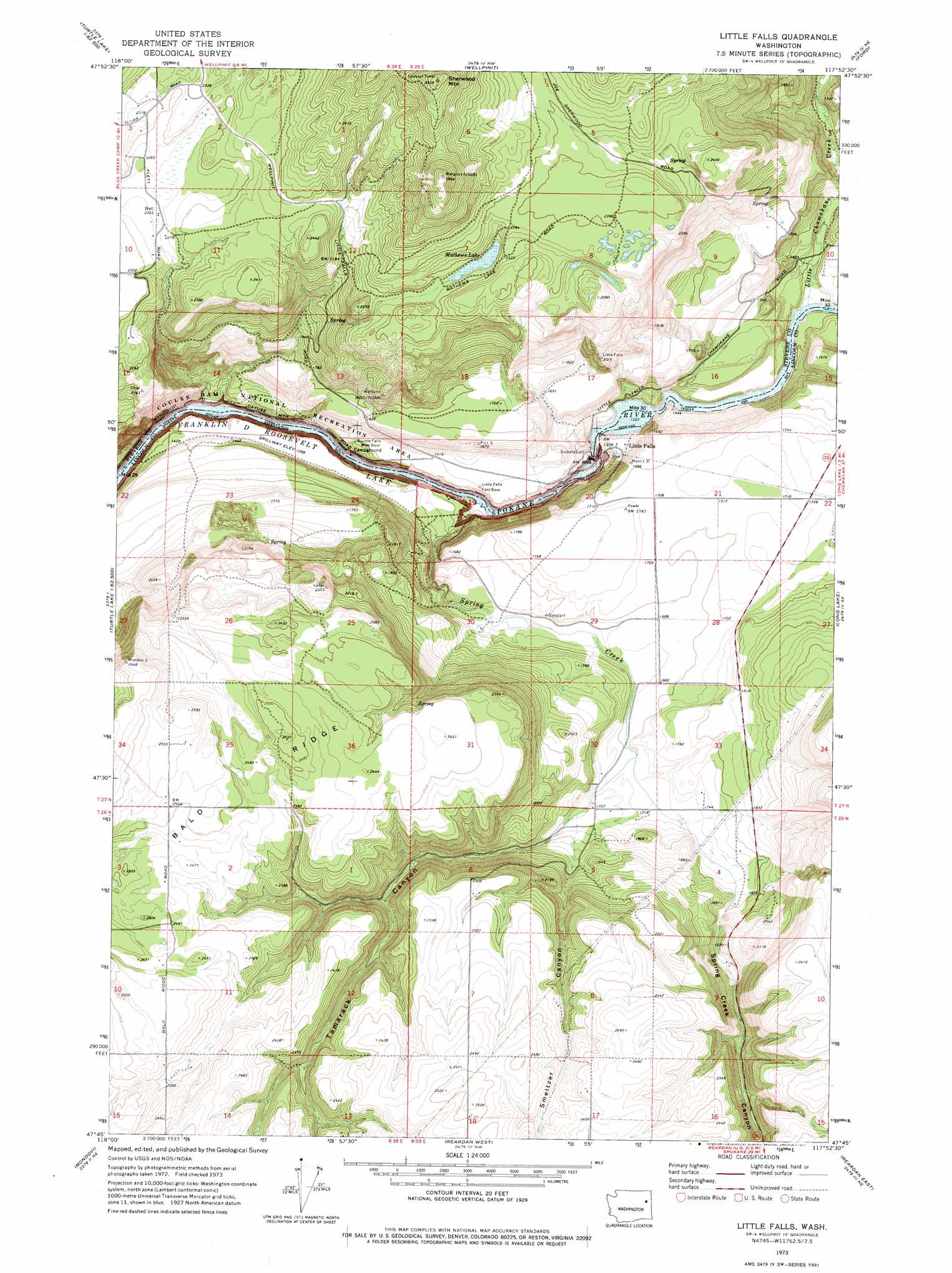
Little Falls Topo Map Washington
To zoom in, hover over the map of Little Falls
USGS Topo Quad 47117g8 - 1:24,000 scale
| Topo Map Name: | Little Falls |
| USGS Topo Quad ID: | 47117g8 |
| Print Size: | ca. 21 1/4" wide x 27" high |
| Southeast Coordinates: | 47.75° N latitude / 117.875° W longitude |
| Map Center Coordinates: | 47.8125° N latitude / 117.9375° W longitude |
| U.S. State: | WA |
| Filename: | o47117g8.jpg |
| Download Map JPG Image: | Little Falls topo map 1:24,000 scale |
| Map Type: | Topographic |
| Topo Series: | 7.5´ |
| Map Scale: | 1:24,000 |
| Source of Map Images: | United States Geological Survey (USGS) |
| Alternate Map Versions: |
Little Falls WA 1973, updated 1977 Download PDF Buy paper map Little Falls WA 2011 Download PDF Buy paper map Little Falls WA 2014 Download PDF Buy paper map |
1:24,000 Topo Quads surrounding Little Falls
Hunters |
Adams Mountain |
Empey Mountain |
Forest Center |
Springdale |
Mccoy Lake |
Turtle Lake |
Wellpinit |
Ford |
Tumtum |
Inkster Lake |
Benjamin Lake |
Little Falls |
Long Lake |
Four Mound Prairie |
Davenport |
Mondovi |
Reardan West |
Reardan East |
Deep Creek |
Bluestem |
Omans |
Edwall |
Waukon |
Medical Lake |
> Back to 47117e1 at 1:100,000 scale
> Back to 47116a1 at 1:250,000 scale
> Back to U.S. Topo Maps home
Little Falls topo map: Gazetteer
Little Falls: Dams
Little Falls Dam elevation 403m 1322′Little Falls Dam elevation 403m 1322′
Little Falls: Lakes
Mathews Lake elevation 693m 2273′Little Falls: Populated Places
Little Falls elevation 441m 1446′Little Falls: Reservoirs
Little Falls Reservoir elevation 403m 1322′Little Falls: Ridges
Bald Ridge elevation 757m 2483′Little Falls: Streams
Little Chamokane Creek elevation 416m 1364′Spring Creek elevation 397m 1302′
Little Falls: Summits
Sherwood Mountain elevation 892m 2926′Little Falls: Valleys
Smeltzer Canyon elevation 575m 1886′Spring Creek Canyon elevation 546m 1791′
Tamarack Canyon elevation 543m 1781′
Little Falls digital topo map on disk
Buy this Little Falls topo map showing relief, roads, GPS coordinates and other geographical features, as a high-resolution digital map file on DVD: