Bluestem Topo Map Washington
To zoom in, hover over the map of Bluestem
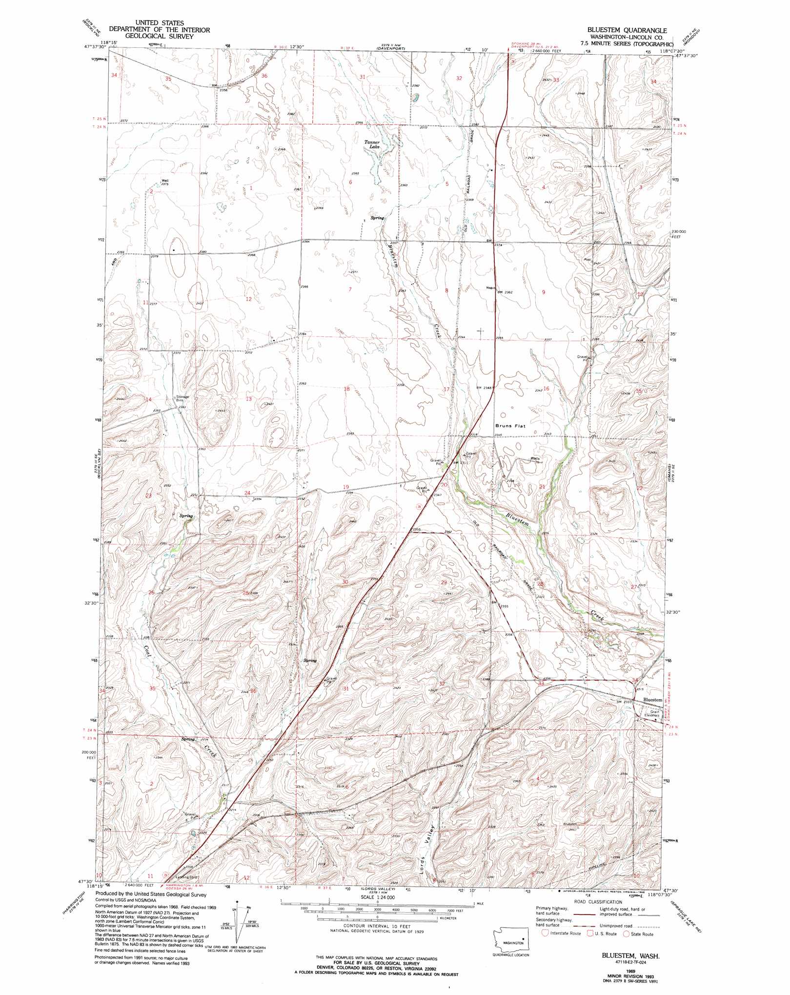
USGS Topo Quad 47118e2 - 1:24,000 scale
| Topo Map Name: | Bluestem |
| USGS Topo Quad ID: | 47118e2 |
| Print Size: | ca. 21 1/4" wide x 27" high |
| Southeast Coordinates: | 47.5° N latitude / 118.125° W longitude |
| Map Center Coordinates: | 47.5625° N latitude / 118.1875° W longitude |
| U.S. State: | WA |
| Filename: | o47118e2.jpg |
| Download Map JPG Image: | Bluestem topo map 1:24,000 scale |
| Map Type: | Topographic |
| Topo Series: | 7.5´ |
| Map Scale: | 1:24,000 |
| Source of Map Images: | United States Geological Survey (USGS) |
| Alternate Map Versions: |
Bluestem WA 1969, updated 1972 Download PDF Buy paper map Bluestem WA 1969, updated 1993 Download PDF Buy paper map Bluestem WA 2011 Download PDF Buy paper map Bluestem WA 2013 Download PDF Buy paper map |
1:24,000 Topo Quads surrounding Bluestem
Lincoln |
Olsen Canyon |
Inkster Lake |
Benjamin Lake |
Little Falls |
Telford |
Rocklyn |
Davenport |
Mondovi |
Reardan West |
Rocklyn Sw |
Rocklyn Se |
Bluestem |
Omans |
Edwall |
Cormana Lake |
Harrington |
Lords Valley |
Sprague Lake Ne |
Sassin |
Lamona |
Harrington Se |
Sprague Lake Sw |
Sprague Lake |
Sprague |
> Back to 47118e1 at 1:100,000 scale
> Back to 47118a1 at 1:250,000 scale
> Back to U.S. Topo Maps home
Bluestem topo map: Gazetteer
Bluestem: Airports
Hanes Airport elevation 673m 2208′Bluestem: Flats
Bruns Flat elevation 717m 2352′Bluestem: Lakes
Tanner Lake elevation 723m 2372′Bluestem: Populated Places
Bluestem elevation 712m 2335′Bluestem digital topo map on disk
Buy this Bluestem topo map showing relief, roads, GPS coordinates and other geographical features, as a high-resolution digital map file on DVD: